Aim
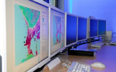
Spectroscopy and hyperspectral remote sensing enables to retrieve very detailed spectral information about a certain surface in dense bandwith intervalls. Information on the “spectral fingerprints” of surfaces is then available in a near-continuous manner. This allows for the differentiation of materials, such different geologic surfaces, different urban materials, or plants of different composition and vigor. Especially field- and laboratory spectroscopy has shown many benefits, as measurements can be carried out in a controlled environment, and can be directly visualized and explained. This course provides you insights into practical experiments using a field spectrometer, and subsequent data analysis to assess key environmental parameters such as plant health, soil moisture content, and geologic composition.
Content
The content of this course includes both the theoretical background of field and imaging spectroscopy, as well as practical experiments and subsequent data analysis. In particular, we will adress: the theoretical background of field and imaging spectroscopy / general reflectance and transmittance properties of plant leaves, canopies and soils / the quantification of biophysical and biochemical properties using spectroscopic measurements, feature parametrization and regression analysis / the advantages and challenges of existing and planned hyperspectral spaceborne sensors
Coding
Software
Techniques
Content
General Course News and Updates
Internship and Inno Lab presentations
On Friday 20th of May at 9am we will have the following internship and inno lab presentations: Andrea Cardenas (Internship at DLR): “Data analysis of the refugee crisis in West Africa and definition of test sites in NRW – Germany”supervisor: Martin Muehlbauer Ása Dögg...

EAGLE application in 2022
We received again more than 200 applicants from all over the world. In total applicants from 42 different countries applied to our international Earth Observation M.Sc. program, covering countries such as Hungary, Morocco, Malaysia, Kenya, Nepal or Columbia. We are...
EAGLE application deadline 2022
Our application deadline for 2022 is approaching. If you want to study applied Earth Observation and learn about a variety of remote sensing sensors and methods as well as about fields of applications, submit your application at the latest on May 15th. Accepted...
MSc defense by Haiyin Ye
On Friday 20th of May at 9am Haiyin will present her M.Sc. thesis "Monitoring Gypsy Moth Outbreak Using Sentinel-1 and Sentinel-2 Data". From the abstract: "Gypsy moth Lymantria dispar (L.) is a serious pest in deciduous forests, the larvae of which can feed on a...
inno lab and MSc defense Jakob Wachter
this Friday, 22nd of April, at 9am we will have one inno lab and one M.Sc. defense, both by Jakob Wachter. inno lab: "Assessment of climate-induced drought impact on crop types in bavaria" (Tobias Ullmann) M.Sc. defense: "Potential of webcam Imagery as reference data...
Inno lab and MSc idea presentation
On Friday 8th of April from 9am onwards we will have the following EAGLE presentations: "Assessment of open-source street-level imagery for building classification in Lima, Peru" by Larissa Gorzawski (Inno lab supervised by Hannes Taubenböck and Christian Geiß)...
MSc idea and inno lab presentations
On Friday 11th of March from 10am onwards the following students will introduce their MSc idea or report on their innovation laboratory: Kemeng Liu (MSc idea): "Mapping Spatial-Temporal Developments of Coastal Aquaculture" supervised by Tobias Ullmann Antonio...

MSc defense by Sofia Garcia
On Friday, March 11th at 9am Sofia will present her M.Sc. thesis "Estimating socioeconomic variables in Bolivia using satellite-based nighttime light images and electricity consumption data". From the abstract: "The lack of up-to-date data on socio-economic parameters...
MSc thesis defense by Nestor Gualsaqui
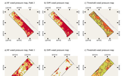
On March 8th at 10:30 Nestor will present his M.Sc. thesis "Pre-crop emergence weed mapping using high satellite imagery". From the abstract: "During the last decades, the growth of the world population has been increasing and weather fluctuations around the world...

MSc defense Nils Karges
Nils Karges will present his M.Sc. thesis "Exploring spatial relationships of soundscape variables in urban areas. " on 15th of February at 9:30. From the abstract: "This work describes the relationship between soundscape and the underlying landscape in an urban...