Aim
Spectroscopy and hyperspectral remote sensing enables to retrieve very detailed spectral information about a certain surface in dense bandwith intervalls. Information on the “spectral fingerprints” of surfaces is then available in a near-continuous manner. This allows for the differentiation of materials, such different geologic surfaces, different urban materials, or plants of different composition and vigor. Especially field- and laboratory spectroscopy has shown many benefits, as measurements can be carried out in a controlled environment, and can be directly visualized and explained. This course provides you insights into practical experiments using a field spectrometer, and subsequent data analysis to assess key environmental parameters such as plant health, soil moisture content, and geologic composition.
Content
The content of this course includes both the theoretical background of field and imaging spectroscopy, as well as practical experiments and subsequent data analysis. In particular, we will adress: the theoretical background of field and imaging spectroscopy / general reflectance and transmittance properties of plant leaves, canopies and soils / the quantification of biophysical and biochemical properties using spectroscopic measurements, feature parametrization and regression analysis / the advantages and challenges of existing and planned hyperspectral spaceborne sensors
Coding
Software
Techniques
Content
General Course News and Updates
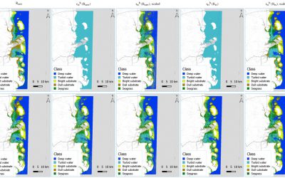
M.Sc. defense by Benjamin Lee
Benjamin will defend his M.Sc. thesis " DEVELOPMENT OF A SEMI-ANALYTICAL MODEL FOR SEAGRASS MAPPING USING CLOUD-BASED COMPUTING AND OPEN SOURCED OPTICAL SATELLITE DATA" on Friday March 6th 10 am in room 1.009 OKW 86. from the abstract: "Seagrasses provide USD$2.28...
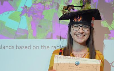
Anna Orthofer successfully presented her M.Sc. thesis
Anna Orthofer presented last Friday her M.Sc. thesis "Deriving Leaf Area Index and mowing dates for grasslands based on the radiative transfer model SLC and Sentinel 2 data" successfully and is our first EAGLE M.Sc. graduate in 2020. Congratulations!
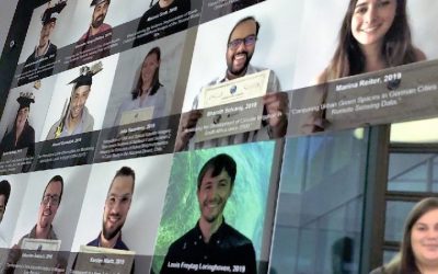
EAGLE wall of fame – our graduates
All our graduated EAGLE students are shown on our wall-of-fame. Great way to see who studied when and what was the topic about. Some of them are already doing their PhD with us or other research organizations and two of these graduates just founded their own remote...
internship presentation by Henrik Fisser and Ronja Lappe
On Friday 24th of January at 10 am in room 1.009 OKW 86 the following two internship presentation will take place: Henrik Fisser: "Into the Uncertain - Noise Quantification of Sentinel-2 Water Signal in Dependence of Atmospheric Correction Methods"and some details...
M.Sc. defense by Anna Orthofer
Anna Orthofer will present her M.Sc. thesis on Friday 7th of February at 10 am in room 1.009 OKW 86. Her M.Sc. was about "Deriving Leaf Area Index and mowing dates for grasslands based on the radiative transfer model SLC and Sentinel 2 data." More details from the...

Internship and MSc idea presentations
On Friday 10th of January the following presentations will take place in OKW86, room 1.009 from 10am onwards. Ojo Segun Adewale:Internship: Prediction of Gross Domestic Product using Remote Sensing Data (A case study of Brazil). Thesis Idea: Application of Remote...
M.Sc. Idea presentation by Nina Gnann and internship by Basil Tufail and Malin Fischer
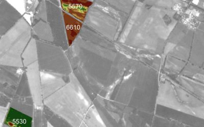
Nina, Malin and Basil will present their M.Sc. idea and internships on Friday 20th of December in room 1.009 OKW 86. Ninas' envisioned M.Sc. is "Plastic waste detection assisted by artificial intelligence". Basil internship is titled: "Global training dataset for...
M.Sc. idea presentation by Felix Glasmann
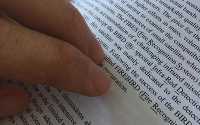
Felix Glasmann is presenting on Friday, 13th of December at 10am in room 1.009 OKW 86, his M.Sc. idea "Potential of the Firebird Mission for the Detection of Gas-flaring Activity". In times of worldwide phenomena like ‘Fridays for Future’ or ‘Extinction Rebellion’ it...
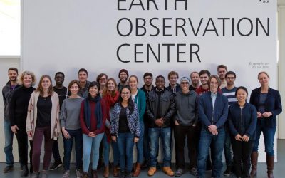
EAGLEs at DLR EOC
Our 2019 EAGLEs visited the DLR-EOC and learned a lot about current earth observation research at DLR. Many talks as well as discussions with PhD, Postdocs and teamleaders were organized by Prof. Claudia Kuenzer, head of the landsurface department and professor in...
Short Presentation on UAV and LiDAR
This Friday at 12am we will have two brief presentations by colleagues from the Max-Planck-Insitute and University Göttingen in room 1.009 OKW 86, right after the student presentations: Dr. Anne Scharf (MPI-AB) "The need for a closer look: how drones could fill in the...