Lecturer
Julia Rieder
ECTS
5 ECTS
Aim
The course provides a practical introduction to LiDAR technology and point cloud analysis. Students gain hands-on experience with LiDAR data, from acquisition principles to processing and interpretation, and learn how LiDAR supports applications such as terrain modelling, forestry, and others. The course emphasizes critical understanding of data quality, limitations, and real-world use cases
Content
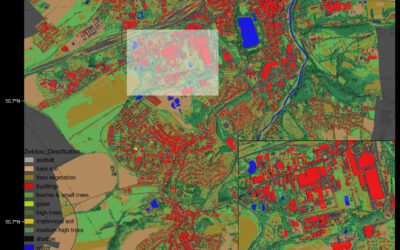
This course provides an overview of the scientific field surrounding LiDAR as a key technology for three-dimensional Earth observation. The course covers the fundamentals of LiDAR remote sensing, point cloud data structures, and processing methodologies across platforms ranging from spaceborne and airborne systems to terrestrial and mobile laser scanning. Furthermore, the course highlights current developments and emerging analytical possibilities enabled by advanced point cloud analysis and discusses future potential as LiDAR technologies and methodologies continue to evolve and converge with related disciplines.
Coding
Software
Techniques
Content
General Course News and Updates

EAGLE summer dialogue
Our annual EAGLE summer dialogue was a great success again even though the weather was quite challenging. The EAGLEs organized a fantastic event with fun activities, great images reviving the last months and years and of course a BBQ, drinks and an outstanding...

new publication by our EAGLE student Clara Vydra
Our EAGLE student Clara just published an article about snow cover variability in Central Asia - great to see our young EAGLE MSc students being on a good track for their scientific career. from the abstract: "Climate change is affecting the snow cover conditions on a...

UAS team – meme
The UAS (UAV or drone) team was quite busy the last months to collect data in Europe, Africa or Arctic and the group spend plenty of hours traveling and collecting Lidar, multispectral, thermal or hyperspectral data in various ecosystems. Of course in many cases faced...

scientific graphics course
Beside the various remote sensing courses such as radar, cloud computing, terrain analysis, urban analysis etc. we do also offer courses on softskills such as scientific writing, presentations as well scientific graphics and maps. Within our scientific graphics course...

EAGLE students introduce locust spatio-temporal modeling
Our EAGLE students Leonie, Sonja and Clara presented methods to model the spatial and temporal distribution of locust in France using statistical modelling approaches within R and the flexSDM package. The elaborated for two hours how the complex data preparation,...

Internship Presentation: Discovering Hydrographic Parameters of HydroSHEDS and TanDEM-X Digital Elevation Model through Exploratory Data Analysis on July 09, 2024
On Tuesday, July 09, Subarno Shankar will present his internship " Discovering Hydrographic Parameters of HydroSHEDS and TanDEM-X Digital Elevation Model through Exploratory Data Analysis " at 12:00 in seminar room 3, John-Skilton-Str. 4a. From the abstract: Climate...

Master Thesis Presentation: Earth Observation for Wildlife Monitoring in cold and polar Regions – A Review and a Case Study about the Northern Bald Ibis on June 11, 2024
On Tuesday, June 11 , Helena Wehner will defend her master thesis " Earth Observation for Wildlife Monitoring in cold and polar Regions – A Review and a Case Study about the Northern Bald Ibis" at 13:00 in seminar room 3, John-Skilton-Str. 4a. From the abstract:...

Master Thesis Presentation: Analysis of Urban Heat Development in Dresden, Germany using Landsat Data from the Past Decade
On Tuesday, May 28, Ina Schulz will defend her master thesis " Analysis of urban heat development in Dresden, Germany using Landsat data from the past decade" at 12:00 in seminar room 3, John-Skilton-Str. 4a. From the abstract: As the number of urban residents is...

Master Thesis Presentation: Modelling LAI of Alpine Grassland on June 11, 2024
On Tuesday, June 11 , Caroline Göhner will defend her master thesis " Modelling LAI of Alpine Grassland" at 12:00 in seminar room 3, John-Skilton-Str. 4a. From the abstract: Alpine grasslands are crucial ecosystem providers and one of the most threatened terrestrial...
Internship Report on Tuesday, May 21st at 12:00
NEW DATE: On Tuesday, May 21st, Elly Schmid will present her internship at 12:00 in seminar room 3, John-Skilton-Str. 4a. : From the abstract: The internship was carried out as part of the HEATS-(Urban heat) Project of the Georisks team at the Earth Observation...