Lecturer
Julia Rieder
ECTS
5 ECTS
Aim
The course provides a practical introduction to LiDAR technology and point cloud analysis. Students gain hands-on experience with LiDAR data, from acquisition principles to processing and interpretation, and learn how LiDAR supports applications such as terrain modelling, forestry, and others. The course emphasizes critical understanding of data quality, limitations, and real-world use cases
Content
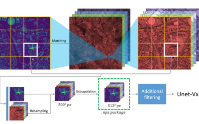
This course provides an overview of the scientific field surrounding LiDAR as a key technology for three-dimensional Earth observation. The course covers the fundamentals of LiDAR remote sensing, point cloud data structures, and processing methodologies across platforms ranging from spaceborne and airborne systems to terrestrial and mobile laser scanning. Furthermore, the course highlights current developments and emerging analytical possibilities enabled by advanced point cloud analysis and discusses future potential as LiDAR technologies and methodologies continue to evolve and converge with related disciplines.
Coding
Software
Techniques
Content
General Course News and Updates
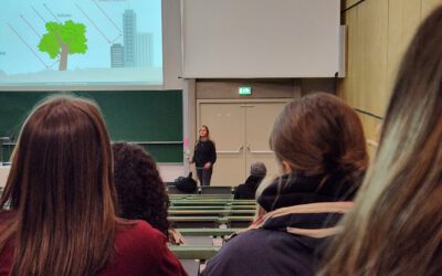
EAGLE students train scientific presentations
Within our scientific presentation course within the EAGLE Msc our students also have to learn how deliver good scientific presentation within a large lecture room and for a larger crowd of scientists. Therefore we expose them to the large number of bsc students...
Inno Lab Report by Helena Wehner on January 23rd at 12:30 p.m.
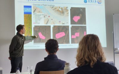
On Tuesday, January 23rd at 12:30 Helena Wehner will present her inno lab report "Low-Cost UAV for Conservation in the Conservation area „Biosphärenreservat Rhön"" (seminar room 3, John-Skilton-Str. 4a). Hosting Institution: Biosphärenreservat Rhön Supervisors: Jonas...
Internship Report by Luis David Almeida Famada
On Tuesday, January 23rd at 12:00 a.m. Luis David Almeida Famada will present his internship report at DLR " "Land Use and Resource Management" Hosting Institution: DLR – Deutsches Zentrum für Luft- und Raumfahrt Supervisors: Dr. Soner Üreyen, Deutsches Luft- und...
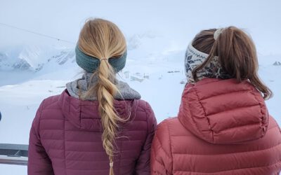
EAGLEs high up in the mountains
Some of our EAGLEs went up to the research station on the highest mountain of Germany to explore the research activities conducted in this area and discuss what remote sensing can contribute. The met ecologists, botanists and other disciplines and learned what Earth...
Article published by our EAGLE Laura Obrecht
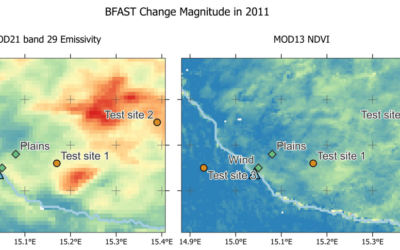
Just before the end of last year Lauras manuscript about fractional cover analysis in Namibia got published! Her research is titled "Mapping Changes in Fractional Vegetation Cover on the Namib Gravel Plains with Satellite-Retrieved Land Surface Emissivity Data"....

EAGLE Xmas party
After a bit more than 2 months of intense Earth Observation courses and lots of studying of radar, cloud computing, r and python programming and much more the EAGLEs are celebrating the end of the year and two weeks break before the second part of the winter terms...
EAGLEs presented their work in the Arctic and South Africa
Today 5 of our EAGLE students presented their work in the past months in the Arctic using remote sensing data, space-borne and UAS, for ecological and conservation applications. Beside their very impressive scientific results did they also report on their general life...
EAGLEs at DLR DFD LAX
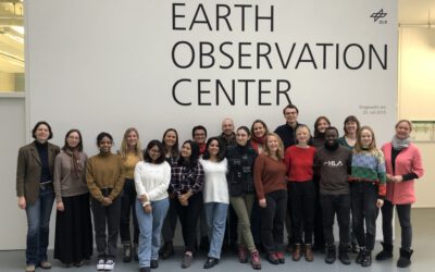
As part of the lecture by Claudia Künzer all EAGLEs of her course also visit the Earth Observation Center of DLR in Oberfpaffenhofen and listen to various talks by remote sensing scientists working in Oberpfaffenhofen: Patrick Sogno, an EAGLE alumni and also PhD...
EAGLE lecturer also training ESA astronauts on earth observation
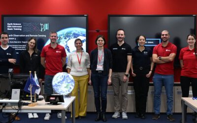
One of our EAGLE lecturer; Dr. Doris Klein, is not only teaching remote sensing to our international EAGLE students but also to future astronauts! Great to see that earth observation is also trained within other disciplines than our own specific remote sensing MSc....
Deep Neural Network Regression for Normalized Digital Surface Model Generation with Sentinel-2 Imagery
Our EAGLE student Konstantin Müller published together with our chairholder of the Deparment of Global Urbanization and Remote Sensing, Hannes Taubenboeck an article about DL for surface model generation. The article explores methods to extract high-resolution...