Lecturer
Julia Rieder
ECTS
5 ECTS
Aim
The course provides a practical introduction to LiDAR technology and point cloud analysis. Students gain hands-on experience with LiDAR data, from acquisition principles to processing and interpretation, and learn how LiDAR supports applications such as terrain modelling, forestry, and others. The course emphasizes critical understanding of data quality, limitations, and real-world use cases
Content
This course provides an overview of the scientific field surrounding LiDAR as a key technology for three-dimensional Earth observation. The course covers the fundamentals of LiDAR remote sensing, point cloud data structures, and processing methodologies across platforms ranging from spaceborne and airborne systems to terrestrial and mobile laser scanning. Furthermore, the course highlights current developments and emerging analytical possibilities enabled by advanced point cloud analysis and discusses future potential as LiDAR technologies and methodologies continue to evolve and converge with related disciplines.
Coding
Software
Techniques
Content
General Course News and Updates
new QGIS plugin and R package
our EAGLE student Konstantin Müller created a QGIS plugin and a corresponding R package for easy point density vizualisation. Create way to learn how to build QGIS plugins and R package for spatial analysis. QGIS plugin: The Bestagon QGIS plugin allows easy density...
MSc defense by Joy Giovanni Matabishi
On Tuesday, October 31, 2023 at 12 a.m Joy-Giovanni Matabishi will present his Msc Thesis “Modelling Bat Distribution and Diversity with Artificial light as a Focal Predictor in South Tyrol” in the seminar room 3 in John-Skilton-Str. 4a/ground floor. Modelling Bat...
MSc defense by Vanessa Rittlinger
On Tuesday, October 24, 2023 at 12:00 a.m. Vanessa Rittllinger will present her master thesis on “Detection of landslides in space and time using optical remote sensing data – A case study in South Tyrol” in seminar room 3 in John-Skilton-Str. 4a/ground floor From the...
MSc defense by Moritz Rösch
On Tuesday, November 27 at 12:00 a.m., 2023 Moritz Rösch will present his MSc defense “Daily spread prediction of European wildfires based on historical burned area time series from Earth observation data using spatio-temporal graph neural networks” in the seminar...
Internship Report
On Tuesday, December 12, 2023 at 12:00 a.m. Sunniva McKeever, Maximilian Merzdorf, and Isabella Metz will present their internship report on their internship at the Kruger National Park, South Africa in seminar room 3 in John-Skilton-Str. 4a/ground floor Subject: "Our...
Internship Report by Christobal Tobbin
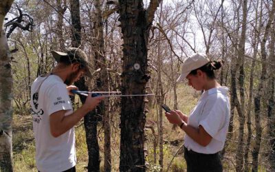
On Tuesday, November 28, 2023 at 13:00 Christobal Tobbin will present his internship report on his internship at DLR “The CONCERT Project” in seminar room 3 in John-Skilton-Str. 4a/ground floor. From the abstract: The CONCERT project with the Agriculture and...
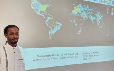
Successful MSc defense by Giovanni Matabishi
Giovanni presented his MSc thesis “Modelling Bat Distribution and Diversity with Artificial light as a Focal Predictor in South Tyrol” today within our EAGLE colloquium and passed successfully. He presented very interesting approaches of remote sensing for modelling...
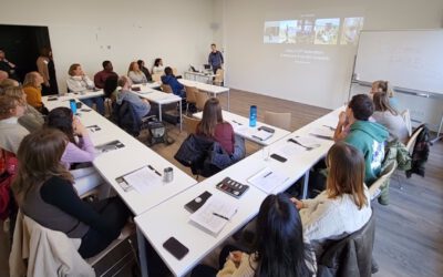
EAGLE 8th generation – first course by Claudia Kuenzer
Our new EAGLEs just spend the whole week learning about all Earth Observation sensors, physics of remote sensing, newest advances and upcoming methods in earth observation. Beside the lecture and getting to know all these crucial information they also had plenty of...
Internship Report by Janik Hoffmann and Lena Jäger
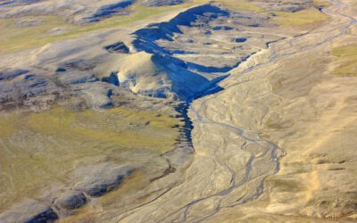
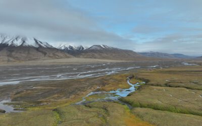
On Tuesday, December 19, 2023 at 12:00 Janik Hoffmann and Lena Jäger will present their internship report on their internship at the University Centre on Svalbard/Norway "Our Arctic Adventure – Northernmost internship on Svalbard" in seminar room 3 in...
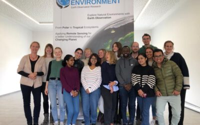
welcome of new EAGLE generation
Today we welcomed the new generation of Earth Observation EAGLE students and are happy to see such a diverse and highly motivated group of students again. Students from Nepal, India, Ruanda or Turkey joint our study program among many other countries and already in...