Lecturer
Julia Rieder
ECTS
5 ECTS
Aim
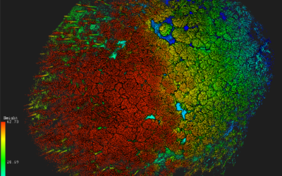
The course provides a practical introduction to LiDAR technology and point cloud analysis. Students gain hands-on experience with LiDAR data, from acquisition principles to processing and interpretation, and learn how LiDAR supports applications such as terrain modelling, forestry, and others. The course emphasizes critical understanding of data quality, limitations, and real-world use cases
Content
This course provides an overview of the scientific field surrounding LiDAR as a key technology for three-dimensional Earth observation. The course covers the fundamentals of LiDAR remote sensing, point cloud data structures, and processing methodologies across platforms ranging from spaceborne and airborne systems to terrestrial and mobile laser scanning. Furthermore, the course highlights current developments and emerging analytical possibilities enabled by advanced point cloud analysis and discusses future potential as LiDAR technologies and methodologies continue to evolve and converge with related disciplines.
Coding
Software
Techniques
Content
General Course News and Updates
Msc Defense by Katrin Wernicke
On Tuesday, July 18 at 10 a.m. Katrin Wernicke will present her MSc Thesis "Deep Learning for Refugee Camps – Mapping Settlement Extents with Sentinel-2 Imagery and Semantic Segmentation" From the abstract: The number of people forced to flee their homes has...
MSc Defense by Nora Nieskens
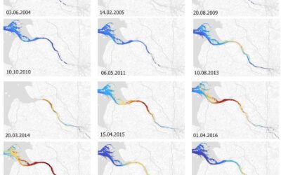
MsC Defense by Nora Nieskens On Friday, September 08, 2023 at 11 a.m. Nora Nieskens will present her Msc Thesis “Estuaries in transition: Earth observation-based analysis of the turbidity dynamics in selected North Sea estuaries” in room 00.B.09 in John-Skilton-Str....
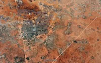
Detection of slope deformation at the Tröllaskagi peninsula, N-Iceland, using Sentinel-1 DInSAR time series
MSc defense (MA2) by Ása Dögg Adalsteinsdóttir On Monday, September 18, 2023 Ása Dögg Adalsteinsdóttir will present her Msc Thesis at 14:00 Detection of slope deformation at the Tröllaskagi peninsula, N-Iceland, using Sentinel-1 DInSAR time series Thema: MSC...
MSc defense by Vanessa Rittlinger
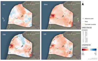
On Tuesday, October 24, 2023 at 10:00 a.m. Vanessa Rittllinger will present her master thesis on “Detection of landslides in space and time using optical remote sensing data – A case study in South Tyrol” in the conference room 01.B.03 in John-Skilton-Str. 4a/1st...
MSc defense and Inno-Lab presentations
On Tuesday 20th of December at 12am we will have various presentations MSc defense by Kevin Yomi on "Evaluation wildfire activity in conflict-affected areas using earth observation and panel regression models: a case study of Borno State, Nigera, from 2003-2020" In...
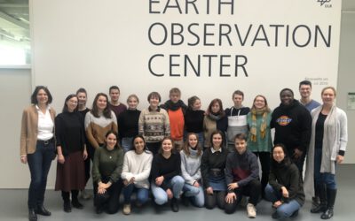
EAGLEs visit DLR EOC
After a long break due to covid we resumed the EAGLE visit of DLR EOC. Many EAGLEs from the current generation and quite some of the past (covid) generations joined this event and listened to many talks by DLR researchers. Some of the presenters were even former...
Social event in the boulder gym
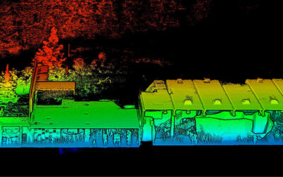
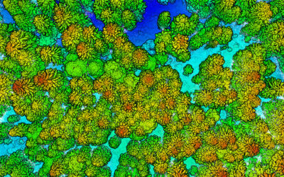
Last week we spend a few hours in the boulder hall to enjoy a day without courses, do some climbing and have plenty of time to chat. Many EAGLEs from the current and old generations joint us as well as many lecturer. Beside the social event we also collected Lidar...
MSc defense Caroline Busse
On Tuesday 22nd of November at 1pm we will have the MSc thesis defense by Caroline on "Change Detection using Sentinel-1 and Sentinel-2 Time Series: A Comparison of Models for the Detection of Forest Disturbances." from the abstract: "Forests provide essential...
internship, innoLab and MSc idea presentations
On Tuesday 22nd of November at 12am we will have the following presentations: Dilara Kim: „Automated glacier snowline mapping from multi-sensor satellite observation“, InnoLab, EURAC Research, Supervisor: Dr. Martina Barandun Walid Ghariani: „PM2.5 Prediction Using...
New EAGLE Earth Observation professors
We are very happy to welcome two new professors within the EAGLE M.Sc. program! Prof. Dr. Hannes Taubenböck and Prof. Dr. Tobias Ullmann will strengthen the urban remote sensing and radar earth observation within the EAGLE program. Various new courses are already...