Lecturer
Julia Rieder
ECTS
5 ECTS
Aim
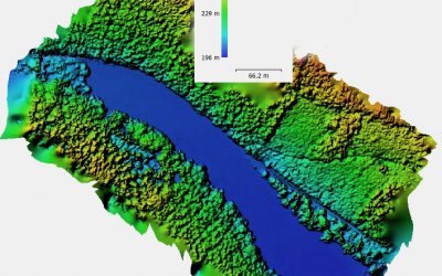
The course provides a practical introduction to LiDAR technology and point cloud analysis. Students gain hands-on experience with LiDAR data, from acquisition principles to processing and interpretation, and learn how LiDAR supports applications such as terrain modelling, forestry, and others. The course emphasizes critical understanding of data quality, limitations, and real-world use cases
Content
This course provides an overview of the scientific field surrounding LiDAR as a key technology for three-dimensional Earth observation. The course covers the fundamentals of LiDAR remote sensing, point cloud data structures, and processing methodologies across platforms ranging from spaceborne and airborne systems to terrestrial and mobile laser scanning. Furthermore, the course highlights current developments and emerging analytical possibilities enabled by advanced point cloud analysis and discusses future potential as LiDAR technologies and methodologies continue to evolve and converge with related disciplines.
Coding
Software
Techniques
Content
General Course News and Updates
internship presentation by Henrik Fisser and Ronja Lappe
On Friday 24th of January at 10 am in room 1.009 OKW 86 the following two internship presentation will take place: Henrik Fisser: "Into the Uncertain - Noise Quantification of Sentinel-2 Water Signal in Dependence of Atmospheric Correction Methods"and some details...
M.Sc. defense by Anna Orthofer
Anna Orthofer will present her M.Sc. thesis on Friday 7th of February at 10 am in room 1.009 OKW 86. Her M.Sc. was about "Deriving Leaf Area Index and mowing dates for grasslands based on the radiative transfer model SLC and Sentinel 2 data." More details from the...

Internship and MSc idea presentations
On Friday 10th of January the following presentations will take place in OKW86, room 1.009 from 10am onwards. Ojo Segun Adewale:Internship: Prediction of Gross Domestic Product using Remote Sensing Data (A case study of Brazil). Thesis Idea: Application of Remote...
M.Sc. Idea presentation by Nina Gnann and internship by Basil Tufail and Malin Fischer
Nina, Malin and Basil will present their M.Sc. idea and internships on Friday 20th of December in room 1.009 OKW 86. Ninas' envisioned M.Sc. is "Plastic waste detection assisted by artificial intelligence". Basil internship is titled: "Global training dataset for...
M.Sc. idea presentation by Felix Glasmann
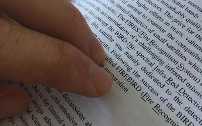
Felix Glasmann is presenting on Friday, 13th of December at 10am in room 1.009 OKW 86, his M.Sc. idea "Potential of the Firebird Mission for the Detection of Gas-flaring Activity". In times of worldwide phenomena like ‘Fridays for Future’ or ‘Extinction Rebellion’ it...
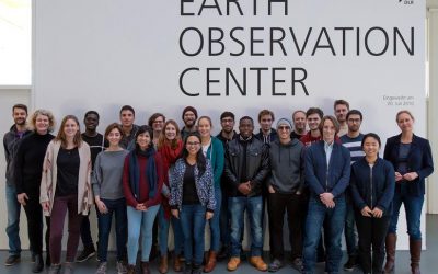
EAGLEs at DLR EOC
Our 2019 EAGLEs visited the DLR-EOC and learned a lot about current earth observation research at DLR. Many talks as well as discussions with PhD, Postdocs and teamleaders were organized by Prof. Claudia Kuenzer, head of the landsurface department and professor in...
Short Presentation on UAV and LiDAR
This Friday at 12am we will have two brief presentations by colleagues from the Max-Planck-Insitute and University Göttingen in room 1.009 OKW 86, right after the student presentations: Dr. Anne Scharf (MPI-AB) "The need for a closer look: how drones could fill in the...
M.Sc. defense by Marius Philipp on Nov. 22nd
Marius Philipp is going to defend his M.Sc. thesis on November 22nd at 10 am in room 1.009 (OKW86). The title of his thesis is "Potential of harmonic analysis using remote sensing data for studying the effects of climate change induced weather extreme events on forest...
MSc idea and internship presentations
On Friday, 8th of November, from 10-12am the following presentation will take place in room 01.009, OKW 86: Michael Wang:"Deriving Surface Heat Island Intensities for TraK and CURE" - internship and thesis idea presentation Patrick Sogno:"The Hitchhikers Guide to an...
M.Sc. idea presentations and internship presentation
On Friday 25th of October several EAGLEs will present their M.Sc. thesis ideas and report back from an internship experience. It will take place at 10am in room 1.009, OKW 86. Katrin Hasenbein (MSc idea): "The potential of time-series data to improve fine scale...