Aim
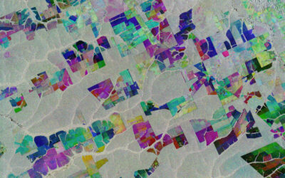
In this course we will learn the alternative image analysis paradigm of object-based image classification. Image objects are areas in images which consist of pixels from the same land-cover class (e.g. buildings, water surfaces, vegetation) and allow the application of additional image classification methods in comparison to pure pixel-based methods and the integration of multi-modal date (e.g. vector data).
Content
In the course we will use satellite images and high resolution aerial images in combination with vector data and analyze various image classification methods (nearest neighbor -> random forests -> deep learning) to extract relevant information from the images.
We will use the software “eCognition”.
The course will be held on 3 days in Würzburg plus an introductory lecture which is being held online.
Session 1: getting to know to image objects and eConition software, basic classification methods
Session 2: advanced classification (Machine Learning)
Session 3: Deep Learning
Coding
Software
Techniques
Content
General Course News and Updates
internship, inno lab and MSc idea
On Monday 21st of December at 10am we will have the following presentations: Camilo (Internship)"Forest cover change between 2000 and 2020 in El Chaco ecoregion, Paraguay" at DLR Johannes Mast (Thesis Idea):"Measuring Urban Polycentricity using Remote Sensing"...
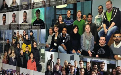
EAGLE wall of graduates is growing steadily
Our EAGLE wall of fame is being continuously extended by pictures of our new graduates and the group pictures of our EAGLE cohortes. Great to see their pictures on our wall and following their career past the EAGLE M.Sc.. Very interesting positions from companies to...
MSc defense by Aiga Taghavi
Aida Taghavi will present her M.Sc. thesis "Potentials of Cosmic-Ray Neutron Probes for Assessing and Mapping SAR-based Soil Moisture in a Mediterranean agro-forestry ecosystem" on Dec. 15th at 1pm. From her abstract: "Accurate near-surface soil moisture (~ 5cm,...
Internships, inno lab and MSc ideas presentations
On Monday, Dec. 14th at 10am, we have another set of internship, innovation lab and MSc. thesis idea presentations: Sandro Groth: Multitask Deep Learning and Google Street View: Assessing seismic building vulnerability in Santiago de Chile (Internship)...
MSc idea & internship
On Monday, Dec. 7th at 10am, various internships, innovation labs and M.Sc. ideas will be presented: Malin Fischer: EO and spatial data analysis for rural village assessment - example from the electrification sector (Internship) Henrik Fisser: Road traffic...
Our newest EAGLE generation featured on 40 years of DLR Earth Observation Centre (EOC) article
We are thrilled to see our youngest EAGLE generation being mentioned on the 40 years anniversary of DLR-EOC news article. Great to see the EAGLE group on the DLR webpage (with some students missing though) fitting perfectly into the interesting and dynamic evolution...
MSc defense by Pawel Kluter
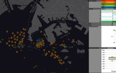
Pawel Kluter will present his M.Sc. thesis on Friday 30th of Oct. at 10 am with the title "Deep Learning Approach to Ship Detection and Classification Using Synthetic Aperture Radar Data". From his abstract: "With over 92,000 large commercial vessels at sea,...
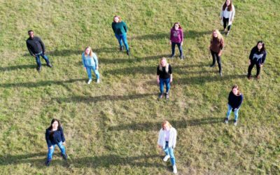
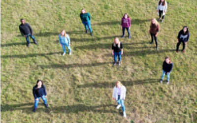
Our EAGLE 2020 generation
Our new EAGLE Earth Observation students arrived and we took a group picture while keeping the required distance due to the current situation. Unfortunately not all students could arrive on time for the group picture and hence cannot be seen on the image below. We are...
New EAGLE stickers arrived
Just in time for the welcome of the new EAGLEs we received our new EAGLE stickers. They are a first trial of irregular shaped stickers and more will come. The fit nicely with our "old" PixelschubserIn sticker (pixel pusher) and more formal "Remote Sensing Scientist"....
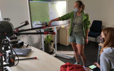
impressions of our UAV course
In September 2020 our UAV course took place and all practical exercises were covered. The manual UAV control as well as the automatic mission planning settings were discussed and actually applied. Various UAV systems were explored by the students and a diversity of...