Aim
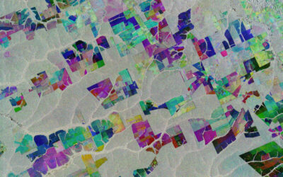
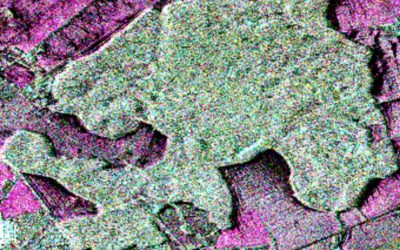
This module of the Urban Remote Sensing course aims to teach the practical workflow to analyze the spatiotemporal dynamics of urban systems employing state-of-the-art concepts and methods. Inter-city and intra-urban patterns based on single-date, multitemporal and time-series data will be detected and interpreted for cities located in different geographical contexts, to frame the diversity of urban configurations at different spatial scales. Research gaps and biases in the current operational frameworks to analyze urban systems will be discussed during the practical sessions. The OpenSource software R and QGIS will be employed during the practical module to focus on the analysis of (1) urban form (i.e., the spatial structure of cities), (2) the urban heat island effect, and (3) urban green infrastructure.
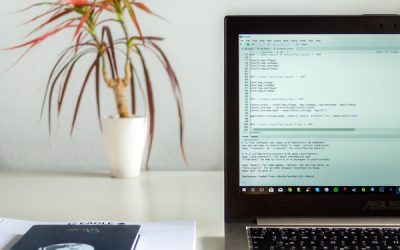
Coding
Coding examples and individual work will be covered
Software
Various software programs will be used, but mainly OpenSource software such as R.
Techniques
Different techniques will be introduced and practically applied.
Content
The content of scientific with regard to the audience will be discussed.
General Course News and Updates
MSc idea & internship
On Monday, Dec. 7th at 10am, various internships, innovation labs and M.Sc. ideas will be presented: Malin Fischer: EO and spatial data analysis for rural village assessment - example from the electrification sector (Internship) Henrik Fisser: Road traffic...
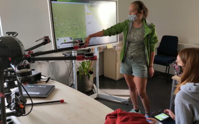
impressions of our UAV course
In September 2020 our UAV course took place and all practical exercises were covered. The manual UAV control as well as the automatic mission planning settings were discussed and actually applied. Various UAV systems were explored by the students and a diversity of...
Internship presentations
On Thursday 30th at 10 am the following EAGLE students will present their internships or inno labs: Tobias Gutzmann: 'Aerial Image Analysis for WW2 Warfare Material Detection' at Luftbilddatenbank Henrik Fisser: 'Sentinel-2 Truck Detection - Sensing Trade from Space...
2020 applications
We received again a high number of very good applicants and are currently working through all application files. We will invite all eligible applicants in the next weeks for an interview. In total we received 137 eligible applications from the EU as well as North and...
internship presentation by Henrik Fisser and Ronja Lappe
On Friday 24th of January at 10 am in room 1.009 OKW 86 the following two internship presentation will take place: Henrik Fisser: "Into the Uncertain - Noise Quantification of Sentinel-2 Water Signal in Dependence of Atmospheric Correction Methods"and some details...

Internship and MSc idea presentations
On Friday 10th of January the following presentations will take place in OKW86, room 1.009 from 10am onwards. Ojo Segun Adewale:Internship: Prediction of Gross Domestic Product using Remote Sensing Data (A case study of Brazil). Thesis Idea: Application of Remote...
M.Sc. Idea presentation by Nina Gnann and internship by Basil Tufail and Malin Fischer
Nina, Malin and Basil will present their M.Sc. idea and internships on Friday 20th of December in room 1.009 OKW 86. Ninas' envisioned M.Sc. is "Plastic waste detection assisted by artificial intelligence". Basil internship is titled: "Global training dataset for...
MSc idea and internship presentations
On Friday, 8th of November, from 10-12am the following presentation will take place in room 01.009, OKW 86: Michael Wang:"Deriving Surface Heat Island Intensities for TraK and CURE" - internship and thesis idea presentation Patrick Sogno:"The Hitchhikers Guide to an...

M.Sc. idea presentations and internship presentation
On Friday 25th of October several EAGLEs will present their M.Sc. thesis ideas and report back from an internship experience. It will take place at 10am in room 1.009, OKW 86. Katrin Hasenbein (MSc idea): "The potential of time-series data to improve fine scale...
Internship and InnoLab presentations
On Monday, 14th of October, at 5pm in room ZHSG 01.002, after the welcome of the new EAGLEs we will have the following internship and Innovation Laboratory presentations: Pawel Kluter (Internship): "Remote Sensing in the Federal Criminal Police Office" Pawel Kluter...