Aim
The potential and challenges of Unmanned Aerial Vehicles for monitoring our environment is covered using theoretical as well as practical approaches.
Content
In recent years, the use of small Unmanned Aerial Vehicles (UAV, UASs or also called Drones) inceased to map and monitor our environment at unprecedented detail. The development of new multispectral instruments on UAVs have given the remote sensing community exciting opportunities to acquire new data. With these new opportunities also new challenges such as sensor calibration, georeferencing as well as processing workflows, calibration/validation, and derivation of relevant land cover information. The course will cover theory and practice to apply UAVs in environmental research and its use for remote sensing analysis.
Coding
Software
Techniques
Content
General Course News and Updates

WG: EAGLE Innolab Presentation “Automated Basement Identification in SVI: A Two-Stage Learning Framework”
On July 15, 2025, Gökce Budak will present her Innolab results on " Automated Basement Identification in SVI: A Two-Stage Learning Framework" at 13:00 in seminar room 3, John-Skilton-Str. 4a. From the abstract: The presence of a basement, a structural attribute not...
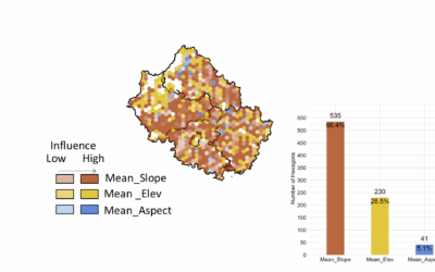
EAGLE Master Thesis Presentation “Ability of Random Forest Model to Predict the Mean and Standard Deviation of Winter Wheats Biomass in Bavaria: A case study”
On July 08, 2025, Sharmin Mim will defend her master thesis on "Ability of Random Forest Model to Predict the Mean and Standard Deviation of Winter Wheats Biomass in Bavaria: A case study " at 13:00 in seminar room 3, John-Skilton-Str. 4a. From the abstract:...
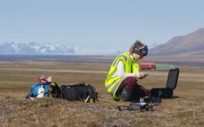
EAGLE Innolab Presentation “Ecology fieldwork in the high Arctic – A drone, tundra and reindeer”
On July 08, 2025, Ronja Seitz will present her Innolab on " Ecology fieldwork in the high Arctic - A drone, tundra and reindeer" at 12:00 in seminar room 3, John-Skilton-Str. 4a. From the abstract: Spitsbergen is the biggest island of the Svalbard archipelago,...
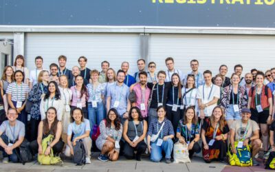
EORC Staff and EAGLE Students at ESA Living Planet Symposium 2025
This week, our EORC team and EAGLE MSc students are joining the global Earth observation community at the ESA Living Planet Symposium (LPS) 2025 — one of the most important gatherings for Earth system scientists, remote sensing experts, and space agencies worldwide....
EAGLE Master Defense: Quantification of Plant Functional Groups and Disturbances of Tundra Vegetation in the High Arctic Using High-Resolution UAV Timeseries Data
On July 01, 2025Ronja Seitz will present her Master Thesis on Quantification of Plant Functional Groups and Disturbances of Tundra Vegetation in the High Arctic Using High-Resolution UAV Timeseries Data " at 12:00 in seminar room 3, John-Skilton-Str. 4a. From...

Alpine Earth Observation: Learning Remote Sensing Where Science Meets Nature
Last week, our Alpine Earth Observation course brought a group of EAGLE students high into the Bavarian Alps, immersing them in a landscape where science and the raw beauty of high Alpine nature meet. Nestled at the Schneefernerhaus research station, the course...

EAGLE Innolab: Development of a QGIS Plugin for the Planning of Ground-Mounted Photovoltaic Systems
On June 16, 2025, Georg Starz will present his Innolab results on " Development of a QGIS Plugin for the Planning of Ground-mounted Photovoltaic Systems " at 10:00 in seminar room 3, John-Skilton-Str. 4a. From the abstract: After a decline in the mid-2010s, the...
EAGLE Master Defense: Enhancing Land Cover Classification in Southern Africa Using Multi-Sensor and Multi-Algorithm Approaches
On June 10, 2025, Christobal Tobbin will present his Master Thesis on " Enhancing Land Cover Classification in Southern Africa Using Multi-Sensor and Multi-Algorithm Approaches" at 12:00 online. From the abstract: The Kavango-Zambezi (KAZA) region which is a part of...
Radio Bavaria BR2 covered our activities at the Africa-Festival
Once again, our team proudly took part in the International Africa Festival in Würzburg, continuing our active participation within the University of Würzburg's exhibition—a tradition we’ve upheld for many years. This year’s event highlighted the ongoing commitment of...

🎓 Congratulations to Sunniva McKeever on a Successful MSc Defense! 🌍🌲
Today, we proudly celebrate our MSc student Sunniva McKeever, who has just successfully defended her Master thesis entitled: “Spatio-temporal Forest Structure Dynamics in Germany: A Synthesis of Remote Sensing Products.” Supervised by Prof. Dr. Tobias Ullmann,...