Hyperspectral Earth Observation
Hyperspectral Remote Sensing04-GEO-OMA5 Lecturer Martin Bachmann ECTS 5 ECTS Aim Spectroscopy and hyperspectral remote sensing enables to retrieve very detailed spectral information about a certain surface in dense bandwith intervalls. Information on the...
Scientific Maps
Scientific Maps04-GEO-SOS6 Lecturer Martin Wegmann ECTS 5 ECTS AimWithin this course different methods to analyse point pattern statistically and conduct a spatial prediction are covered. Students will learn how to design such analysis, how to avoid caveats,...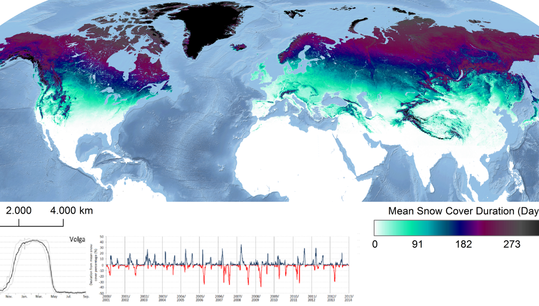
Earth Observation Time-Series Analysis
Earth Observation Time-Series Analysis 04-GEO-ENV10 Lecturer Andreas Dietz ECTS 5 ECTS Aim Within this course remote sensing time series potentials and limitations will be discussed and practically evaluated. Analyzing time series data and discussing their...