
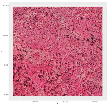
 The data provided by aerial imagery are amongst the oldest sources of spatially explicit information for modern-time environmental management. These data are often captured over landscape-level domains using overlapping flight stripes to enable stereo photogrammetric analysis based on parallax and obtaining information on vertical forest structure. As compared to the state-of-the-art LiDAR data, the stereo photogrammetric analysis is associated with a number of advantages and disadvantages for creating surface models, including the absence of bare earth ground data and usual geometric distortions (disadvantage) as well as reasonable acquisition costs and provision of multispectral information (advantages). The idea behind this work within an innovation laboratory is to analyze a series of multitemporal stereo orthophotos from the Bavarian Forest National Park (BFNP) to create surface models. The final products can be subtracted from the available LiDAR-based DTMs to provide canopy height models (CHM) representing the actual tree heights. The final aim of this analysis is to enable a further generation of multitemporal forest structure data that will be sued for a change detection of forest structural attributes as affected by natural disturbances.

A First Get-Together with the New EAGLE Generation 🦅
A new EAGLE generation means new faces, new ideas, and the start of another journey in Earth Observation. And what better way to kick things off than with a relaxed evening at the pub? Our first social event brought together the new students, older EAGLE generations,...



![[Spotlight] Lecturer Spotlight: Julian Faeth](https://eagle-science.org/wp-content/uploads/2026/10/Julian_Faeth_EORC_EAGLE_2026-400x250.jpg)



