Some of our former M.Sc. students published a peer-reviewed article about the importance of remote sensing training approaches, how it helped them in their career and what need to be improved.
The article is titled: “More than counting pixels – perspectives on the importance of remote sensing training in ecology and conservation” and published in Remote Sensing in Ecology and Conservation.
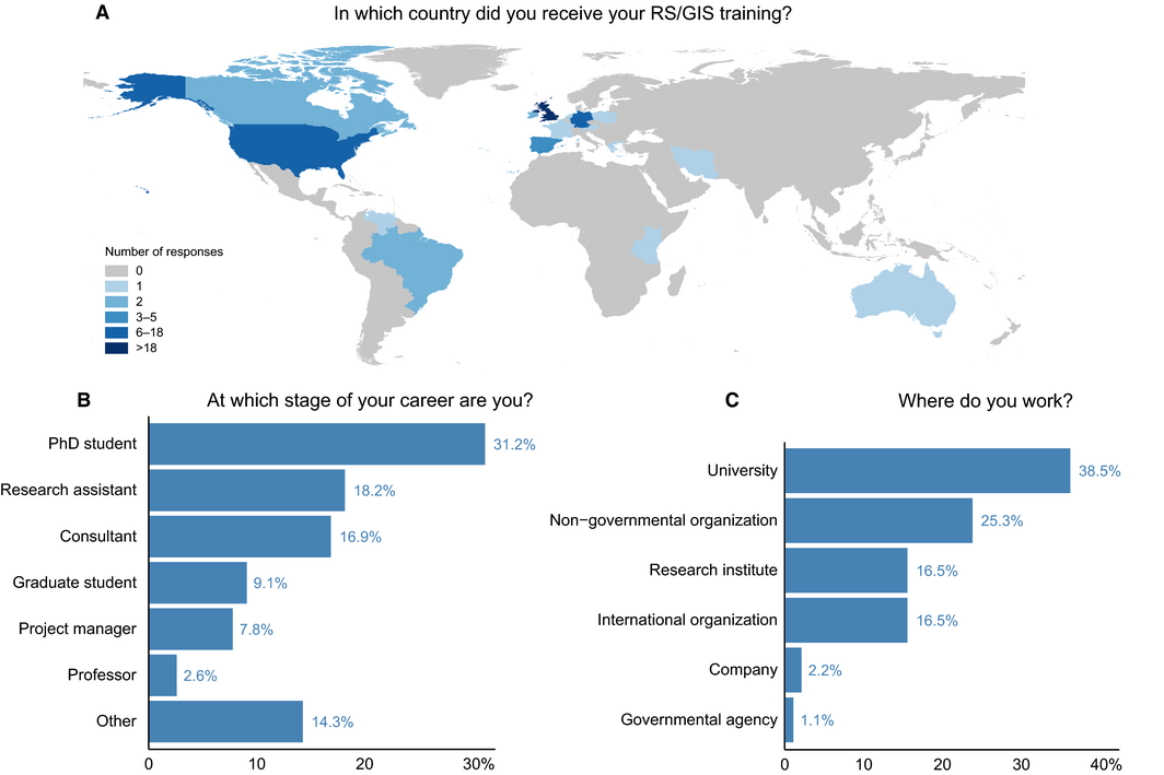
From the abstract: As remote sensing (RS) applications and resources continue to expand, their importance for ecology and conservation increases – and so does the need for effective and successful training of professionals working in those fields. Methodological and applied courses often form part of university curricula, but their practical and long-term benefits only become clear afterwards. Having recently received such training in an interdisciplinary master’s programme, we provide our perspectives on our shared education. Through an online survey we include experiences of students and professionals in different fields. Most participants perceive their RS education as useful for their career, but express a need for more training at university level. Hands-on projects are considered the most effective learning method. Besides methodological knowledge, soft skills are clear gains, including problem solving, self-learning and finding individual solutions, and the ability to work in interdisciplinary teams. The largest identified gaps in current RS training concern the application regarding policy making, methodology and conservation. To successfully prepare students for a career, study programmes need to provide RS courses based on state-of-the-art methods, including programming, and interdisciplinary projects linking research and practice supported by a sound technical background.
http://onlinelibrary.wiley.com/wol1/doi/10.1002/rse2.27/full