
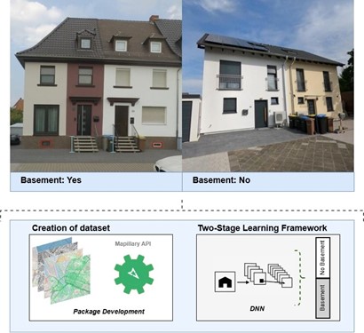
On July 15, 2025, Gökce Budak will present her Innolab results on ” Automated Basement Identification in SVI: A Two-Stage Learning Framework” at 13:00 in seminar room 3, John-Skilton-Str. 4a.
From the abstract:
The presence of a basement, a structural attribute not available in existing datasets, is critically important in hazard modelling and is directly associated with risks such as flooding, radon exposure, and the soft-story vulnerability of buildings. During my InnoLab at geomer GmbH, I developed a modular AI-based pipeline that detects the presence of basements from Mapillary street-level imagery (SVI). As part of this work, I developed a custom Python package to filter SVI and spatially align building façades with the Full haus building data provided by geomer GmbH. The pipeline combines object detection and few-shot learning techniques to identify buildings with or without basements, even in cases where training data is limited and class distributions are imbalanced. This methodology aims to contribute a novel and valuable data layer to geographic risk assessment.
Hosting institution: geomer GmbH
Supervisor: Dr. Insa Otte

![[Spotlight] Lecturer Spotlight: Julian Faeth](https://eagle-science.org/wp-content/uploads/2026/10/Julian_Faeth_EORC_EAGLE_2026-400x250.jpg)






