M.Sc. defense by Marius Philipp on Nov. 22nd

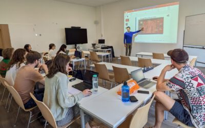
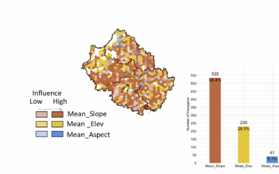
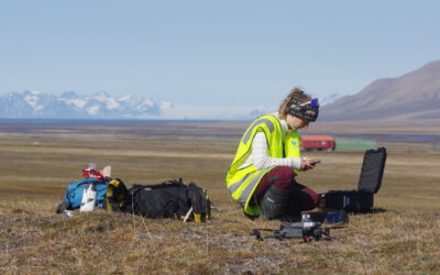
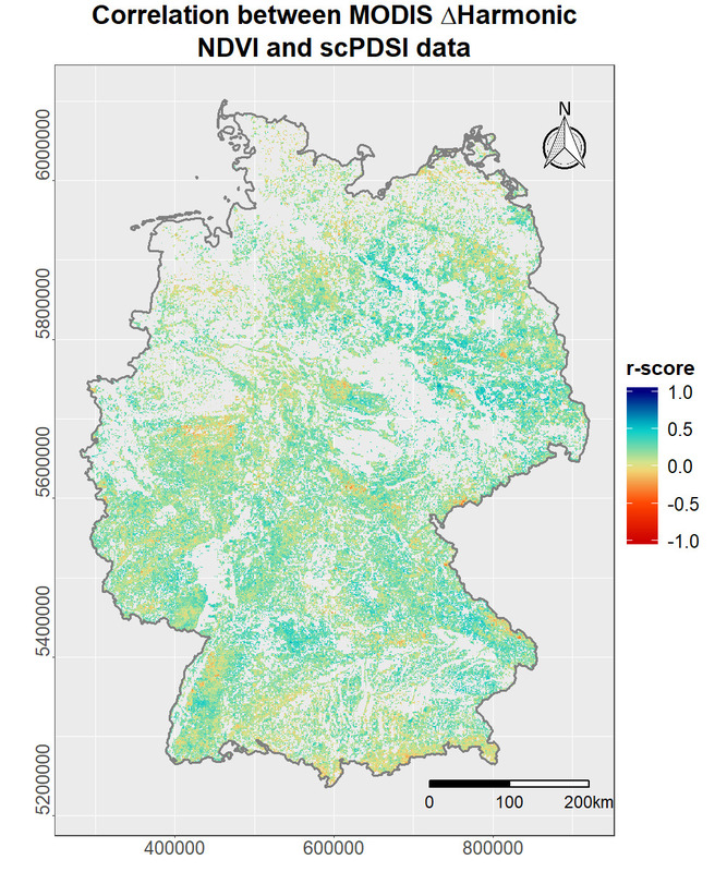
Marius Philipp is going to defend his M.Sc. thesis on November 22nd at 10 am in room 1.009 (OKW86). The title of his thesis is “Potential of harmonic analysis using remote sensing data for studying the effects of climate change induced weather extreme events on forest ecosystems”. From his abstract: Forest systems provide crucial ecosystem functions to our environment, such as balancing carbon stocks and influencing the local, regional and global climate. An increasing trend of climate change induced weather extreme events, including drought, are hereby a major challenge for forest management. Within this context, the application of remote sensing data provides a powerful means for quick, operational and inexpensive analysis over large spatial scales and time. That said, the potential of optical satellite data is limited by weather induced noise, mainly caused by cloud contamination. In order to mitigate these effects of noise and data gaps in remote sensing time-series analysis, harmonic modeling can be a powerful tool for addressing said issues. This thesis was dedicated to studying the potential of harmonic analysis for quantifying the phenological response to drought events in German forests. The harmonic modeling method was compared with a z-score standardization approach and correlated against both, meteorological and topographical data. Optical satellite imagery from Landsat and the MODIS was used in combination with the three vegetation indices NDVI, NBR and the TC based Greenness.

read more news:

EAGLE summer dialogue

EAGLE summer dialogue

Our annual EAGLE summer dialogue was a great success again even though the weather was quite challenging. The EAGLEs organized a fantastic event with fun activities, great images reviving the last months and years and of course a BBQ, drinks and an outstanding...

new publication by our EAGLE student Clara Vydra

new publication by our EAGLE student Clara Vydra

Our EAGLE student Clara just published an article about snow cover variability in Central Asia - great to see our young EAGLE MSc students being on a good track for their scientific career. from the abstract: "Climate change is affecting the snow cover conditions on a...

UAS team – meme

UAS team – meme

The UAS (UAV or drone) team was quite busy the last months to collect data in Europe, Africa or Arctic and the group spend plenty of hours traveling and collecting Lidar, multispectral, thermal or hyperspectral data in various ecosystems. Of course in many cases faced...

scientific graphics course

scientific graphics course

Beside the various remote sensing courses such as radar, cloud computing, terrain analysis, urban analysis etc. we do also offer courses on softskills such as scientific writing, presentations as well scientific graphics and maps. Within our scientific graphics course...

EAGLE students introduce locust spatio-temporal modeling

EAGLE students introduce locust spatio-temporal modeling

Our EAGLE students Leonie, Sonja and Clara presented methods to model the spatial and temporal distribution of locust in France using statistical modelling approaches within R and the flexSDM package. The elaborated for two hours how the complex data preparation,...