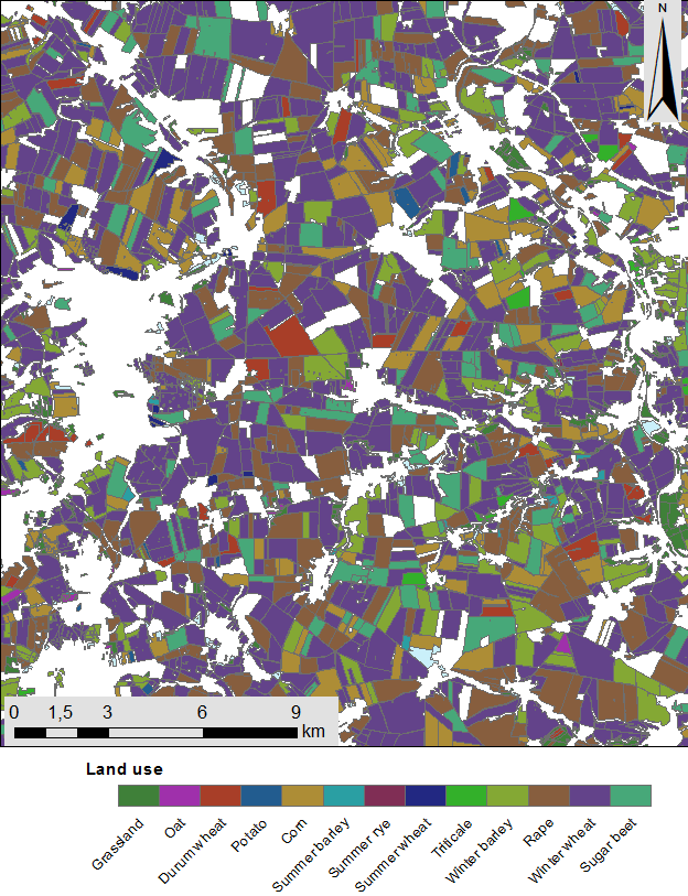
 Remote sensing based crop mapping is still challenging when just relying on optical information as the only data source. Due to the unavailability of adequate optical satellite images the integration of SAR is promising and can be explored within an innovation laboratory. The combination of SAR (TERRA-SAR-X and Sentinel-1) and optical images (RapidEye and Sentinel-2) for classification will improve the reliability and accuracy of crop maps. In addition, a sequential masking classification technique will be used to classify individual crop classes. These results will be compared with results of a one-step classification, in which all crop classes were classified at the same time. It has to be determined if the sequential masking approach will improve overall classification accuracies, compared to the one-step classification. As a study site the TERENO test site DEMMIN in Mecklenburg-Western Pomerania is suggested.

Successful MSc Defense by Anna Bischof
We congratulate Anna Bischof on the successful defense of her MSc thesis, "Feasibility of Unoccupied Aerial System-Based Active Fire Monitoring in African Savannas." Anna's research addressed one of the key challenges in fire ecology and remote sensing: understanding...