Aim
In this module you will gain a detailed understanding of the advantages and challenges of Earth observation using Light Detection and Ranging (LiDAR) systems. Compared to other types of remote sensing data, the data from active Light Detection and Ranging (LiDAR) systems is of particular importance for local studies, where the 3D component (height) of objects is of relevance. Commonly LiDAR data is applied it in the field of digital terrain modelling, in forestry – e.g. for canopy height assessment, or urban structure applications. LiDAR embraces a range of active remote sensing systems mounted on different platforms, which provide valuable information for characterization of horizontal and vertical structure of the earth surface by measuring the travel time of laser pulses in visible and near-infrared spectral domains. The quality of scanning depends on the nature of the LIDAR system (discrete-return or full waveform) as well as on a set of other terrain- and data-driven factors. This course provides you with an overview on the theory and applications of LiDAR data, with a particular focus on airborne laser scanning. Following the initial theoretical sections on the principles and basic characteristics of LiDAR data, diverse practical steps and exercises will be implemented to provide real-world examples to illustrate how the LiDAR point clouds can be applied to extract information on terrain, surface and vegetation. These information will be further employed to model vegetation structural attributes on multiple spatial scales ranging from single trees to landscape levels.
Content
Block 1: Introduction to LiDAR (how does laser scanning work?)
- Reminder on general remote sensing issues: difference between active and passive sensing
- History of LiDAR measurements
- Basics of LiDAR data measurements (platforms, sensors)
- Airborne vs. spaceborne LiDAR: history, applications and data access
- Measurement of travel time of laser light (pulsed time of flight)
- On the concept of “structure”: why a third dimension is crucial?
Block 2: Principles of LiDAR measurements
- Platform navigation, orientation and positioning
- Difference between types of data acquisitions: discrete return and echo waveform
- The recorded parameters: elevation, height, signal intensity and co.
- The concept of „single-pulse“ vs. „multiple-pulse“
- How are the incoming returns recorded? first come- first served!
- Terrestrial LiDAR measurement: one position, rotating scanner
- Data formats and big data-management: each byte matters!
Block 3: Elevation models:
- General thoughts: why are the elevation models essential?
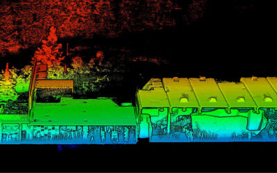
- Digital terrain models
- Digital surface models
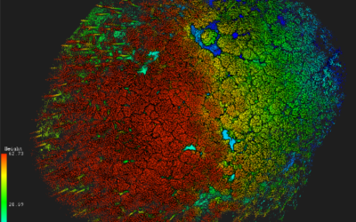
- Normalized DSM (Canopy height models)
- Application fields: Forest, landscape and habitat representations
- Magnified focus on Forest (basic and derived parameters): Diameter at breast height, height, tree type proportions, tree type mapping, crown closure, stem count, growing stock und aboveground biomass
- Single tree measurements
- Urban: City models, roof top and building footprints
Block 4: Exercises in Open-Source domain of LiDAR data processing (Fusion/LDV, LASTools, R)
- Exercises on point cloud processing
- Import, export, visualizations and rendering
- Sample measurements, single tree measurements and associated tasks
- Elevation models
- Data trimming, cropping, smoothing and generalizing
- Catalog and descriptive communication
- Extraction of metrics for modeling purposes
- Thoughts on metrics
- Intensity: yes or no?
- Multi-scale metric extraction
- Multi-source metric extraction
- Class works and workshops (CIP-Pool/Homework)
- Literature review, discussion groups and public presentations
Coding
Coding examples and individual work will be covered
Software
Various software programs will be used, but mainly OpenSource software such as R.
Techniques
Different techniques will be introduced and practically applied.
Content
The content of scientific with regard to the audience will be discussed.
General Course News and Updates
MSc defense and Inno-Lab presentations
On Tuesday 20th of December at 12am we will have various presentations MSc defense by Kevin Yomi on "Evaluation wildfire activity in conflict-affected areas using earth observation and panel regression models: a case study of Borno State, Nigera, from 2003-2020" In...
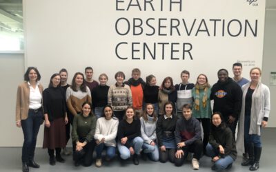
EAGLEs visit DLR EOC
After a long break due to covid we resumed the EAGLE visit of DLR EOC. Many EAGLEs from the current generation and quite some of the past (covid) generations joined this event and listened to many talks by DLR researchers. Some of the presenters were even former...
Social event in the boulder gym
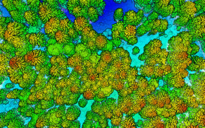
Last week we spend a few hours in the boulder hall to enjoy a day without courses, do some climbing and have plenty of time to chat. Many EAGLEs from the current and old generations joint us as well as many lecturer. Beside the social event we also collected Lidar...
MSc defense Caroline Busse
On Tuesday 22nd of November at 1pm we will have the MSc thesis defense by Caroline on "Change Detection using Sentinel-1 and Sentinel-2 Time Series: A Comparison of Models for the Detection of Forest Disturbances." from the abstract: "Forests provide essential...
internship, innoLab and MSc idea presentations
On Tuesday 22nd of November at 12am we will have the following presentations: Dilara Kim: „Automated glacier snowline mapping from multi-sensor satellite observation“, InnoLab, EURAC Research, Supervisor: Dr. Martina Barandun Walid Ghariani: „PM2.5 Prediction Using...
New EAGLE Earth Observation professors
We are very happy to welcome two new professors within the EAGLE M.Sc. program! Prof. Dr. Hannes Taubenböck and Prof. Dr. Tobias Ullmann will strengthen the urban remote sensing and radar earth observation within the EAGLE program. Various new courses are already...
MSc defense by Larissa Gorzawski
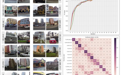
On Wednesday 5th of October at 2pm Larissa will present her M.Sc. thesis "Deep transfer learning on street-level imagery for classification of seismic building types in Lima, Peru". From the abstract: "Comprehensive exposure models for seismic risk assessment require...

M.Sc. defense by Jakob Rieser
On Monday, 26th of September at 10am, Jakob will present his M.Sc. thesis „A Synergistic Use of Optical and SAR Remote Sensing Data for the Long-term Evolution of Biocrusts and their Activity Across Diverse Dryland Ecosystems”. from the abstract: "Biological soil...

MSc defense by Christopher Chan
Chris will present his M.Sc. thesis "Investigating the capability of UAV imagery in AI-assisted mapping of Refugee Camps in East Africa" on Friday 16th of September at 2pm. From his abstract: " Refugee camps and informal settlements provide accommodation to some of...
MSc defense by Annika Ludwig
Annika will present her M.Sc. thesis "Analysis of alpine grassland management dynamics based on webcam and optical remote sensing time series" on Friday 9th of September at 9am. From the abstract: "The aim of this study is to detect relationships between environmental...