Aim
In this module you will gain a detailed understanding of the advantages and challenges of Earth observation using Light Detection and Ranging (LiDAR) systems. Compared to other types of remote sensing data, the data from active Light Detection and Ranging (LiDAR) systems is of particular importance for local studies, where the 3D component (height) of objects is of relevance. Commonly LiDAR data is applied it in the field of digital terrain modelling, in forestry – e.g. for canopy height assessment, or urban structure applications. LiDAR embraces a range of active remote sensing systems mounted on different platforms, which provide valuable information for characterization of horizontal and vertical structure of the earth surface by measuring the travel time of laser pulses in visible and near-infrared spectral domains. The quality of scanning depends on the nature of the LIDAR system (discrete-return or full waveform) as well as on a set of other terrain- and data-driven factors. This course provides you with an overview on the theory and applications of LiDAR data, with a particular focus on airborne laser scanning. Following the initial theoretical sections on the principles and basic characteristics of LiDAR data, diverse practical steps and exercises will be implemented to provide real-world examples to illustrate how the LiDAR point clouds can be applied to extract information on terrain, surface and vegetation. These information will be further employed to model vegetation structural attributes on multiple spatial scales ranging from single trees to landscape levels.
Content
Block 1: Introduction to LiDAR (how does laser scanning work?)
- Reminder on general remote sensing issues: difference between active and passive sensing
- History of LiDAR measurements
- Basics of LiDAR data measurements (platforms, sensors)
- Airborne vs. spaceborne LiDAR: history, applications and data access
- Measurement of travel time of laser light (pulsed time of flight)
- On the concept of “structure”: why a third dimension is crucial?
Block 2: Principles of LiDAR measurements
- Platform navigation, orientation and positioning
- Difference between types of data acquisitions: discrete return and echo waveform
- The recorded parameters: elevation, height, signal intensity and co.
- The concept of „single-pulse“ vs. „multiple-pulse“
- How are the incoming returns recorded? first come- first served!
- Terrestrial LiDAR measurement: one position, rotating scanner
- Data formats and big data-management: each byte matters!
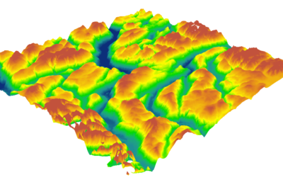
Block 3: Elevation models:
- General thoughts: why are the elevation models essential?
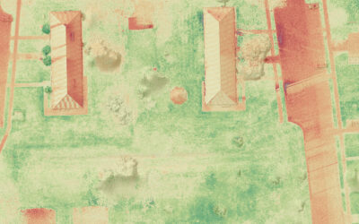
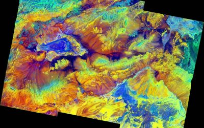
- Digital terrain models
- Digital surface models
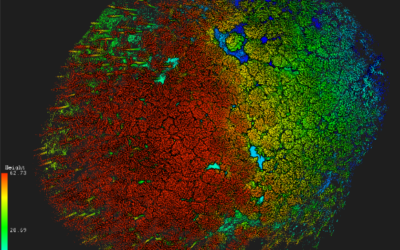
- Normalized DSM (Canopy height models)
- Application fields: Forest, landscape and habitat representations
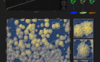
- Magnified focus on Forest (basic and derived parameters): Diameter at breast height, height, tree type proportions, tree type mapping, crown closure, stem count, growing stock und aboveground biomass
- Single tree measurements
- Urban: City models, roof top and building footprints
Block 4: Exercises in Open-Source domain of LiDAR data processing (Fusion/LDV, LASTools, R)
- Exercises on point cloud processing
- Import, export, visualizations and rendering
- Sample measurements, single tree measurements and associated tasks
- Elevation models
- Data trimming, cropping, smoothing and generalizing
- Catalog and descriptive communication
- Extraction of metrics for modeling purposes
- Thoughts on metrics
- Intensity: yes or no?
- Multi-scale metric extraction
- Multi-source metric extraction
- Class works and workshops (CIP-Pool/Homework)
- Literature review, discussion groups and public presentations
Coding
Coding examples and individual work will be covered
Software
Various software programs will be used, but mainly OpenSource software such as R.
Techniques
Different techniques will be introduced and practically applied.
Content
The content of scientific with regard to the audience will be discussed.
General Course News and Updates
MSc defense by Annika Ludwig
Annika will present her M.Sc. thesis "Analysis of alpine grassland management dynamics based on webcam and optical remote sensing time series" on Friday 9th of September at 9am. From the abstract: "The aim of this study is to detect relationships between environmental...
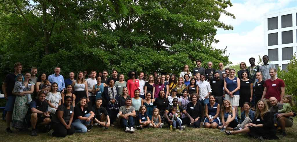
EAGLE summer dialogue 2022
After two years we finally had our EAGLE summer dialogue again with many Earth Observation alumni, now working in various research organizations and companies. Great to talk to all our past and present students and also seeing all the students getting to know each...
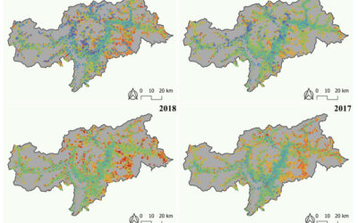
WWF course on applied Earth Observation
Our EAGLE students joint a course offered by the earth observation unit at WWF and learned how to apply remote sensing within a conservation NGO. They learned a lot and their results are published as story maps on their webpage...
Inno lab and internship presentations
On Friday, 8th of July, at 9:30 we will have the following presentations: Jana Maier (InnoLab at DLR): Multitemporal SAR Analysis for Sentinel-1 metrics based Land Cover Classification in West Africa - InnoLab in Agroecosystems and Phenology at DLR. Nora Nieskens...
MSc defense by Antonio Castaneda
On Friday, 1st of July at 9am Antonio will present his M.Sc. thesis "Potential and limits of using UAS in forest monitoring". From the abstract: "The exponential development, usage, and application of uncrewed area systems (UAS) have given remote scientists a clear...
internship, inno lab and MSc idea presentation
On Monday, 30th of May, from 10am onwards, we will have the following presentations: Ása Dögg (Inno-lab): "Potential of Sentinel-1 data for research and monitoring in Tröllaskagi peninsula, Iceland - Snow cover mapping using S-1 time series."Supervisors: Tobias...
Internship and Inno Lab presentations
On Friday 20th of May at 9am we will have the following internship and inno lab presentations: Andrea Cardenas (Internship at DLR): “Data analysis of the refugee crisis in West Africa and definition of test sites in NRW – Germany”supervisor: Martin Muehlbauer Ása Dögg...

EAGLE application in 2022
We received again more than 200 applicants from all over the world. In total applicants from 42 different countries applied to our international Earth Observation M.Sc. program, covering countries such as Hungary, Morocco, Malaysia, Kenya, Nepal or Columbia. We are...
EAGLE application deadline 2022
Our application deadline for 2022 is approaching. If you want to study applied Earth Observation and learn about a variety of remote sensing sensors and methods as well as about fields of applications, submit your application at the latest on May 15th. Accepted...
MSc defense by Haiyin Ye
On Friday 20th of May at 9am Haiyin will present her M.Sc. thesis "Monitoring Gypsy Moth Outbreak Using Sentinel-1 and Sentinel-2 Data". From the abstract: "Gypsy moth Lymantria dispar (L.) is a serious pest in deciduous forests, the larvae of which can feed on a...