Aim
In this course we will learn the alternative image analysis paradigm of object-based image classification. Image objects are areas in images which consist of pixels from the same land-cover class (e.g. buildings, water surfaces, vegetation) and allow the application of additional image classification methods in comparison to pure pixel-based methods and the integration of multi-modal date (e.g. vector data).
Content
In the course we will use satellite images and high resolution aerial images in combination with vector data and analyze various image classification methods (nearest neighbor -> random forests -> deep learning) to extract relevant information from the images.
We will use the software “eCognition”.
The course will be held on 3 days in Würzburg plus an introductory lecture which is being held online.
Session 1: getting to know to image objects and eConition software, basic classification methods
Session 2: advanced classification (Machine Learning)
Session 3: Deep Learning
Coding
Software
Techniques
Content
General Course News and Updates
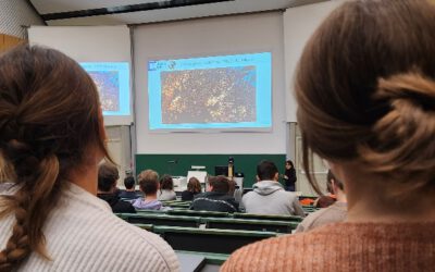
Our Eagles Soar in Remote Sensing: A Look Back at Their Successful Scientific Presentation Course
We are thrilled to share the amazing achievements of our talented students who recently completed their scientific presentation course with flying colors. Our eagles had the exciting opportunity to introduce over 100 BSc students to the world of remote sensing,...
EAGLE Internship Presentation “Effect of Semicircular Bunds for Soil moisture conservation in Ethiopia”
On January 28, 2025, Suriya Elango will present his internship on "Effect of Semicircular Bunds for Soil moisture conservation in Ethiopia" at 12:00 in seminar room 3, John-Skilton-Str. 4a. From the abstract: This study assessed the impact of semi-circular soil...
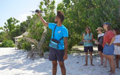
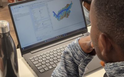
Empowering Future Earth Observation Experts! 🌍
At EAGLE, our Earth Observation students are diving deep into the fascinating world of geospatial analysis! Through hands-on training, they master cutting-edge algorithms and techniques to address pressing environmental challenges such as Georisk Assessment:...
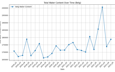
Marlene and Anna did their internship with Nature Seychelles
In a collaboration that highlights the intersection of technology and ecological preservation, Marlene Bauer and Anna Bischof, EAGLE M.Sc. students in Earth Observation, have engaged in a significant internship with Nature Seychelles. Their tenure on the scenic island...
EAGLE Internship Presentation “Earth Observation for Construction Statistics” at the Federal Agency for Cartography and Geodesy”
On January 28, 2025, Georg Starz will present her internship on "Earth Observation for Construction Statistics (BKG, Frankfurt)" at 12:15 in seminar room 3, John-Skilton-Str. 4a. From the abstract: The lack of affordable housing, especially in urban areas, is...
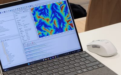
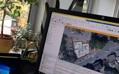
Empowering Students with SAGA GIS for Environmental Applications
At EAGLE Earth Observation, we are committed to equipping our students with the tools and knowledge needed to excel in the field of environmental science. As part of this effort, our students are exploring the power of various scientific open-source software packages...
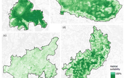
EAGLE Internship Presentation “Mapping Ecosystem Services in Norway”
On January 28, 2025, Sonja Maas will present her internship on " Mapping Ecosystem Services in Norway" at 13:00 in seminar room 3, John-Skilton-Str. 4a. From the abstract: Nature plays an important role in human well-being by providing essential services such as the...
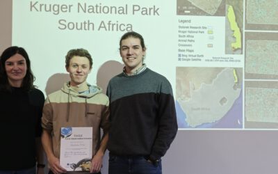
Successful Master Thesis Defense by Konstantin Müller
On January 14th, Konstantin Müller successfully defended his master’s thesis titled "Animal Path Segmentation and Analysis via Generalized Deep Neural Network Regression". Supervised by Jakob Schwalb-Willmann and Dr. Mirjana Bevanda, the presentation was delivered to...
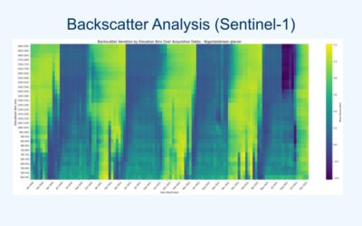
EAGLE Internship Presentation “Glacier Surface Dynamics and Snowline Analysis Using Remote Sensing Data”
On January 21, 2025, Daria Ushakova will present her internship on "Glacier Surface Dynamics and Snowline Analysis Using Remote Sensing Data" at 13:00 in seminar room 3, John-Skilton-Str. 4a. From the abstract: This internship focused on analysing glacier surface...
EAGLE Master Thesis Defense “Linking Wildlife Conservation to Nature’s Contributions to People: A Case Study for the European Wildcat (Felis silvestris silvestris) in German Protected Forests”
On January 21, 2025, Svenja Dobelmann will defend her master thesis" Linking Wildlife Conservation to Nature’s Contributions to People: A Case Study for the European Wildcat (Felis silvestris silvestris) in German Protected Forests" at 12:00 in seminar room 3,...