Aim
Within this course object-oriented image analysis is introduced using different very high to high remote sensing data. Different approaches and techniques will be covered to allow students to apply this method in applied science.
Content
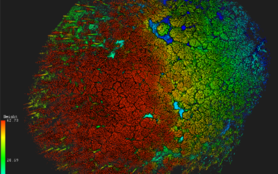
Theoretical basics of object-oriented methods are covered and discussed concerning their disadvantages and advantages for applied landscape analysis. Practical exercises are covering first segmentation steps to ready classified images. Various examples and technical settings are explored to outline the challenges and potential of object-oriented image analysis. Final outcome will be an individual project working on different set of images and methods.
Coding
Software
Techniques
Content
General Course News and Updates
M.Sc. defense by Luisa Pflumm on remote sensing for decision making
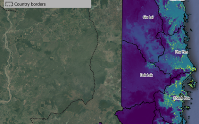
Luisa will defend her M.Sc. thesis "Using remote sensing to enhance conservation decision-making: The case of the little-known silver-backed chevrotain" this Friday at 10am in the meeting room John Skilton 4a. From her abstract: "Southeast Asia is a biodiverse region...
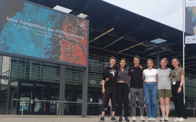
EAGLEs at DLR’s 4th Symposium “New Perspectives on Earth Observation”
From the 26th to the 28th of June, the fourth symposium on Applied Satellite Earth Observation, organized by the DLR took place in Bonn and some of the current EAGLE generation did not miss the opportunity to make a fun trip to the former capital of Germany. From...
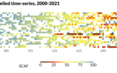
MSc defense Sub-seasonal snowline dynamics of glaciers in Central Asia from multi-sensor satellite observations, 2000-2021
MSc defense (MA2) by Dilara Kim On Monday, September 18, 2023 Dilara Kim will present her Msc Thesis at 13:00 “Sub-seasonal snowline dynamics of glaciers in Central Asia from multi-sensor satellite observations, 2000-2021” From the abstract: Glaciers are an important...
Innovation Lab Presentation by Konstantin Müller
On Tuesday, July 18 at 11 a.m. Konstantin Müller will hold his Innovation Lab Presentation "Analysis of Twitter over New Year's Eve" From the abstract: Until this day, scientists have figured out urban data and structures as morphological or topological...
Msc Defense by Katrin Wernicke
On Tuesday, July 18 at 10 a.m. Katrin Wernicke will present her MSc Thesis "Deep Learning for Refugee Camps – Mapping Settlement Extents with Sentinel-2 Imagery and Semantic Segmentation" From the abstract: The number of people forced to flee their homes has...
MSc Defense by Nora Nieskens
MsC Defense by Nora Nieskens On Friday, September 08, 2023 at 11 a.m. Nora Nieskens will present her Msc Thesis “Estuaries in transition: Earth observation-based analysis of the turbidity dynamics in selected North Sea estuaries” in room 00.B.09 in John-Skilton-Str....
Detection of slope deformation at the Tröllaskagi peninsula, N-Iceland, using Sentinel-1 DInSAR time series
MSc defense (MA2) by Ása Dögg Adalsteinsdóttir On Monday, September 18, 2023 Ása Dögg Adalsteinsdóttir will present her Msc Thesis at 14:00 Detection of slope deformation at the Tröllaskagi peninsula, N-Iceland, using Sentinel-1 DInSAR time series Thema: MSC...
MSc defense by Vanessa Rittlinger
On Tuesday, October 24, 2023 at 10:00 a.m. Vanessa Rittllinger will present her master thesis on “Detection of landslides in space and time using optical remote sensing data – A case study in South Tyrol” in the conference room 01.B.03 in John-Skilton-Str. 4a/1st...
MSc defense and Inno-Lab presentations
On Tuesday 20th of December at 12am we will have various presentations MSc defense by Kevin Yomi on "Evaluation wildfire activity in conflict-affected areas using earth observation and panel regression models: a case study of Borno State, Nigera, from 2003-2020" In...
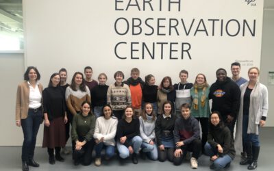
EAGLEs visit DLR EOC
After a long break due to covid we resumed the EAGLE visit of DLR EOC. Many EAGLEs from the current generation and quite some of the past (covid) generations joined this event and listened to many talks by DLR researchers. Some of the presenters were even former...