Aim
Within this course object-oriented image analysis is introduced using different very high to high remote sensing data. Different approaches and techniques will be covered to allow students to apply this method in applied science.
Content
Theoretical basics of object-oriented methods are covered and discussed concerning their disadvantages and advantages for applied landscape analysis. Practical exercises are covering first segmentation steps to ready classified images. Various examples and technical settings are explored to outline the challenges and potential of object-oriented image analysis. Final outcome will be an individual project working on different set of images and methods.
Coding
Software
Techniques
Content
General Course News and Updates

Internship, Innovation Lab and MSc idea presentations
The following students presented their innovation labs, internships and ideas for MSc. thesis: Ahmed: Innovation Lab at DLR (team of Ursula Gessner) and Master Thesis Idea: Title: Status of Agricultural Lands in Egypt using Earth Observation Maninder (at DLR,...
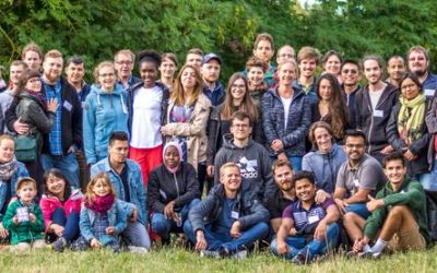
EAGLE summer dialogue 2018
Our 2018 EAGLE summer dialogue took place last Friday, 22nd of June and was a great place to meet all students, lectures, staff of the department and quite some external guests from all around Europe.
Internship and Innovation Lab presentations
Today some of our EAGLE students presented their internship and innovation laboratory projects. Very interesting topics and they obviously applied and deepened their remote sensing knowledge a lot. Julia Sauerbrey: Prediction of Organic Matter Content from Sentinel-2...
application deadline is approaching – May 15th
the application deadline for our next term of the international M.Sc. program EAGLE “applied Earth Observation and Geoanalysis of the Living Environment” is approaching. Application for the upcoming winter term are accepted until May 15th
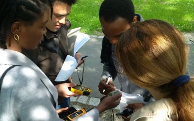
EAGLE students learn remote sensing field work
The course "from field work to spatial data" by Tobias Ullmann and Martin Wegmann is covering the whole range of field campaign planning and especially training all necessary methods such as GPS handling, coordinate systems, setting waypoints or finding locations. In...

MSc thesis started by Jakob Schwalb-Willmann
Jakob Schwalb-Willmann just started his M.Sc. thesis titled "A deep learning movement prediction model using environmental data to identify movement anomalies". He will combine animal movement and remote sensing data in order to develop a generic, data-driven DL-based...
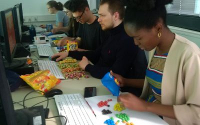
EAGLE students coding with sweets
Today our EAGLE students applied data munging, pipes, plotting and statistics using colour distribution of sweets. They specifically used the dplyr, ggplot, kableExtra and others to compute derivatives, rearrange the data, plot it and run statistics on colour...
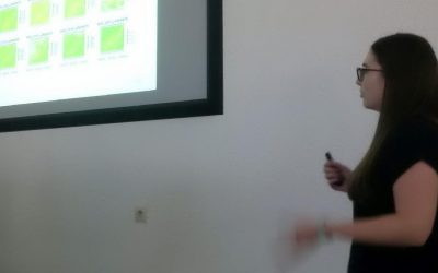
Final presentations of the remote sensing programming course
The final project presentations of the spatial coding course by the EAGLE students revealed quite some impressive analysis achieved within the last couple of months. All analysis were done using R and presentations created within R using knitr. The aim was to run a...
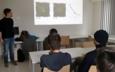
internship and innovation laboratory presentations
The following internship and innovation laboratory projects were presented today: Karsten Wiertz did his internship at the Białowieza national park on "Spatio-temporal analysis of tree mortality and gaps in the Białowieza Forest using high resolution imagery". Jakob...
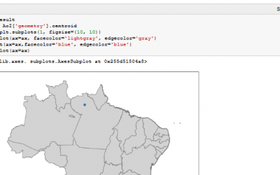
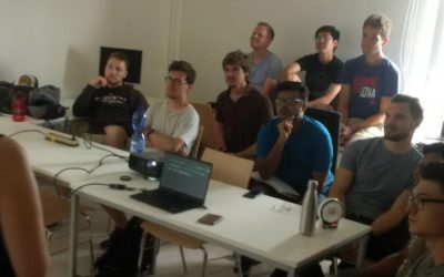
Spatial Python block course
Last week Steven Hill and Thorsten Dahms gave a course that introduced EAGLE students to Python-based spatial data analysis. The advantages and challenges of different python libraries, data sets and methods were covered in hands-on exercises and also discussed...