Aim
Designing scientific graphics that provide all necessary information without being too packed, focusing on the essential message and being able to actually create such graphics will be covered In this class. All necessary tools and and approaches to create adequate figures and maps will be covered.
Content
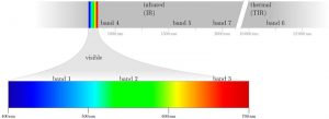
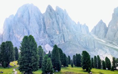
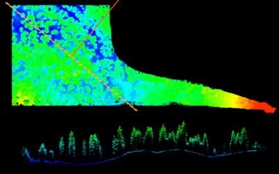
figure from the book “Remote Sensing and GIS for Ecologists” by Wegmann, Leutner and Dech, created with tikz
General guidelines of scientific graphics and maps will be covered based on e.g. Tufte and followed by practical implementation of graphic ideas, as well as critical evaluation of the results. Only open source program will be used such as R or tikz/pgf and students will have the opportunity to work specifically on certain scientific graphics or maps using e.g. ggplot2 and explore the potential and limits of good scientific graphs. Good map designs will be discussed as well and common mistakes will be pointed out. After this course you will be capable to create your own graphics for a specific scientific purpose e.g. your M.Sc. thesis.
Coding
Software
Techniques
Content
General Course News and Updates
MSc thesis defense by Florian Baumgartner
Floran Baumgartner will present his M.Sc. thesis "The potential of Sentinel-2 time series for yield estimation of a perennial wild plant mix-ture using machine learning" on Friday 29th of October at 10am. From the abstract: "Monocultures are generally accompanied by...
MSc idea and InnoLab presentations
On Friday 15th of October at 10am we will have the following MSc idea and inno lab presentations: Nestor Gualsaqui - M.Sc. Thesis Idea: "Pre-crop emergence weed mapping using high satellite imagery"supervisor: Dr. Michael Thiel Yomna Eid - Innovation Lab:...
MSc defense by Frederic Schwarzenbacher
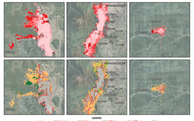
Frederic Schwarzenbacher will defend his M.Sc. thesis on Monday 6th at 3pm. The title is "Habitat suitability modeling for Desert Locust in the Awash River basin: Estimation of the breeding probability based on remote sensing, climatology and environment data" and...
MSc idea and internship presentations
Next Monday, Sept. 20th, at 9:30am the following EAGLE students will present thier MSc. thesis idea or internship: Sofia Garcia:“Estimating socioeconomic variables in Bolivia using satellite-based NTL and electricity consumption data”(Thesis idea, supervisors Hannes...
MSc defense by Belen Villacis
Belen will defend her M.Sc. thesis “Spatio-temporal patterns of urban expansion among main biomes in Ecuador using LULC data from 1990-2018” on Wednesday 8th of September, 2pm. From the abstract: "Over the past decades, the world has experienced an accelerated...
MSc defense by Ronja Lappe
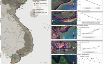
Ronja Lappe handed in her M.Sc. thesis "Assessing 30 years of coastline dynamics in Vietnam using the Landsat archive"from the abstract: "Almost half of the world’s human population lives in coastal regions, with 40 % less than ten meters above sea level. Due to...
MSc defense by Martin Koenig
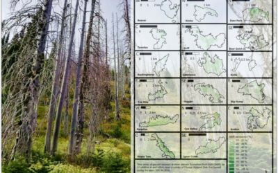
Martin König handed in his thesis with the title “Examining post-fire vegetation recovery with Landsat time series analysis in Olympic National Park (USA)”. Martin used remote sensing and ground collected data to make sense of vegetation recovery patterns for larger...
thesis idea presentations
On Monday 26th of July at 2pm we will have two MSc thesis idea presentations: Jakob Wachter (thesis idea):"Derivation of Snow cover in mountain regions from Webcam and Sentinel Imagery (thesis idea)" - supervisors Dr. Tobias Ullmann and Dr. Mattia Rossi, EURAC...
Thesis idea and internship presentation
On Thursday, July 22nd at 2pm we will have the following presentations: Haiyin Ye (thesis idea):"Monitoring gypsy moth outbreak using Sentinel-1 and Sentinel-2 data" - supervisors Soyeon bae and Martin Wegmann Christabel Ansah (internship):"Virtual...
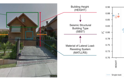
MSc Defense by Sandro Groth
Sandro Groth will present his M.Sc. thesis "Using street-level imagery and multi-task deep learning for multi-hazard risk related building characterization" on June 28th at 9am. From his abstract: "Accurate building characterization is a key component of multi-hazard...