Aim
Designing scientific graphics that provide all necessary information without being too packed, focusing on the essential message and being able to actually create such graphics will be covered In this class. All necessary tools and and approaches to create adequate figures and maps will be covered.
Content
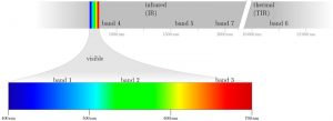
figure from the book “Remote Sensing and GIS for Ecologists” by Wegmann, Leutner and Dech, created with tikz
General guidelines of scientific graphics and maps will be covered based on e.g. Tufte and followed by practical implementation of graphic ideas, as well as critical evaluation of the results. Only open source program will be used such as R or tikz/pgf and students will have the opportunity to work specifically on certain scientific graphics or maps using e.g. ggplot2 and explore the potential and limits of good scientific graphs. Good map designs will be discussed as well and common mistakes will be pointed out. After this course you will be capable to create your own graphics for a specific scientific purpose e.g. your M.Sc. thesis.
Coding
Software
Techniques
Content
General Course News and Updates

scientific graphics course
Beside the various remote sensing courses such as radar, cloud computing, terrain analysis, urban analysis etc. we do also offer courses on softskills such as scientific writing, presentations as well scientific graphics and maps. Within our scientific graphics course...

EAGLE students introduce locust spatio-temporal modeling
Our EAGLE students Leonie, Sonja and Clara presented methods to model the spatial and temporal distribution of locust in France using statistical modelling approaches within R and the flexSDM package. The elaborated for two hours how the complex data preparation,...

Internship Presentation: Discovering Hydrographic Parameters of HydroSHEDS and TanDEM-X Digital Elevation Model through Exploratory Data Analysis on July 09, 2024
On Tuesday, July 09, Subarno Shankar will present his internship " Discovering Hydrographic Parameters of HydroSHEDS and TanDEM-X Digital Elevation Model through Exploratory Data Analysis " at 12:00 in seminar room 3, John-Skilton-Str. 4a. From the abstract: Climate...

Master Thesis Presentation: Earth Observation for Wildlife Monitoring in cold and polar Regions – A Review and a Case Study about the Northern Bald Ibis on June 11, 2024
On Tuesday, June 11 , Helena Wehner will defend her master thesis " Earth Observation for Wildlife Monitoring in cold and polar Regions – A Review and a Case Study about the Northern Bald Ibis" at 13:00 in seminar room 3, John-Skilton-Str. 4a. From the abstract:...

Master Thesis Presentation: Analysis of Urban Heat Development in Dresden, Germany using Landsat Data from the Past Decade
On Tuesday, May 28, Ina Schulz will defend her master thesis " Analysis of urban heat development in Dresden, Germany using Landsat data from the past decade" at 12:00 in seminar room 3, John-Skilton-Str. 4a. From the abstract: As the number of urban residents is...

Master Thesis Presentation: Modelling LAI of Alpine Grassland on June 11, 2024
On Tuesday, June 11 , Caroline Göhner will defend her master thesis " Modelling LAI of Alpine Grassland" at 12:00 in seminar room 3, John-Skilton-Str. 4a. From the abstract: Alpine grasslands are crucial ecosystem providers and one of the most threatened terrestrial...
Internship Report on Tuesday, May 21st at 12:00
NEW DATE: On Tuesday, May 21st, Elly Schmid will present her internship at 12:00 in seminar room 3, John-Skilton-Str. 4a. : From the abstract: The internship was carried out as part of the HEATS-(Urban heat) Project of the Georisks team at the Earth Observation...
Spatial Earth Observation R packages by our EAGLEs
Our EAGLE students that took and passed our Introduction to spatial programming course had to submit an R package that applies spatial methods for a variety of Earth Observation data. We are very proud to show the huge diversity of very interesting and useful R...
publication by our EAGLE Ben Lee
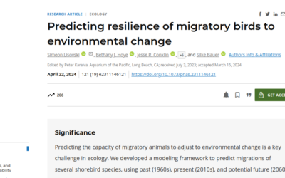
Our EAGLE Ben conducted an internship during his EAGLE studies which led to a new publication on "Predicting resilience of migratory birds to environmental change" jointly with the Alfred Wegener Institute Helmholtz Centre for Polar and Marine Research, Section Polar...
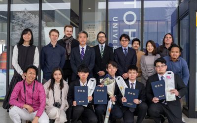
EAGLE student Konstantin Müller completed an internship at IRIDeS in Japan
Our EAGLE M.Sc. student Konstantin Müller successfully completed a three-month internship at The International Research Institute for Disaster Science (IRIDeS) in Japan. IRIDeS is a leading institute dedicated to advancing research and understanding in the field of...