Aim
Aim of this course is to provide you with an overview on geographic processes of urbanization, the related demographic and structural changes of cities, and data analyses methods using remote sensing data for applications in urban geography.
Content
Humankind is within its largest migration ever: from rural areas into cities. The drivers of this global process of urbanization from demographic to economic and the related structural changes cities are facing will be discussed in this course. Remote sensing is one crucial data source in this dynamic transformation and its products are highly relevant for urban planning, as well as environmental management. Within this course different approaches and techniques are covered focusing on deriving relevant information about urbanized areas on different levels of detail. Uni-temporal-, multi-temporal-, and time series based image classification, segmentation, the analyses of point patterns, GIS analyses to assess spatial context and dependencies, as well as analyses in the 3D domain will be addressed in this course. This will be done providing and discussing example applications from different regions globally (e.g. urban sprawl analysis of megacities, the development of new dimensions of urban landscapes such as mega-regions, the rearrangement of business districts within the urban landscape, etc.). You will learn what capabilities Earth observation data, methods and products have for urban research and applications and how to design remote sensing based urban analysis, how to avoid caveats, troubleshoot errors and interpret the results.
General Course News and Updates
MSc defense and Inno-Lab presentations
On Tuesday 20th of December at 12am we will have various presentations MSc defense by Kevin Yomi on "Evaluation wildfire activity in conflict-affected areas using earth observation and panel regression models: a case study of Borno State, Nigera, from 2003-2020" In...
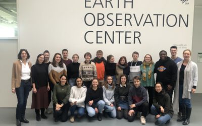
EAGLEs visit DLR EOC
After a long break due to covid we resumed the EAGLE visit of DLR EOC. Many EAGLEs from the current generation and quite some of the past (covid) generations joined this event and listened to many talks by DLR researchers. Some of the presenters were even former...
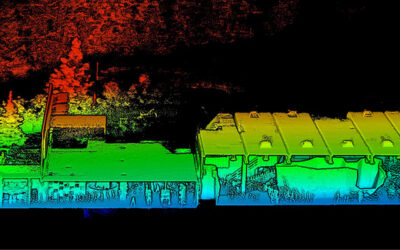
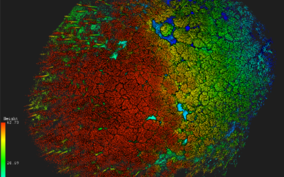
Social event in the boulder gym
Last week we spend a few hours in the boulder hall to enjoy a day without courses, do some climbing and have plenty of time to chat. Many EAGLEs from the current and old generations joint us as well as many lecturer. Beside the social event we also collected Lidar...
MSc defense Caroline Busse
On Tuesday 22nd of November at 1pm we will have the MSc thesis defense by Caroline on "Change Detection using Sentinel-1 and Sentinel-2 Time Series: A Comparison of Models for the Detection of Forest Disturbances." from the abstract: "Forests provide essential...
internship, innoLab and MSc idea presentations
On Tuesday 22nd of November at 12am we will have the following presentations: Dilara Kim: „Automated glacier snowline mapping from multi-sensor satellite observation“, InnoLab, EURAC Research, Supervisor: Dr. Martina Barandun Walid Ghariani: „PM2.5 Prediction Using...
New EAGLE Earth Observation professors
We are very happy to welcome two new professors within the EAGLE M.Sc. program! Prof. Dr. Hannes Taubenböck and Prof. Dr. Tobias Ullmann will strengthen the urban remote sensing and radar earth observation within the EAGLE program. Various new courses are already...
MSc defense by Larissa Gorzawski
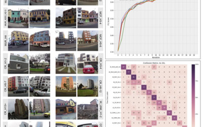
On Wednesday 5th of October at 2pm Larissa will present her M.Sc. thesis "Deep transfer learning on street-level imagery for classification of seismic building types in Lima, Peru". From the abstract: "Comprehensive exposure models for seismic risk assessment require...

M.Sc. defense by Jakob Rieser
On Monday, 26th of September at 10am, Jakob will present his M.Sc. thesis „A Synergistic Use of Optical and SAR Remote Sensing Data for the Long-term Evolution of Biocrusts and their Activity Across Diverse Dryland Ecosystems”. from the abstract: "Biological soil...

MSc defense by Christopher Chan
Chris will present his M.Sc. thesis "Investigating the capability of UAV imagery in AI-assisted mapping of Refugee Camps in East Africa" on Friday 16th of September at 2pm. From his abstract: " Refugee camps and informal settlements provide accommodation to some of...
MSc defense by Annika Ludwig
Annika will present her M.Sc. thesis "Analysis of alpine grassland management dynamics based on webcam and optical remote sensing time series" on Friday 9th of September at 9am. From the abstract: "The aim of this study is to detect relationships between environmental...