Aim
Aim of this course is to provide you with an overview on geographic processes of urbanization, the related demographic and structural changes of cities, and data analyses methods using remote sensing data for applications in urban geography.
Content
Humankind is within its largest migration ever: from rural areas into cities. The drivers of this global process of urbanization from demographic to economic and the related structural changes cities are facing will be discussed in this course. Remote sensing is one crucial data source in this dynamic transformation and its products are highly relevant for urban planning, as well as environmental management. Within this course different approaches and techniques are covered focusing on deriving relevant information about urbanized areas on different levels of detail. Uni-temporal-, multi-temporal-, and time series based image classification, segmentation, the analyses of point patterns, GIS analyses to assess spatial context and dependencies, as well as analyses in the 3D domain will be addressed in this course. This will be done providing and discussing example applications from different regions globally (e.g. urban sprawl analysis of megacities, the development of new dimensions of urban landscapes such as mega-regions, the rearrangement of business districts within the urban landscape, etc.). You will learn what capabilities Earth observation data, methods and products have for urban research and applications and how to design remote sensing based urban analysis, how to avoid caveats, troubleshoot errors and interpret the results.
General Course News and Updates
Pilar Endara Pinillos handed in her M.Sc. thesis
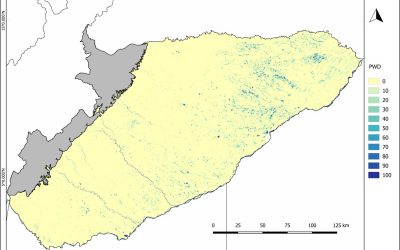
Pilar Endara Pinillos handed in her M.Sc. thesis "Flooding patterns and vegetation developments in the Orinoco flooded savannas of Colombia." Her M.Sc. defense will be on Wednesday 13th at 2pm in room 0.004 (OKW 86). The ecosystems that are present within Colombian...
Marcus Groll successfully defended his M.Sc. thesis
we congratulate Marcus Groll for his successful defense of this M.Sc. presentation “Deep learning for Instance Segmentation of bomb craters on historical aerial images of the Second World War ”. He has only a few days off before starting his new job as image data...
internship and innovation lab presentations
The following students will present next Tuesday (26th) at 2pm in room 0.004 their internships or innovation labs:Itohan-osa Abu (internship): Mangrove Mapping with TimeScan Data for Nigeria and an Analysis in Context of Coastal Gas Flaring Salim Soltani (internship):...
M.Sc. thesis handed in by Marcus Groll
Marcus Groll handed in his M.Sc. thesis "Deep learning for Instance Segmentation of bomb craters on historical aerial images of the Second World War " and will defend it next week. Abstract: During the Second World War (WWII) many air strikes were flown on German...
M.Sc. defense of Maninder Singh Dhillon
We congratulate Maninder who successfully defended his M.Sc. thesis “Comparing the performance of crop growth models using synthetic remote sensing data at DEMMIN, Germany” supervised by Martin Wegmann and Christopher Conrad.
Maninder Singh Dhillon handed in his MSc
Maninder Singh Dhillon handed in his M.Sc. "Comparing the performance of crop growth models using synthetic remote sensing data at DEMMIN, Germany" supervised by Thorsten Dahms with the first and second supervisors Martin Wegmann and Christopher Conrad, respectively....
EAGLE visit DLR-EOC
Our EAGLEs in 2018 visited the German Aerospace Center, namely the Earth Observation Center, close to Munich. Various topics were presented by DLR scientist and the EAGLEs hat the chance to discuss various topics in small groups with individual scientists.
Internship and M.Sc. idea presentations
on Thursday, December 13th, at 12:30 we will have the following presentations in the student working room (Josef Martin Weg 52, 3rd floor): internship presentations: Johni Miah"Remote Sensing and Geographic Information System for Decision...
New 2018 EAGLE students now online
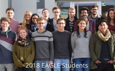
Web presence of you new EAGLE students is online. Our new 2018 EAGLE students created their own webspace in order to present the group and each student individually. Have a look who started EAGLE this year, read about their background and interests - and especially...
M.Sc. graduation by Jakob Schwalb-Willmann
Congratulation to Jakob Schwalb-Willmann who successfully graduated today! His M.Sc. topic was "A deep learning movement prediction framework for identifying anomalies in animal-environment interactions" aiming to explore the potential of animal movement...

