
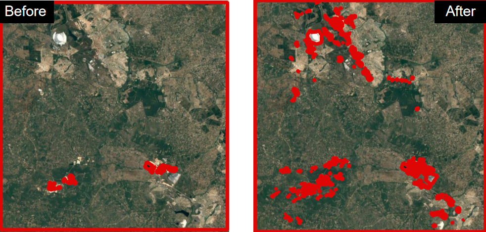
On August 11, 2026, Espérance Kandjale will present her Innolab results on ” Post-processing and Quality Assessment of Mapathon-Derived Mining Data for Cobalt Belt Mapping ” at 12:00 in seminar room 3, John-Skilton-Str. 4a.
From the abstract: During my internship, I worked on the post-processing and quality assessment of Mapathon-derived mining data for the DRC Cobalt Belt. The objective was to improve the reliability and usability of collaboratively mapped mining datasets by identifying and correcting geometric, attribute, and spatial inconsistencies.
1st supervisor: Konstantin Müller
From the abstract: During my internship, I worked on the post-processing and quality assessment of Mapathon-derived mining data for the DRC Cobalt Belt. The objective was to improve the reliability and usability of collaboratively mapped mining datasets by identifying and correcting geometric, attribute, and spatial inconsistencies.
1st supervisor: Konstantin Müller
![[spotlight] Lecturer Spotlight: Thilo Erbertseder](https://eagle-science.org/wp-content/uploads/2026/10/Thilo_Lecturer_Portrait_EAGLE_EORC_2026-400x250.jpg)




![[Spotlight] Lecturer Spotlight: Julian Faeth](https://eagle-science.org/wp-content/uploads/2026/10/Julian_Faeth_EORC_EAGLE_2026-400x250.jpg)


