
On April 03, 2025, Lallu Nikerthil Prathapan will present her Master Thesis ” Revealing Inconsistencies in Population Datasets in Refugee and IDP Camps ” at 15:00 in seminar room 3, John-Skilton-Str. 4a.
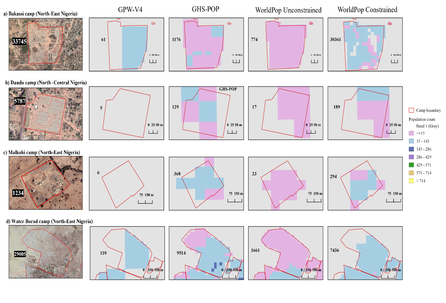
From the abstract: Accurate population estimates are crucial for effective humanitarian aid in refugee and IDP camps. This study compares four global population datasets—GPW-V4, GHS-POP, and two versions of WorldPop—against DTM IOM survey data from 210 refugee camps in Nigeria. The findings reveal that most datasets significantly underestimate camp populations, with WorldPop Constrained performing relatively better but still proving unreliable. To explore potential alternatives, the study also examines building footprint datasets (VIDA, Google, Microsoft, and OSM) and their representativeness in refugee/IDP regions. The results highlight major gaps in population datasets and suggest that combining building footprint data with survey information could improve accuracy for gridded population estimates
1st Supervisor: Prof. Dr. Hannes Taubenböck
From the abstract: Accurate population estimates are crucial for effective humanitarian aid in refugee and IDP camps. This study compares four global population datasets—GPW-V4, GHS-POP, and two versions of WorldPop—against DTM IOM survey data from 210 refugee camps in Nigeria. The findings reveal that most datasets significantly underestimate camp populations, with WorldPop Constrained performing relatively better but still proving unreliable. To explore potential alternatives, the study also examines building footprint datasets (VIDA, Google, Microsoft, and OSM) and their representativeness in refugee/IDP regions. The results highlight major gaps in population datasets and suggest that combining building footprint data with survey information could improve accuracy for gridded population estimates
1st Supervisor: Prof. Dr. Hannes Taubenböck
![[spotlight] Lecturer Spotlight: Thilo Erbertseder](https://eagle-science.org/wp-content/uploads/2026/10/Thilo_Lecturer_Portrait_EAGLE_EORC_2026-400x250.jpg)




![[Spotlight] Lecturer Spotlight: Julian Faeth](https://eagle-science.org/wp-content/uploads/2026/10/Julian_Faeth_EORC_EAGLE_2026-400x250.jpg)


