About
De-Cyuan is a researcher at the University of Würzburg with an academic background in Urban Planning and Spatial Information. He has practical experience as a licensed urban planner and spatial data scientist, focusing on remote sensing applications for spatial planning. He currently works at the Chair of Global Urbanization and Remote Sensing and collaborates with the Geolinguistics/Text2Geo team at the German Aerospace Center (DLR-GZS).
His research focuses on exploring the interaction between human activities and the physical environments of cities through the integration of remote sensing and textual data (e.g. social media), with the aim of better representing the complexity of cities. De-Cyuan is passionate about drawing insights from multiple disciplines and brings a deep curiosity to both research and teaching.
")
Recent News

M.Sc. idea presentation by Salim Soltani
Salim Soltani will present his M.Sc. idea ""Spatio-Temporal Analysis of Urbanization caused by the Belt-and-Road Initiative" on October 23rd at 10:30 in 1.009 OKW 86.
Welcome of the 2019 EAGLEs
On Monday, 14th of October, at 4 p.m., we will again welcome a new generation of EAGLEs (Z6, 01.002). After the official welcome and some introductory presentations, we will also introduce the lecturer and provide first details about the upcoming semester(s)....

Several Successful M.Sc. defenses
Several of our EAGLE students successfully defended their M.Sc. thesis in the past month. We congratulate all of them and especially wish the ones who already started their own Earth Observation company all the best!
M.Sc. defense by Bharath Selvaraj
Bharath Selvaraj will defend his M.Sc. thesis on August 8th at 10am in room 0.004. From the abstract of his thesis: "Over the centuries, humanity made immeasurable progress in both technological innovation and medicine. This progress comes at the cost of environmental...
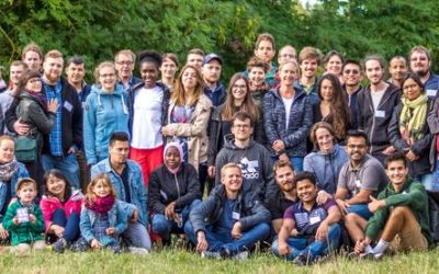
EAGLE Summer Dialogue 2019
Our 2019 EAGLE Summer Dialogue was a great success again and thanks a lot to all our EAGLE students who organised it. More than 100 participants enjoyed talks by Sandra Lohberger (RSS GmbH) and Alfred Schumm (WWF) who covered beside the technical aspects of their work...
Internship and Innovation Lab presentations
on Monday 15th of July at 10 a.m. in room 0.009 (OKW 86) we will have another series of internship and innovation lab presentations plus on M.Sc. idea presentation: (Internship) Marius Philipp -- "Mono Delta Monitoring System (MODES)" (Internship) Silvan...
Innovation Lab and thesis presentation
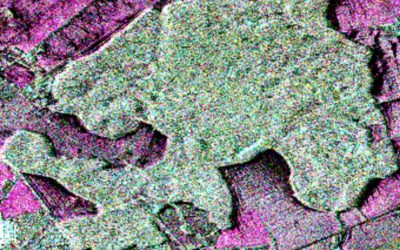
On Thursday 27th of June at 10am in room 0.004 (OKW 86) the following students will present their M.Sc. idea and their innovation lab outcome: Thesis idea presentation by Johni Miah:"Detecting and Assessing Ground Subsidence of Dhaka City, Bangladesh, using Synthetic...
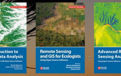
textbooks on remote sensing
Our already published textbook on "Remote Sensing and GIS for Ecologists - using Open Source software" was very well perceived and we got very positive feedback. However, either an introduction or more advanced methods and data was asked for as well. Hence, we decided...
EAGLE summer dialogue 2019
Our next EAGLE summer dialogue to bring together all EAGLE students and lecturer, staff of our department and all colleagues from close and far away is slowly approaching. On June 28th we welcome again everybody to join us for the EAGLE summer event with two keynotes:...

Julia Sauerbrey successful M.Sc. defense
Congratulations to Julia Sauerbrey who successfully presented her M.Sc. thesis. Read more about her interesting research project.