
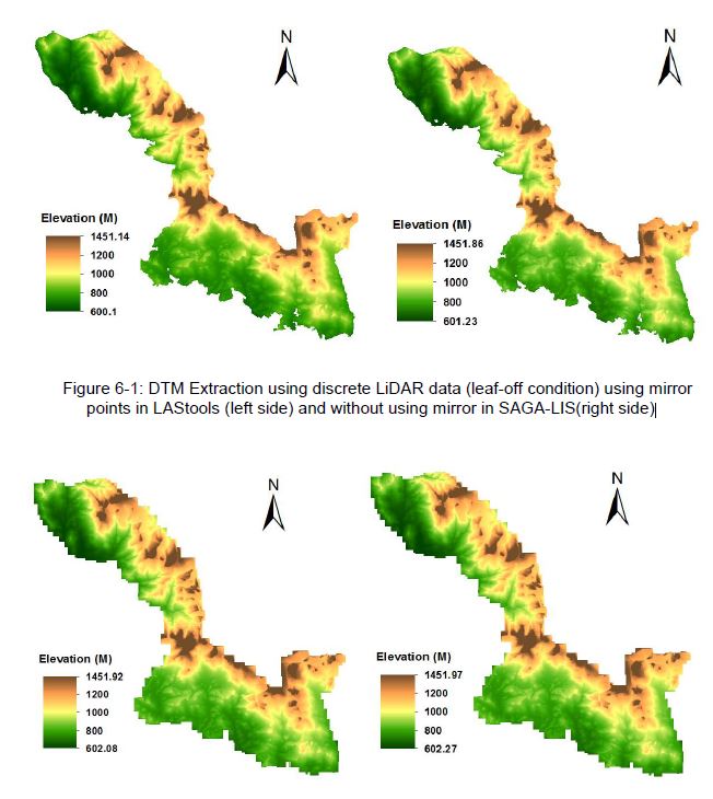
 The M.Sc thesis by Raja Ram Aryal has been handed in (supervision of Dr. Hooman Latifi and Prof. Michael Hahn). The thesis focused on a comparative study on the variations of an adaptive TIN ground filtering algorithm to extract DTM from discrete LiDAR point cloud captured in leaf-off and full wave LiDAR point cloud collected in leaf-on conditions. In addition Analysis of Variance (ANOVA) type II was used to assess the influential factors that are related to DTM random error. The Accuracy assessment of extracted DTMs was done at local and landscape levels in heterogeneous forest stands of Bavarian Forest National Park. The DTM generated using mirror points in leaf-off returned less RMSE (0.844 m) than in leaf-on (0.988 m) conditions. Furthermore RMSE values of 0.916 m (leaf-off) and 1.078 m (leaf-on) were observed the local level analysis when no mirror points were used. However, RMSE value of ca. 0.5 m was observed at the landscape level, with leaf-off DTM showing slightly higher error than leaf-on DTM. The DTM error increased with increasing slope. Deciduous habitat was found to significantly influence DTM error in both leaf-off and leaf-on conditions. Interaction effects were mainly observed between slope and forest habitat type.
DTMs Extracted using denser point cloud LiDAR data (leaf-on condition) using mirror points (left side) and without using mirror (right side)




![[Spotlight] Lecturer Spotlight: Julian Faeth](https://eagle-science.org/wp-content/uploads/2026/10/Julian_Faeth_EORC_EAGLE_2026-400x250.jpg)



