Aim
The module addresses methods on how Earth Observation and the use of geoinformation can support different fields of land and water management. The students will be guided to gain knowledge in selected practical examples.
Content
A general introduction on the subject, which strongly integrates large fields of environmental sciences and studies, is given. The students select topics in which remote sensing and geoinformation can significantly contribute parameters for answering relevant management questions. The topics include the derivation and use of parameters for monitoring land and/or water resources and examples how they can actually implemented in analytical or predictive models, or in indicator systems. The examples may include the management of the resources in rangelands, croplands, irrigation and drainage systems, river catchments, urban areas, or others. Focus may be set on special geographical settings. Depending on the selected topics and scale relevant Earth Observation parameters can include land cover and land use mapping, biophysical variables (LAI/FPAR/Chlorophyll, evapotranspiration , etc.), biomass or crop yields, soil moisture, phenological metrics and other dynamic parameters.
Coding
Software
Techniques
Content
General Course News and Updates
M.Sc. idea presentations and internship presentation
On Friday 25th of October several EAGLEs will present their M.Sc. thesis ideas and report back from an internship experience. It will take place at 10am in room 1.009, OKW 86. Katrin Hasenbein (MSc idea): "The potential of time-series data to improve fine scale...

M.Sc. idea presentation by Salim Soltani
Salim Soltani will present his M.Sc. idea ""Spatio-Temporal Analysis of Urbanization caused by the Belt-and-Road Initiative" on October 23rd at 10:30 in 1.009 OKW 86.
Welcome of the 2019 EAGLEs
On Monday, 14th of October, at 4 p.m., we will again welcome a new generation of EAGLEs (Z6, 01.002). After the official welcome and some introductory presentations, we will also introduce the lecturer and provide first details about the upcoming semester(s)....
Internship and InnoLab presentations
On Monday, 14th of October, at 5pm in room ZHSG 01.002, after the welcome of the new EAGLEs we will have the following internship and Innovation Laboratory presentations: Pawel Kluter (Internship): "Remote Sensing in the Federal Criminal Police Office" Pawel Kluter...

M.Sc. presentation by Johni Miah
Johni Miah will present his M.Sc. thesis " Detecting and Assessing Ground Subsidence of Dhaka City, Bangladesh, Using Synthetic Aperture Radar Data of Sentinel-1" on September 30th at 2pm in OKW 86. From the abstract: " The identification and measurement of ground...

Several Successful M.Sc. defenses
Several of our EAGLE students successfully defended their M.Sc. thesis in the past month. We congratulate all of them and especially wish the ones who already started their own Earth Observation company all the best!
M.Sc. defense by Louis Freytag Loringhoven
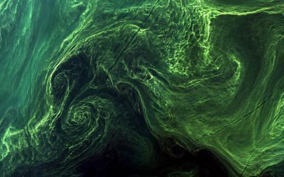
On Tuesday, 24th at 2pm Louis Freytag-Loringhoven will present his M.Sc. thesis "Remote sensing of water quality using Sentinel-2 towards a potential separation of Cyanobacteria blooms from other Algae." from the abstract: Globally, the over-enrichment of nutrients...

M.Sc. thesis presentation by Karsten Wiertz
Karsten Wiertz will present his M.Sc. thesis on Wednesday 14th at 11am in room 0.004 KW 86 with the title "Development of a semi-automatic remote sensing approach for change- detection of forest structures in Bialowieza Forest." From the abstract: The diversity of...

M.Sc. thesis defense by Sebastian Roersch
Sebastian Roersch will defend his thesis "Development of a semi-automated method to measure solar potential" next Wednesday (14th) at 10 am in 0.004 OKW 86. From his abstract: "In the second half of the 21st century, it will be decided how big the impact of climate...
M.Sc. presentation by Marina Reiter
Marina Reiter will present her M.Sc. thesis "Comparing Urban Green Spaces in German Cities Using Remote Sensing Data" on Thursday 8th of August at 11am in OKW 86, 0.004. Looking forward to a great presentation and lively discussion afterwards. From her abstract: "The...