Lecturer
Julia Rieder
ECTS
5 ECTS
Aim
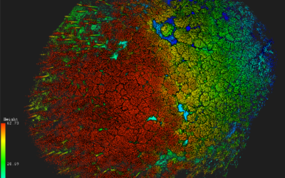
The course provides a practical introduction to LiDAR technology and point cloud analysis. Students gain hands-on experience with LiDAR data, from acquisition principles to processing and interpretation, and learn how LiDAR supports applications such as terrain modelling, forestry, and others. The course emphasizes critical understanding of data quality, limitations, and real-world use cases
Content
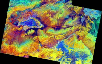
This course provides an overview of the scientific field surrounding LiDAR as a key technology for three-dimensional Earth observation. The course covers the fundamentals of LiDAR remote sensing, point cloud data structures, and processing methodologies across platforms ranging from spaceborne and airborne systems to terrestrial and mobile laser scanning. Furthermore, the course highlights current developments and emerging analytical possibilities enabled by advanced point cloud analysis and discusses future potential as LiDAR technologies and methodologies continue to evolve and converge with related disciplines.
Coding
Software
Techniques
Content
General Course News and Updates

EAGLE application in 2022
We received again more than 200 applicants from all over the world. In total applicants from 42 different countries applied to our international Earth Observation M.Sc. program, covering countries such as Hungary, Morocco, Malaysia, Kenya, Nepal or Columbia. We are...
EAGLE application deadline 2022
Our application deadline for 2022 is approaching. If you want to study applied Earth Observation and learn about a variety of remote sensing sensors and methods as well as about fields of applications, submit your application at the latest on May 15th. Accepted...
MSc defense by Haiyin Ye
On Friday 20th of May at 9am Haiyin will present her M.Sc. thesis "Monitoring Gypsy Moth Outbreak Using Sentinel-1 and Sentinel-2 Data". From the abstract: "Gypsy moth Lymantria dispar (L.) is a serious pest in deciduous forests, the larvae of which can feed on a...
inno lab and MSc defense Jakob Wachter
this Friday, 22nd of April, at 9am we will have one inno lab and one M.Sc. defense, both by Jakob Wachter. inno lab: "Assessment of climate-induced drought impact on crop types in bavaria" (Tobias Ullmann) M.Sc. defense: "Potential of webcam Imagery as reference data...
Inno lab and MSc idea presentation
On Friday 8th of April from 9am onwards we will have the following EAGLE presentations: "Assessment of open-source street-level imagery for building classification in Lima, Peru" by Larissa Gorzawski (Inno lab supervised by Hannes Taubenböck and Christian Geiß)...
MSc idea and inno lab presentations
On Friday 11th of March from 10am onwards the following students will introduce their MSc idea or report on their innovation laboratory: Kemeng Liu (MSc idea): "Mapping Spatial-Temporal Developments of Coastal Aquaculture" supervised by Tobias Ullmann Antonio...

MSc defense by Sofia Garcia
On Friday, March 11th at 9am Sofia will present her M.Sc. thesis "Estimating socioeconomic variables in Bolivia using satellite-based nighttime light images and electricity consumption data". From the abstract: "The lack of up-to-date data on socio-economic parameters...
MSc thesis defense by Nestor Gualsaqui
On March 8th at 10:30 Nestor will present his M.Sc. thesis "Pre-crop emergence weed mapping using high satellite imagery". From the abstract: "During the last decades, the growth of the world population has been increasing and weather fluctuations around the world...

MSc defense Nils Karges
Nils Karges will present his M.Sc. thesis "Exploring spatial relationships of soundscape variables in urban areas. " on 15th of February at 9:30. From the abstract: "This work describes the relationship between soundscape and the underlying landscape in an urban...

MSc defense Camilo Zamora
On Friday 11th of February at 9am Camilo Zamora will present his M.Sc. thesis "Deforestation dynamics in the Dry Chaco ecoregion: a three decades of change detection and fragmentation study analysis". From the abtract: "Tropical forests represent 52% of global forests...