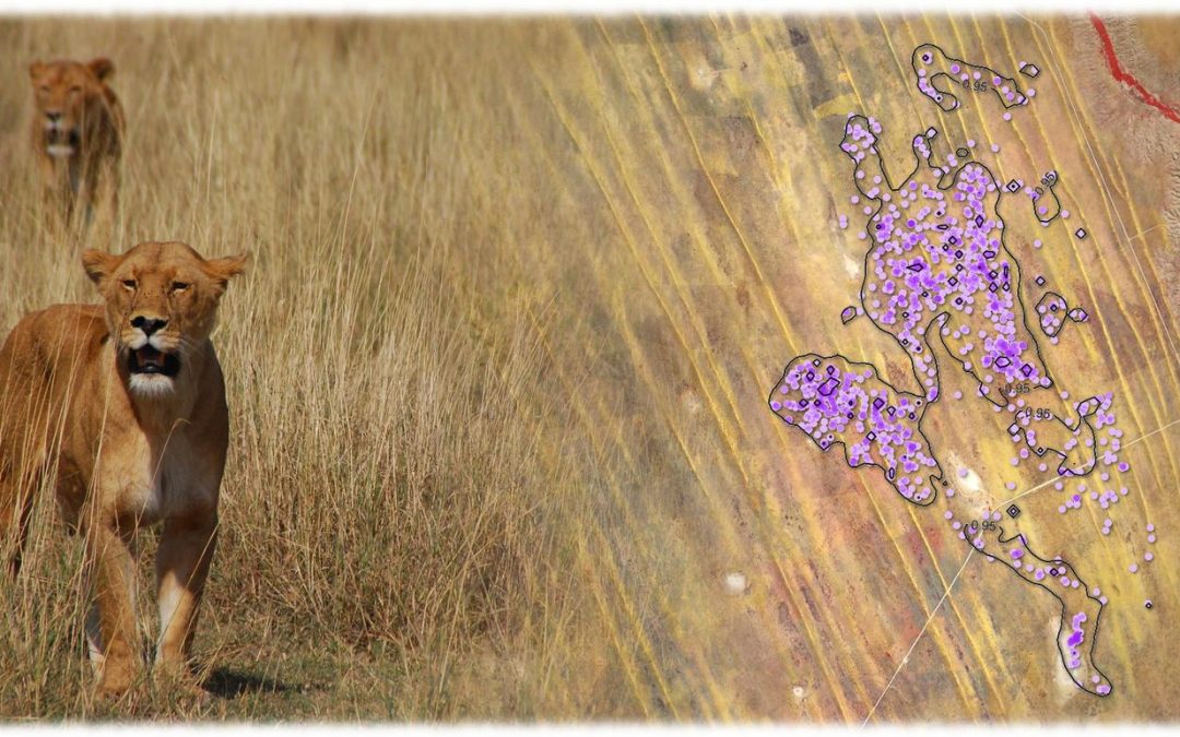
Spatial Modelling and Prediction04-GEO-OMA1 Lecturer Martin Wegmann ECTS 5 ECTS Aim: Within this course different methods to analyse point pattern statistically and conduct a spatial prediction are covered. Students will learn how to design such analysis, how...
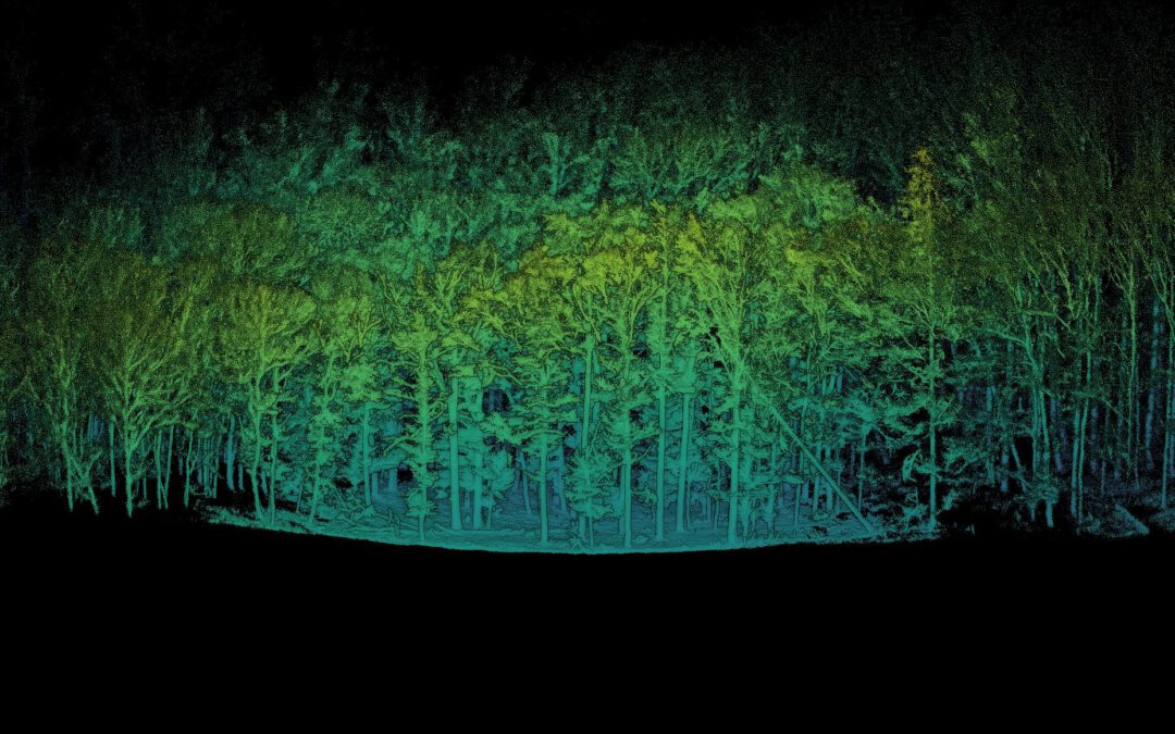
LiDAR remote sensing(04-GEO-OMA4-242-m01) Lecturer Julia Rieder ECTS 5 ECTS Aim The course provides a practical introduction to LiDAR technology and point cloud analysis. Students gain hands-on experience with LiDAR data, from acquisition principles to...
We use cookies to ensure that we give you the best experience on our website. If you continue to use this site we will assume that you are happy with it.