Aim
In this lecture you will gain a broad overview of the applications of remote sensing. Examples from different disciplines and applied Earth Observation projects will provide your with a comprehensive understanding of if, where and how remote sensing can contribute to qualitative and quantitative assessments of the cryosphere, forest ecosystems, agro-ecosystems, the coastal zone and urban ecosystems; amongst others. We will evaluate the potential of passive and active sensor systems and adress the advantages and shortcomings of existing sensors in the optical / mutlsispectral, thermal and microwave domain.
Content
This lecture provides knowledge on applications of Earth Observation with a focus on remote sensing of the land surface. Which research questions of different disciplines can be answered by the means of Earth Observation? What are the main approaches? The module links up remote sensing measurements to geo- and biophysical parameters required for further geoanalysis. Commonly used methodological approaches for the derivation of the different parameters are presented. Examples include amongst others applications in geography, environmental planning, ecology, biology, oceanology, soil science, geology, atmospheric science, but also e.g. pollution control (monitoring) and natural resource management. In addition, the module outlines selected examples, how remote sensing technology can be transferred to the workplace of professionals also beyond science, e.g. via the use of geoinformation systems.
General Course News and Updates

EireR R package: unified gateway to Irish geospatial data
Anyone who's tried to do geospatial work across the whole island of Ireland knows the headache. Ireland is one island geographically, but it's split across two jurisdictions, the Republic and Northern Ireland, and each one runs its own data infrastructure. Different...

Impact of agrophotovoltaic facilities – an R package
There's a new R package on the block, and it's solving a problem that sounds simple until you actually try to do it: how do you tell whether putting solar panels over a farm field is good or bad for the soil and the crops around them? Marlene, one of our EAGLE...

Successful MSc Defense by Anna Bischof
We congratulate Anna Bischof on the successful defense of her MSc thesis, "Feasibility of Unoccupied Aerial System-Based Active Fire Monitoring in African Savannas." Anna's research addressed one of the key challenges in fire ecology and remote sensing: understanding...

EAGLE Internship Presentation: Fire and drought research in savanna ecosystems – Kruger National Park
On June 16, 2026, Sebastian Rothaug and Clemens Schömig will present their internship results on " Fire and drought research in savanna ecosystems – Kruger National Park" at 12:00 PM in seminar room 3, John-Skilton-Str. 4a. From the abstract: Climate change is...

EAGLE MSc Defense: Feasibility of Unoccupied Aerial System-Based Active Fire Monitoring in African Savannas
On June 09, 2026, Anna Bischof will present her Master Thesis on " Feasibility of Unoccupied Aerial System-Based Active Fire Monitoring in African Savannas" at 12:00 in seminar room 3, John-Skilton-Str. 4a. From the abstract: Fire is a fundamental Earth system process...

EAGLE Innolab Presentation: Temporal Analysis of Lava Dome Morphology and Crevasse Development at Great Sitkin Volcano
On June 02, 2026, Daniel Voellner will present his Innolab results on " Temporal Analysis of Lava Dome Morphology and Crevasse Development at Great Sitkin Volcano" at 12:00 in seminar room 3, John-Skilton-Str. 4a. title of presentation: From the abstract: Volcanic...

Successful MSc Defense by Laura Obrecht
At the recent EAGLE MSc defenses, Laura Obrecht presented her thesis on the detection of grassland mowing events using Sentinel-1 InSAR coherence and deep learning approaches. Her work, titled “Detektion von Grünlandmahd mit Sentinel-1 InSAR Coherence und einem Deep...

First-semester EAGLE students deliver an impressive suite of R packages
One of the most encouraging signs of a strong Earth Observation curriculum is when students move beyond learning existing tools and start building their own. In their very first semester of the EAGLE MSc program, our students did exactly that: developing a diverse and...

EAGLE MSc Defense: Evaluating the Potential of a Deep Learning Framework for Detecting Mowing Events in German Grasslands with Sentinel-1 InSAR Coherence
On May 22, 2026, Laura Obrecht will present her Master Thesis on " Evaluating the Potential of a Deep Learning Framework for Detecting Mowing Events in German Grasslands with Sentinel-1 InSAR Coherence" at 11:00 a.m. in room 01.B.03 (EORC meeting room 1st floor). From...
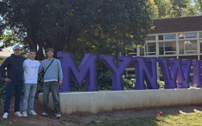
From Kruger to Potchefstroom: Reconnecting with South African EAGLE
After completing their internship in Kruger National Park, EAGLE students Sebastian and Clemens were not quite ready to leave South Africa behind. Instead of heading straight home, they reunited with their South African EAGLE friend, Charl Strydom, for a road trip...