

EAGLE News and Updates

A First Get-Together with the New EAGLE Generation 🦅
A new EAGLE generation means new faces, new ideas, and the start of another journey in Earth Observation. And what better way to kick things off than with a relaxed evening at the pub? Our first social event brought together the new students, older EAGLE generations,...
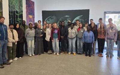
Welcome, new EAGLEs!
The newest group of EAGLE students arrived in Würzburg! They come from different countries, with different backgrounds and different skills, and that’s exactly what makes this program special. Remote sensing is a big field, and it gets better when people look at it...
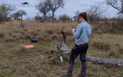
EAGLE student Jolien Grafe spent her internship in Kruger National Park
Jolien spent her internship in Kruger National Park in South Africa, working together with SANParks. She was part of an ongoing DFG project here at EORC that looks at how fire and drought shape savanna ecosystems. The project is led by Mirjana Bevanda and Tobias...
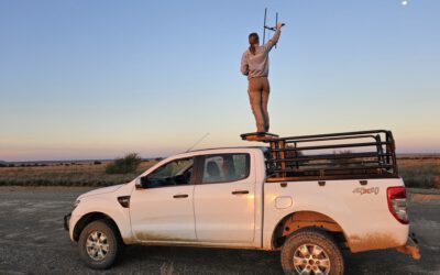
Night shifts with the black-footed cat: Jolien Grafe’s internship in Benfontein
Most remote sensing work happens in the daylight, at a desk or in a field with a drone. Jolien Grafe, one of our EAGLE M.Sc. students, spent a good part of her internship doing the opposite: sitting on a hill at dusk, listening for a beeping signal from a very small,...

[Spotlight] Lecturer Spotlight: Julian Faeth
Dr. Julian Fäth is a postdoctoral researcher at our EORC. His teaching combines remote sensing, forest ecology and geospatial data science with a strong focus on operational applications and climate adaptation. Since 2018, Julian has been actively involved in...
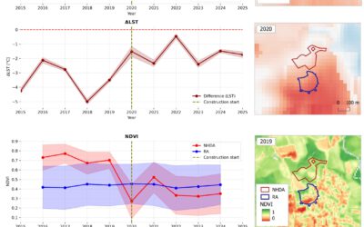
EAGLE MSc Defense: New Housing Development Areas: Assessing Structural Types and Environmental Effect
On September 22, 2026, Agnes Zwick will present her Master Thesis on " New Housing Development Areas: Assessing Structural Types and Environmental Effect" at 10:00 at the seminar room 3 in John-Skilton-Str. 4a. From the abstract: Germany faces a persistent tension...
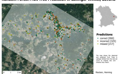
EAGLE Internship Presentation: Internship at the German Remote Sensing Data Center (DFD) of the German Aerospace Center (DLR)
On September 22, 2026, Henning Riecken will present his internship results on " Internship at the German Remote Sensing Data Center (DFD) of the German Aerospace Center (DLR)" at 12:00 at the seminar room 3 in John-Skilton-Str. 4a. From the abstract: Through the...
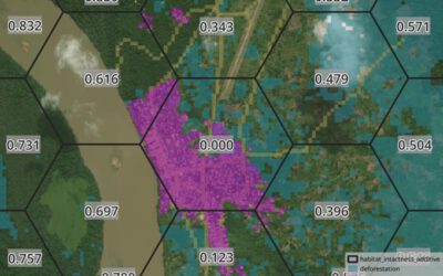
EAGLE Internship Presentation: Verifiable Nature Units
On August 25, 2026, Lutz Kleemann will present his internship results on " Verifiable Nature Units" at 12:00 at the seminar room 3 in John-Skilton-Str. 4a. From the abstract: Biodiversity credits and conservation work increasingly depend on measurable outcomes. During...
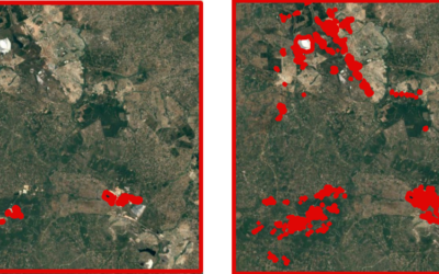
EAGLE Innolab Presentation: Post-processing and Quality Assessment of Mapathon-Derived Mining Data for Cobalt Belt Mapping
On August 11, 2026, Espérance Kandjale will present her Innolab results on " Post-processing and Quality Assessment of Mapathon-Derived Mining Data for Cobalt Belt Mapping " at 12:00 in seminar room 3, John-Skilton-Str. 4a. From the abstract: During my internship, I...
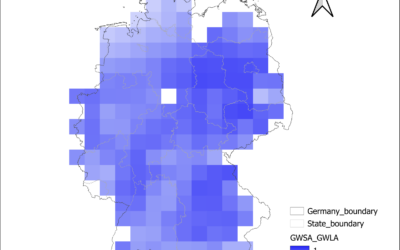
EAGLE Internship Presentation: Groundwater Level Trends in Germany: A National-Scale Assessment Using In-Situ Monitoring Data and GRACE Satellite Products
On August 04, 2026 Anugraha Das will present her internship results on " Groundwater Level Trends in Germany: A National-Scale Assessment Using In-Situ Monitoring Data and GRACE Satellite Products" at 12:00 at the seminar room 3 in John-Skilton-Str. 4a. From the...
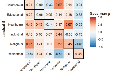
EAGLE Innolab Presentation: Comparing intra-urban thermal patterns using high-resolution HotSat-1 and Landsat 8 data from 14 U.S. cities
On July 24, 2026, Wajiha Yasmeen will present her inno lab results on " Comparing intra-urban thermal patterns using high-resolution HotSat-1 and Landsat 8 data from 14 U.S. cities " at 12:00 at the EORC meeting room/1st floor in John-Skilton-Str. 4a From the...
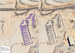
EAGLE Internship Presentation: Detection of OffRoad Tyre Dumpsites at Mining Operations Using Sentinel-2 Imagery and Deep Learning Segmentation
On July 21, 2026, Wajiha Yasmeen will present her internship results on " Detection of Off-The-Road Tyre Dumpsites at Mining Operations Using Sentinel-2 Imagery and Deep Learning Segmentation " at 12:00 at the seminar room 3 in John-Skilton-Str. 4a. From the abstract:...

[spotlight] Lecturer Spotlight: Martin Wegmann
If you've ever sat in a Würzburg classroom learning how to wrangle satellite data, there's a good chance Martin Wegmann was the one standing at the front. He's been the driving force behind the EAGLE MSc program, the Applied Earth Observation degree at the University...
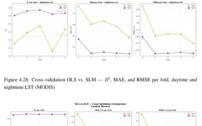
EAGLE MSc Defense: Evaluating Surface Urban Heat Islands in Bavarian Cities through a Multi-Variable Analysis
On July 07, 2026, Farimah Abdolzadeh will present her Master Thesis on " Evaluating Surface Urban Heat Islands in Bavarian Cities through a Multi-Variable Analysis " at 13:00 at the seminar room 3 in John-Skilton-Str. 4a. From the abstract: Surface Urban Heat Island...
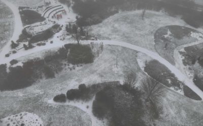
EAGLE Internship Presentation: ” Global Water Detection and Thermal UAV Data Analysis”
On July 14, 2026, Elena Scholz will present her internship results on " Global Water Detection and Thermal UAV Data Analysis" at 12:00 in seminar room 3, John-Skilton-Str. 4a. From the abstract: Internship 1 - DLR-DFD “Watersecurity and Coastal Systems” The majority...

EAGLE Internship Presentation: Svalbard
On July 07, 2026, Aoibhin Murphy and Marlene Sehrbrock will present her internship results on " Svalbard" at 12:00 in seminar room 3, John-Skilton-Str. 4a. From the abstract: Using thermal and RGB imagery collected via UAVs, we investigated the potential of thermal...
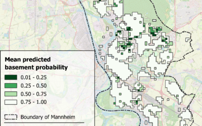
EAGLE MSc Defense: Machine Learning Inference of Building Basement Presence Using Street-Level Imagery and Multi-Source Geospatial Attributes: A Case Study of Mannheim, Germany
On July 01, 2026, Gökçe Yağmur Özcan will present her Master Thesis on " Machine Learning Inference of Building Basement Presence Using Street-Level Imagery and Multi-Source Geospatial Attributes: A Case Study of Mannheim, Germany " at 11:00 at the EORC...

EireR R package: unified gateway to Irish geospatial data
Anyone who's tried to do geospatial work across the whole island of Ireland knows the headache. Ireland is one island geographically, but it's split across two jurisdictions, the Republic and Northern Ireland, and each one runs its own data infrastructure. Different...