Mar 8, 2017 | course, news, wegmann
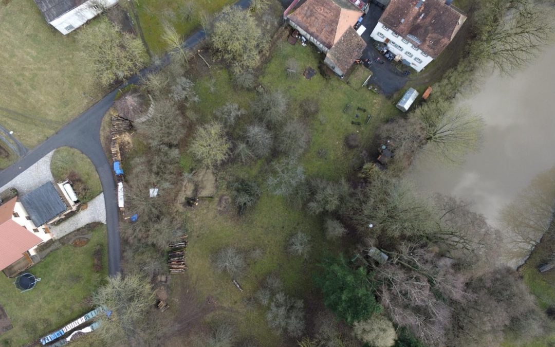
one of our field sites in the Steigerwald For several upcoming EAGLE courses we visited potential field sites and tested our equipment. During this first field work of the year our UAV and D-GPS data collection were tested in the Steigerwald at the research station of...
Mar 1, 2017 | lecturer, MSc thesis, wegmann
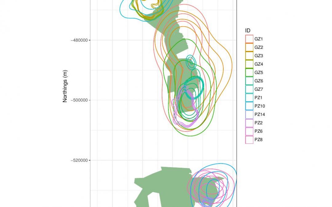
The M.Sc. thesis “Can animal movement and remote sensing data help to improve conservation efforts?” by Matthias Biber M.Sc. student within the Global Change Ecology program handed in his thesis. He explored the potential of remote sensing data to explain animal...
Dec 2, 2016 | lecturer, MSc thesis, news, wegmann
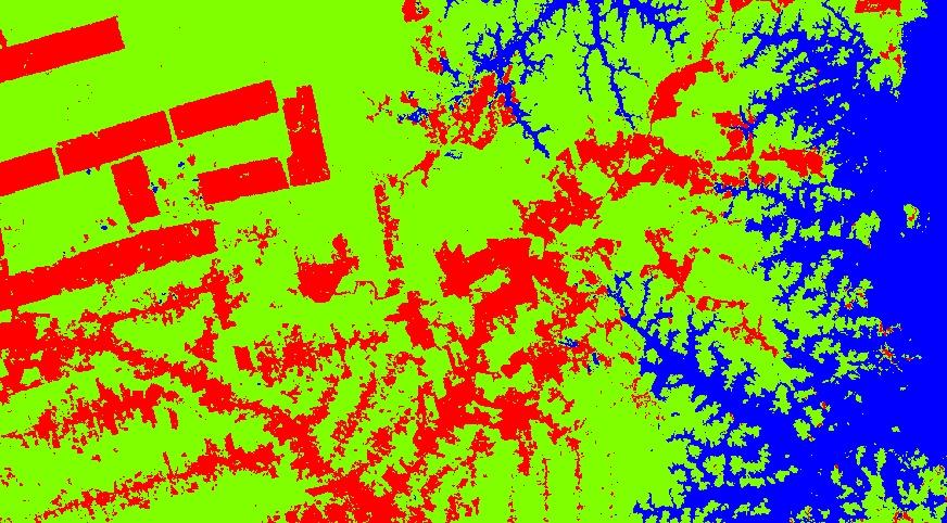
Henrike Schulte to Bühne started her M.Sc. „Quantifying landcover change using remote sensing data in a transboundary protected area“ in cooperation with the Zoological Society of London, Dr. Nathalie Pettorelli within the Global Change Ecology study program. Her...
Dec 2, 2016 | MSc thesis, news, wegmann
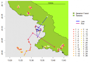
Joe Premier submitted his M.Sc. thesis on “The Lynx Effect: Behaviour of Roe Deer in the Presence of Lynx in a European Forest Ecosystem” within the Global Change Ecology M.Sc. program. He was co-supervised by Marco Heurich from the Bavarian Forest Nationalpark....
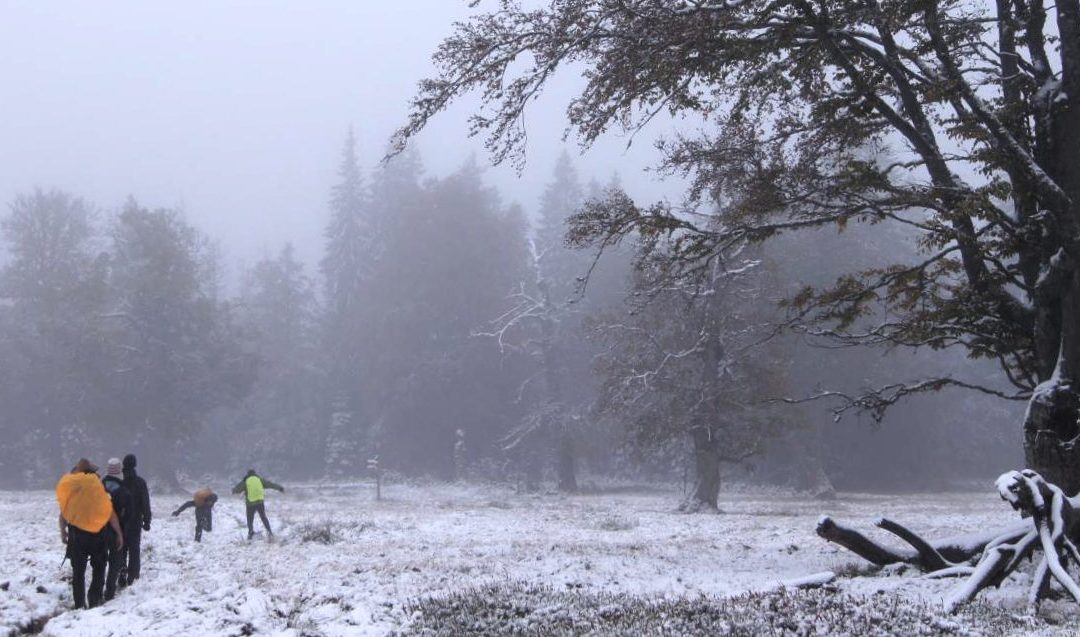
Oct 16, 2016 | course, news, wegmann, WS2016
The course on remote sensing for biodiversity analysis covered 10 days of field work, R coding, testing field methods such as UAVs and lots of hiking in the National Park Bavarian Forest. This year we had sunny and rainy weather and on the peaks also snow which made...
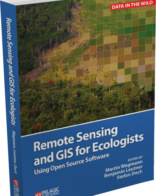
May 23, 2016 | lecturer, news, wegmann
The book “remote sensing and GIS for ecologists – using Open Source software” edited by the EAGLE lecturer Martin Wegmann is a book about how ecologists can integrate remote sensing and GIS in their daily work. It will allow ecologists to get started...