Lecturer
Julia Rieder
ECTS
5 ECTS
Aim
The course provides a practical introduction to LiDAR technology and point cloud analysis. Students gain hands-on experience with LiDAR data, from acquisition principles to processing and interpretation, and learn how LiDAR supports applications such as terrain modelling, forestry, and others. The course emphasizes critical understanding of data quality, limitations, and real-world use cases
Content
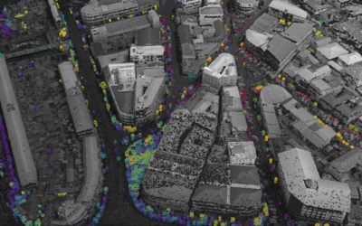
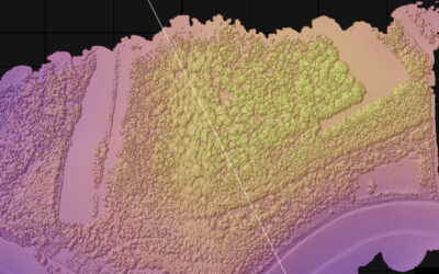
This course provides an overview of the scientific field surrounding LiDAR as a key technology for three-dimensional Earth observation. The course covers the fundamentals of LiDAR remote sensing, point cloud data structures, and processing methodologies across platforms ranging from spaceborne and airborne systems to terrestrial and mobile laser scanning. Furthermore, the course highlights current developments and emerging analytical possibilities enabled by advanced point cloud analysis and discusses future potential as LiDAR technologies and methodologies continue to evolve and converge with related disciplines.
Coding
Software
Techniques
Content
General Course News and Updates
Spatial Earth Observation R packages by our EAGLEs
Our EAGLE students that took and passed our Introduction to spatial programming course had to submit an R package that applies spatial methods for a variety of Earth Observation data. We are very proud to show the huge diversity of very interesting and useful R...
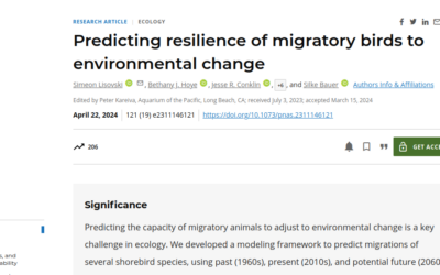
publication by our EAGLE Ben Lee
Our EAGLE Ben conducted an internship during his EAGLE studies which led to a new publication on "Predicting resilience of migratory birds to environmental change" jointly with the Alfred Wegener Institute Helmholtz Centre for Polar and Marine Research, Section Polar...
EAGLE student Konstantin Müller completed an internship at IRIDeS in Japan
Our EAGLE M.Sc. student Konstantin Müller successfully completed a three-month internship at The International Research Institute for Disaster Science (IRIDeS) in Japan. IRIDeS is a leading institute dedicated to advancing research and understanding in the field of...
Internship Presentation: Application of Geospatial Science in Reinsurance
On Tuesday, May 07, at 12:00 Ronja Seitz will present her internship presentation on "Application of Geospatial Science in Reinsurance " in seminar room 3, John-Skilton-Str. 4a. From the abstract: I used the opportunity of my mandatory internship to enter an entirely...
Internship Report on Tuesday, April 30 at 14:00
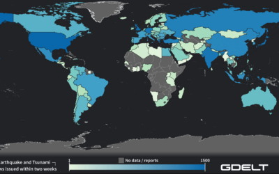
On Tuesday, April 30 Konstantin Müller will present his internship " GDELT News Analysis of the Noto Earthquake via ERNIE" at 14:00 in 01.B.03, John-Skilton-Str. 4a. : From the abstract: The analysis of socioeconomic data has gained increasing importance. The exchange...
EAGLE MSc. graduation
We are very happy to celebrate again the graduation of some of our EAGLE M.Sc. students. The candidates already handed in their M.Sc. thesis a while ago but just recently we had our EAGLE graduation party and enjoyed to celebrate this important milestone with all...
Master Thesis Defense: Unmasking the Shadow Economy in Ghana: Mapping The Distribution of Umbrella Covered Informal Vendors In Kumasi
On Tuesday, April 30, at 13:00 Prince Lartey Lawson will present his master thesis on " Unmasking the Shadow Economy in Ghana: Mapping The Distribution of Umbrella Covered Informal Vendors In Kumasi " in 01.B.03 Meeting Room 1st Floor, John-Skilton-Str. 4a. From the...
Master Thesis Defense: “Flood susceptibility mapping using remote sensing and geospatial data in West Africa “
On Tuesday, April 30, at 12:00 Wilmer Fabián Montién Tique will present his master thesis on " Flood susceptibility mapping using remote sensing and geospatial data in West Africa " in 01.B.03 Meeting Room 1st Floor, John-Skilton-Str. 4a. Abstract: Floods in West...

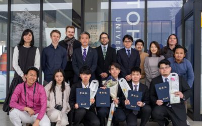
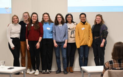
EAGLE workshop on Earth Observation application
Our first EAGLE workshop on Earth Observation applications covered various topics. After a heartily welcome by Tobias Ullmann did more than 50 participants listen to the following talks: Ása Aðalsteinsdóttir: “SAR Monitoring in Iceland” Katrin Wernicke:...

DGPF award for our EAGLE MSc Luisa Wagner
We are very happy to congratulate our former EAGLE student Luisa Wagner for the 2nd prize of the Karl‐Kraus‐Nachwuchsförderpreis 2024. Luisa received this award for her M.Sc. thesis which she handed in early last year on "Analysis of ice shelf front dynamics in Pine...