Lecturer
Julia Rieder
ECTS
5 ECTS
Aim
The course provides a practical introduction to LiDAR technology and point cloud analysis. Students gain hands-on experience with LiDAR data, from acquisition principles to processing and interpretation, and learn how LiDAR supports applications such as terrain modelling, forestry, and others. The course emphasizes critical understanding of data quality, limitations, and real-world use cases
Content
This course provides an overview of the scientific field surrounding LiDAR as a key technology for three-dimensional Earth observation. The course covers the fundamentals of LiDAR remote sensing, point cloud data structures, and processing methodologies across platforms ranging from spaceborne and airborne systems to terrestrial and mobile laser scanning. Furthermore, the course highlights current developments and emerging analytical possibilities enabled by advanced point cloud analysis and discusses future potential as LiDAR technologies and methodologies continue to evolve and converge with related disciplines.
Coding
Software
Techniques
Content
General Course News and Updates
application deadline for winter term 2017 is approaching
Applications for the EAGLE M.Sc. program are accepted until May 15th 2017 for the next winter term. The next application deadline will be only next year, again on May 15th 2018. You need the following documents for your application: a cover letter stating your...
news coverage of one of our students in the University press
One of our students, Pilar Endara, was interviewed by the news team of the University of Würzburg. She talked about her background, the reasons why she studied in Germany, her experiences and her plans for the future. Moreover her reasons why she studies EAGLE and her...
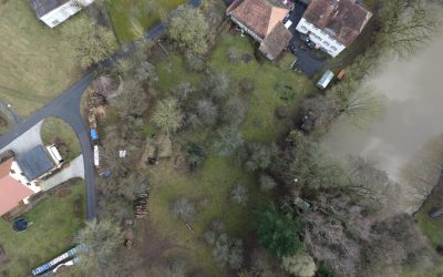
testing UAV and D-GPS application in the Steigerwald
one of our field sites in the Steigerwald For several upcoming EAGLE courses we visited potential field sites and tested our equipment. During this first field work of the year our UAV and D-GPS data collection were tested in the Steigerwald at the research station of...
M.Sc. handed in on animal movement and remote sensing
The M.Sc. thesis “Can animal movement and remote sensing data help to improve conservation efforts?” by Matthias Biber M.Sc. student within the Global Change Ecology program handed in his thesis. He explored the potential of remote sensing data to explain animal...
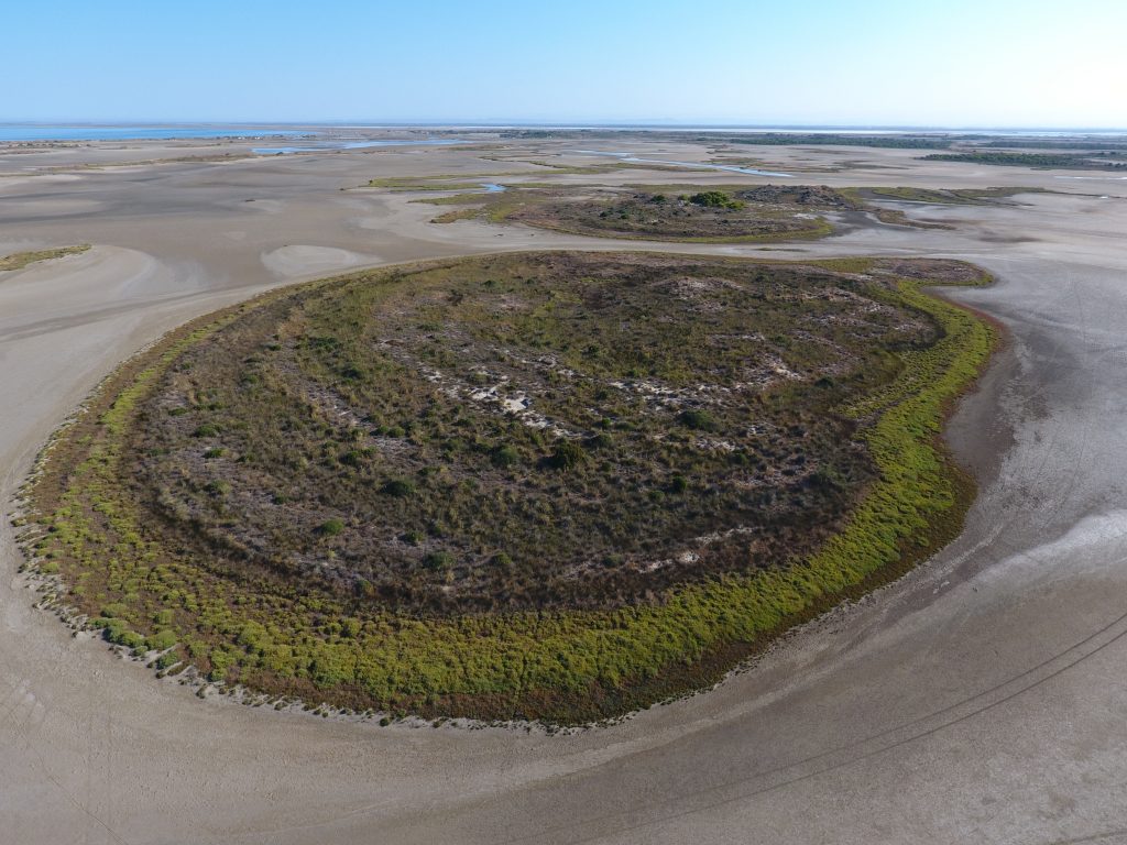
MSc topic on wetland modeling
M.Sc thesis (+ a two-month internship): Agent-based modeling to understand Mediterranean wetland (former saltworks) dynamic based on multiple remote sensing data The Camargue’s former saltworks is a 6500-ha site located at the Mediterranean coast in southern France....
EAGLE students webpage is now online
Our EAGLE students setup their own webpage at http://students.eagle-science.org! Read about their background, motivation and expectations concerning the EAGLE M.Sc. study program. Moreover, the EAGLE students will post news about ongoing social as well as scientific...

EAGLE is part of the Copernicus Academy Network
We are happy to receive the notification that the EAGLE training program is endorsed by the Copernicus Academy Network. This network aims to foster the use and benefits of Copernicus. The EAGLE program applied within the DLR and University Wuerzburg network to be part...
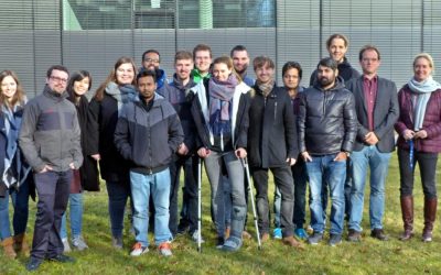
EAGLE students visit DLR-EOC
Our EAGLE 2016 students visited the DLR-EOC last Friday and got a very good overview of the work done by the scientists at DLR. Many different topics were covered and nearly all applications of applied earth observation research done at DLR-EOC were presented. ...
M.Sc. started on monitoring protected areas
Henrike Schulte to Bühne started her M.Sc. „Quantifying landcover change using remote sensing data in a transboundary protected area“ in cooperation with the Zoological Society of London, Dr. Nathalie Pettorelli within the Global Change Ecology study program. Her...
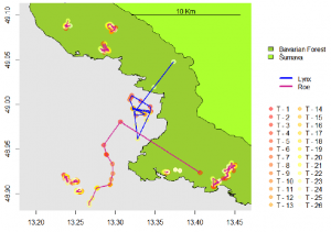
M.Sc. thesis on animal movement interactions and the environment
Joe Premier submitted his M.Sc. thesis on “The Lynx Effect: Behaviour of Roe Deer in the Presence of Lynx in a European Forest Ecosystem” within the Global Change Ecology M.Sc. program. He was co-supervised by Marco Heurich from the Bavarian Forest Nationalpark....