
Aim
In this course we will learn the alternative image analysis paradigm of object-based image classification. Image objects are areas in images which consist of pixels from the same land-cover class (e.g. buildings, water surfaces, vegetation) and allow the application of additional image classification methods in comparison to pure pixel-based methods and the integration of multi-modal date (e.g. vector data).
Content
In the course we will use satellite images and high resolution aerial images in combination with vector data and analyze various image classification methods (nearest neighbor -> random forests -> deep learning) to extract relevant information from the images.
We will use the software “eCognition”.
The course will be held on 3 days in Würzburg plus an introductory lecture which is being held online.
Session 1: getting to know to image objects and eConition software, basic classification methods
Session 2: advanced classification (Machine Learning)
Session 3: Deep Learning
Coding
Software
Techniques
Content
General Course News and Updates

EAGLE MSc Defense: New Housing Development Areas: Assessing Structural Types and Environmental Effect
On September 22, 2026, Agnes Zwick will present her Master Thesis on " New Housing Development Areas: Assessing Structural Types and Environmental Effect" at 10:00 at the seminar room 3 in John-Skilton-Str. 4a. From the abstract: Germany faces a persistent tension...

EAGLE Internship Presentation: Internship at the German Remote Sensing Data Center (DFD) of the German Aerospace Center (DLR)
On September 22, 2026, Henning Riecken will present his internship results on " Internship at the German Remote Sensing Data Center (DFD) of the German Aerospace Center (DLR)" at 12:00 at the seminar room 3 in John-Skilton-Str. 4a. From the abstract: Through the...

EAGLE Internship Presentation: Verifiable Nature Units
On August 25, 2026, Lutz Kleemann will present his internship results on " Verifiable Nature Units" at 12:00 at the seminar room 3 in John-Skilton-Str. 4a. From the abstract: Biodiversity credits and conservation work increasingly depend on measurable outcomes. During...

EAGLE Innolab Presentation: Post-processing and Quality Assessment of Mapathon-Derived Mining Data for Cobalt Belt Mapping
On August 11, 2026, Espérance Kandjale will present her Innolab results on " Post-processing and Quality Assessment of Mapathon-Derived Mining Data for Cobalt Belt Mapping " at 12:00 in seminar room 3, John-Skilton-Str. 4a. From the abstract: During my internship, I...

EAGLE Internship Presentation: Groundwater Level Trends in Germany: A National-Scale Assessment Using In-Situ Monitoring Data and GRACE Satellite Products
On August 04, 2026 Anugraha Das will present her internship results on " Groundwater Level Trends in Germany: A National-Scale Assessment Using In-Situ Monitoring Data and GRACE Satellite Products" at 12:00 at the seminar room 3 in John-Skilton-Str. 4a. From the...

EAGLE Innolab Presentation: Comparing intra-urban thermal patterns using high-resolution HotSat-1 and Landsat 8 data from 14 U.S. cities
On July 24, 2026, Wajiha Yasmeen will present her inno lab results on " Comparing intra-urban thermal patterns using high-resolution HotSat-1 and Landsat 8 data from 14 U.S. cities " at 12:00 at the EORC meeting room/1st floor in John-Skilton-Str. 4a From the...

EAGLE Internship Presentation: Detection of OffRoad Tyre Dumpsites at Mining Operations Using Sentinel-2 Imagery and Deep Learning Segmentation
On July 21, 2026, Wajiha Yasmeen will present her internship results on " Detection of Off-The-Road Tyre Dumpsites at Mining Operations Using Sentinel-2 Imagery and Deep Learning Segmentation " at 12:00 at the seminar room 3 in John-Skilton-Str. 4a. From the abstract:...
![[spotlight] Lecturer Spotlight: Martin Wegmann](https://eagle-science.org/wp-content/uploads/2026/07/Martin_Wegmann_EAGLE_lecture_2026-400x250.jpg)
[spotlight] Lecturer Spotlight: Martin Wegmann
If you've ever sat in a Würzburg classroom learning how to wrangle satellite data, there's a good chance Martin Wegmann was the one standing at the front. He's been the driving force behind the EAGLE MSc program, the Applied Earth Observation degree at the University...
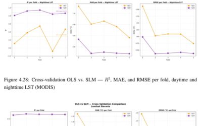
EAGLE MSc Defense: Evaluating Surface Urban Heat Islands in Bavarian Cities through a Multi-Variable Analysis
On July 07, 2026, Farimah Abdolzadeh will present her Master Thesis on " Evaluating Surface Urban Heat Islands in Bavarian Cities through a Multi-Variable Analysis " at 13:00 at the seminar room 3 in John-Skilton-Str. 4a. From the abstract: Surface Urban Heat Island...
EAGLE Internship Presentation: ” Global Water Detection and Thermal UAV Data Analysis”
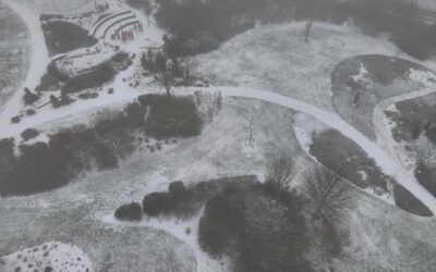
On July 14, 2026, Elena Scholz will present her internship results on " Global Water Detection and Thermal UAV Data Analysis" at 12:00 in seminar room 3, John-Skilton-Str. 4a. From the abstract: Internship 1 - DLR-DFD “Watersecurity and Coastal Systems” The majority...