Aim
In this course we will learn the alternative image analysis paradigm of object-based image classification. Image objects are areas in images which consist of pixels from the same land-cover class (e.g. buildings, water surfaces, vegetation) and allow the application of additional image classification methods in comparison to pure pixel-based methods and the integration of multi-modal date (e.g. vector data).
Content
In the course we will use satellite images and high resolution aerial images in combination with vector data and analyze various image classification methods (nearest neighbor -> random forests -> deep learning) to extract relevant information from the images.
We will use the software “eCognition”.
The course will be held on 3 days in Würzburg plus an introductory lecture which is being held online.
Session 1: getting to know to image objects and eConition software, basic classification methods
Session 2: advanced classification (Machine Learning)
Session 3: Deep Learning
Coding
Software
Techniques
Content
General Course News and Updates
Welcome to our new EAGLEs – Embarking on an Earth Observation Journey
As the autumn term begins and the leaves turn golden across Europe, we are pleased to welcome a fresh cohort of EAGLEs—our new MSc students in Earth Observation and Geoinformatics. This year’s group brings together curious minds from diverse academic and cultural...
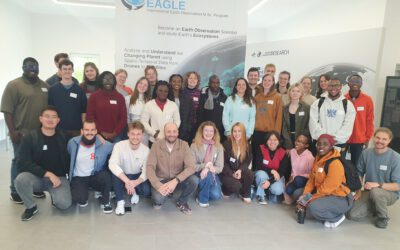
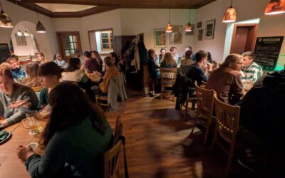
New EAGLEs take off into the Winter Term 2025/26
As in previous years, the next generation of EAGLE Master's students from around the world gathered at the Earth Observation Research Center (EORC) on the first day of the winter term to begin their studies at the University of Würzburg. Prof. Dr. Tobias Ullmann...
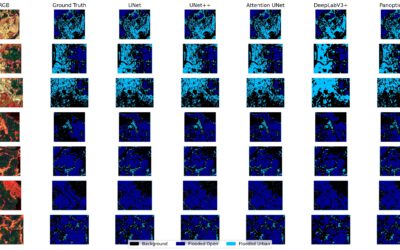
EAGLE MSc Defense “Coastal Urban Flood Detection and Analysis Using SAR and CNN-Based Methods: A Case Study for Central Vietnam”
On September 23, 2025, Elly Schmid will present her Master Thesis on " Urban Flood Detection and Analysis Using SAR and CNN-Based Methods: A Case Study for Central Vietnam" at 12:00 in seminar room 3, John-Skilton-Str. 4a. From the abstract: With over half of the...
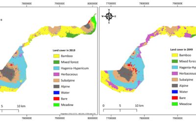
EAGLE MSc Defense “Utilizing deep learning and Earth Observation data to predict land cover changes in Volcanoes National Park, Rwanda”
On September 16, 2025, Jean de Dieu Tuyizere will present his Master Thesis on "Utilizing deep learning and Earth Observation data to predict land cover changes in Volcanoes National Park, Rwanda" at 12:00 in seminar room 3, John-Skilton-Str. 4a From the abstract:...
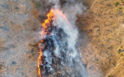
Mapping Fire from the Sky – Anna Bischof’s MSc Thesis on Savanna Fire Patterns
Wildfires are an essential ecological process in African savannas, shaping landscapes, influencing biodiversity, and playing a key role in nutrient cycling. Understanding their dynamics is crucial for both science and management – and this is where EAGLE MSc student...
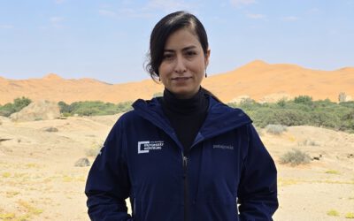
Exploring the Desert: Farimah’s Internship at Gobabeb in Namibia
We’re excited to share that our EAGLE MSc student, Farimah, is currently spending her internship at the renowned Gobabeb Namib Research Institute, nestled in the heart of the Namib Desert—one of the oldest and most unique desert ecosystems in the world. Farimah’s...

M.Sc. Student Clara Vydra Begins Thesis Field Work on Alpine Water Resources
We’re pleased to share that our M.Sc. student Clara Vydra has recently begun her thesis field work in the Austrian Alps in collaboration with the German Alpine Association (DAV) and the German Aerospace Center (DLR). Her research focuses on the impacts of climate...
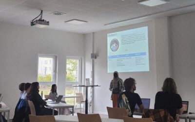
Future in Focus: EAGLE Students Host Mini-Symposium on Remote Sensing Innovations
In a spirited display of teamwork, scientific curiosity, and professional growth, our international MSc students from the EAGLE program recently organised and chaired their own scientific mini-symposium, showcasing the latest developments in remote sensing. The event...
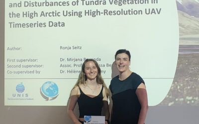
Successful MSc Thesis Defense by Ronja Seitz on UAV-Based Monitoring of High-Arctic Tundra Dynamics
We warmly congratulate Ronja Seitz on the successful defense of her MSc thesis, which tackled one of the most pressing environmental challenges of our time: the rapid warming of the high Arctic. Her research focused on Svalbard, one of the fastest-warming regions on...
🗺 Exploring Map Visualizations
Within our EAGLE courses our students have to learn a wide variety of skills - beside the fundamental earth observation theory and practice also skills like map creation is part of the curriculum. One of our students Ronja Seitz has created three visualizations guides...