May 1, 2016 | lecturer, MSc thesis, news
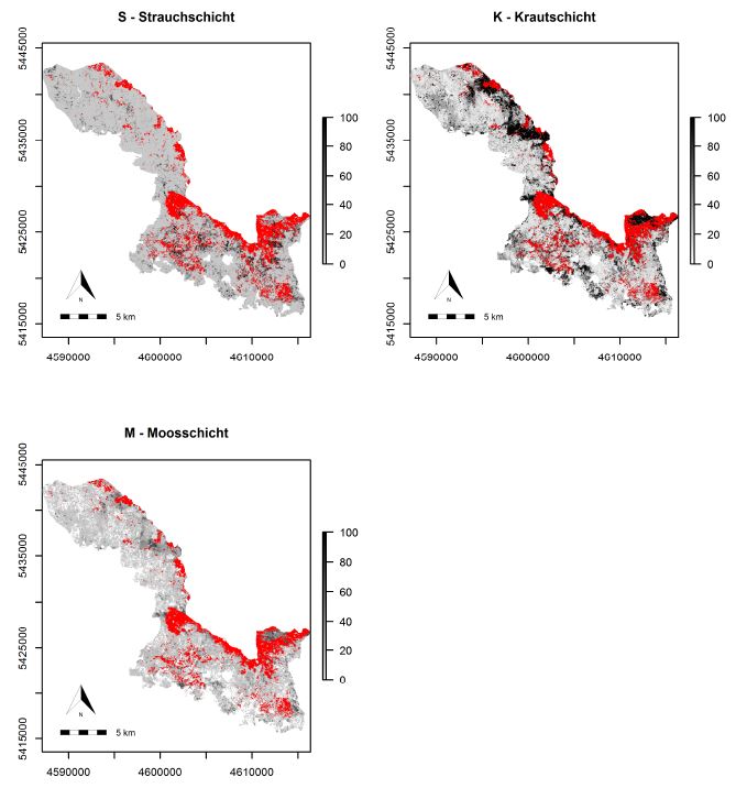
The M.Sc thesis by Bastian Schumann focused on a LiDAR-based approach to combine structural metrics and forest habitat information for causal and predictive models of under-story canopy cover. The data base used consisted of a bi-temporal LiDAR dataset as well as two...
Apr 20, 2016 | innovation laboratories, news, wegmann
Analyzing species-environment interaction is feasible using various data and method. An increasing technology is the tracking of animals and especially its linkage to remote sensing, as covered in AniMove.org. However, with this technology new challenges have to be...
Apr 7, 2016 | MSc thesis, news, wegmann
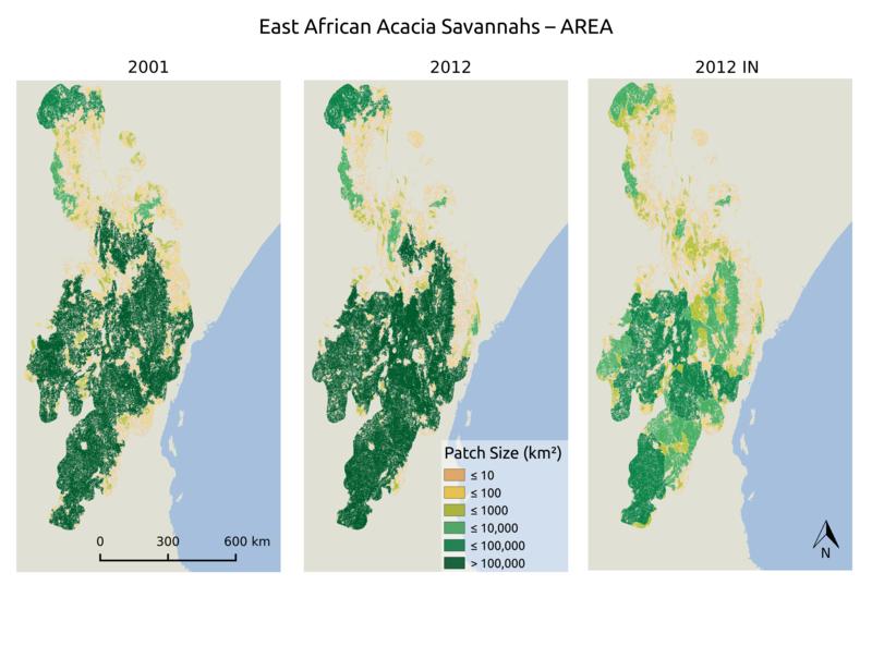
The MSc thesis by Asja Bernd titled “Mind the Gap: A Global Analysis of Grassland Fragmentation using MODIS Land Cover Data” is handed in. Very interesting results on global grassland fragmentation. Read the abstract:Around the world, grassland and savannah...
Apr 7, 2016 | MSc thesis, news, wegmann
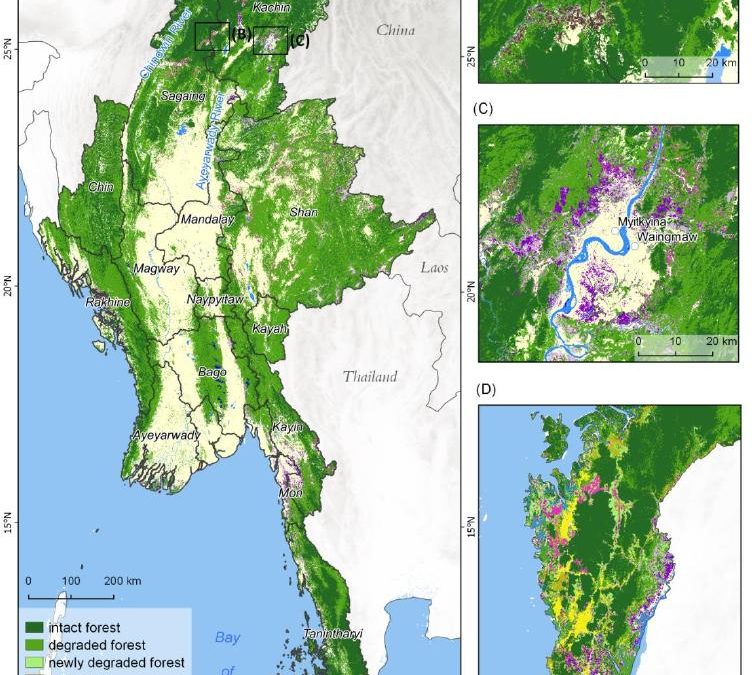
The MSc by Andrea Hess “Deforestation in Myanmar – what can we say about causes?” has been handed in. It has been supervised by Peter Leimgruber (Smithsonian Conservation Biology Institute) and Martin Wegmann. Deforestation in the tropics is a global issue. Tropical...
Mar 7, 2016 | innovation laboratories, news
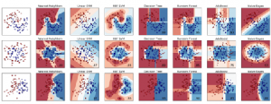
This study will examine whether the application of hybrid classifiers increases the classification accuracy in comparison to a single classifier. A combination between parametric and non-parametric classifiers will be applied and their performance will be assessed....
Feb 7, 2016 | innovation laboratories, news
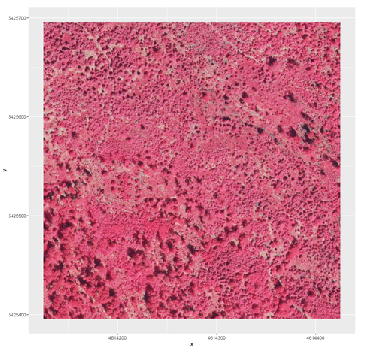
The data provided by aerial imagery are amongst the oldest sources of spatially explicit information for modern-time environmental management. These data are often captured over landscape-level domains using overlapping flight stripes to enable stereo photogrammetric...