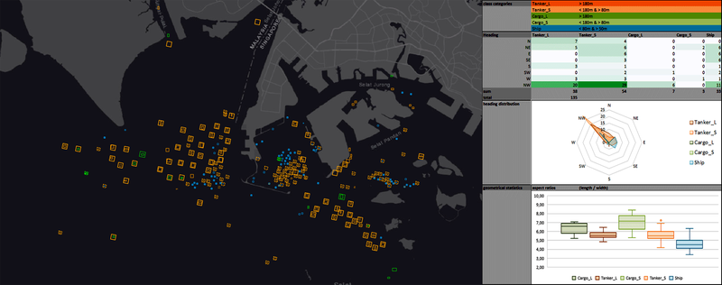
Pawel Kluter will present his M.Sc. thesis on Friday 30th of Oct. at 10 am with the title “Deep Learning Approach to Ship Detection and Classification Using Synthetic Aperture Radar Data”. From his abstract: “With over 92,000 large commercial vessels at sea, transporting 80% of the world’s merchandize by volume, maritime transport is the backbone of international trade. Safety and security are the main concerns of the parties involved, driving the development of surveillance systems. SAR sensors like TerraSAR-X are designated monitoring tools for the maritime domain and have been used for ship detection over the past four decades. With the rise of CNNs, the next step for ship surveillance is their utilization for ship type classification. In cooperation with Airbus Defence and Space, their proprietary CNN and SVM software was deployed and tested in order to achieve ship type recognition in maritime TSX StripMap scenes. The key challenge in this deep learning approach was to acquire enough positive samples with coherent SAR parameters to train the necessary classifiers that differentiate between tankers and cargos. Therefore, a multi-leveled manual method of object extraction, a target specific dashboard, as well as a CNN-GIS-Interface were developed. The deployed software achieved ship type classification, but the high expectations were not fully met. The overall classification precision peaked at 79% with a recall value of 71%, with two out of five classifiers ultimately performing unsatisfyingly due to a shortage of training data. Judging by the performance of the strongest classifiers, the overall approach seems highly promising.” First supervisor is Tobias Ullmann.

