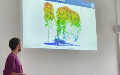
MSc. presentation by Fowad Ahmed

Fowad Ahmed will present his M.Sc. thesis “Agricultural landscape Configuration and Pattern Analysis with VHR Imagery in Bavaria” on Friday 11th at 11am.
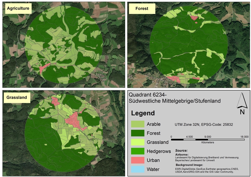
from the abstract: “Hedgerows and woody linear features are an integral part of the landscapes where they exist. These natural and semi-natural physical features deliver several ecosystems services and functions as ecological hotspots to its surrounding flora and fauna. These physical feature mostly found within agriculture landscape are prone to come under increasing pressure, with the human population set to exceed 9 billion by 2050. In this study, a four-band (RGB+Near Infrared) high spatial resolution (1 m) airborne imagery was utilized and following geographic object-based image analysis methodology, the detection of hedgerows on fifteen selected sites across the Bavarian landscape was carried out. The GEOBIA was implemented in ENVI feature extraction module, and SVM algorithm was used for classification purposes. The classification results showed that hedgerows with the combination of VHR imagery and GEOBIA can be identified with good accuracy(Overall accuracy: 0.97%, kappa:0.97). The results highlighted that inconsistency in airborne imagery influences the classification accuracies. A combined land use maps were generated after the inclusion of hedgerows maps within land-use maps from ATKIS DLM and Landklif land use map. Subsequently, the landscape pattern of study sites was analysed through landscape composition and configuration metrics.” supervised by Carina Kuebert-Flock

read more news:

High alpine and snow training

High alpine and snow training

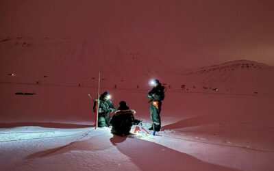
In collaboration with the German Alpine Club (DAV), Laura, one of our EAGLE students and Clara, a student assistant at our institute, recently participated in avalanche rescue training aimed at equipping individuals with essential skills and knowledge to respond...

semester wrap-up by our latest EAGLE generation

semester wrap-up by our latest EAGLE generation

Our latest generation of EAGLEs just wrote a nice blog post summarizing their first months within the EAGLE program, outlining how they bonded and formed a group plus how they experienced their first earth observation courses within our international M.Sc. program:...

International Day of Women and Girls in Science

International Day of Women and Girls in Science

We would like to celebrate the International Day of Women and Girls in Science with you! It is celebrated annually on February 11th. This day aims to promote full and equal access to science for women and girls, as well as to recognize the achievements of women in...

GRASS GIS introduced in our EAGLE MSc

GRASS GIS introduced in our EAGLE MSc

The very powerful and versatile spatial analysis program, GRASS, is introduced today within our EAGLE spatial data software course. GRASS provides a wide variety of functions, but just a few possibilities such as VI calculation, time-series or Python programming in...

Introduction to Whitebox software

Introduction to Whitebox software

The Whitebox geospatial software offers a wide range of functionality which are partly also not available in other packages, such as hydrological analysis or Lidar processing. Our earth observation EAGLE students are learning diverse geospatial software packages in...

Internship Networking event

Internship Networking event

Our EAGLEs have to conduct two internship and like to do them in quite diverse fields. Their research interests range from dry ecosystems to mountains, from conservation to agriculture, from the Arctic to Africa and from Earth Observation companies to large research...