Aim
In this seminar, we cover most aspects of remote sensing based assessment of Land Surface Dynamics. Topics such as snow cover dynamics, water body dynamics, forest cover and further vegetation dynamics, urbanization dynamics, coastal dynamics, or dynamics of geophysical parameters such as land surface temperature or selected indices will be addressed. In this contexts we look at opportunities arising from optical-, multi-spectral- and radar sensors, as well as thermal imagery. Data availability and access, as well as typical software tools for the handling of multispectral data or time-series analyses will be addressed as well. The course will consist of a theoretical part and a practical part, where the theory consists of a seminar (written seminar and presentation on a topic to be chosen from a list of available topics), and where the practical will consist of data processing examples.
Content
Topics cover most aspects of remote sensing based assessment of Land Surface Dynamics. Topics such as snow cover dynamics, water body dynamics, forest cover and further vegetation dynamics, urbanization dynamics, coastal dynamics, or dynamics of geophysical parameters such as land surface temperature or selected indices will be addressed. We adress questions such as climate change induced shifts of snow or rainy seasons, look at patterns of forest loss and degradation over time, analyze urbanization patterns and impacts of these processes on the natural environment, and assess changes in coastal morphology. Sensors in focus will be the ones allowing for long time series analyses, such as AVHRR, MODIS, ENVISAT, Landsat, TerraSAR-X, and the Sentinel Satellites.
Coding
Software
Techniques
Content
General Course News and Updates
impressions of our UAV course
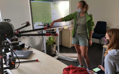
In September 2020 our UAV course took place and all practical exercises were covered. The manual UAV control as well as the automatic mission planning settings were discussed and actually applied. Various UAV systems were explored by the students and a diversity of...
M.Sc. presentation by Segun Adewale Ojo
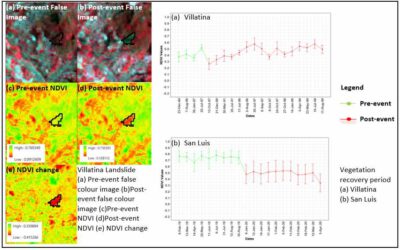
Segun will defend his M.Sc. "Application of Remote Sensing Techniques to detect historical landslides for improving risk assessment in Antioquia, Colombia." on Oct. 16th at 10 am. From the abstract: "In developing countries, current urbanization trends are leading to...
internship, inno lab and MSc idea presentations
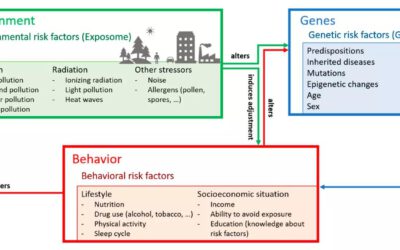
On Thursday 24th of September from 10am onwards we will have a range of presentations covering a MSc idea presentation Patrick Sogno on "Earth Observation for Exposome Mapping - Proof of Concept and Case Study in Augsburg, Germany" followed by various internship...
EAGLE student published review article with Prof. Kuenzer
Congratulations to our EAGLE student Patrick Sogno who published together with Prof. Claudia Kuenzer a review article on "Earth Observation Data Supporting Non-Communicable Disease Research: A Review". From the abstract: "A disease is non-communicable when it is not...
M.Sc. defense by Michael Wang
Michael Wang will present his thesis "Comparison of Surface Urban Heat Islands Using the World Settlement Footprint Imperviousness Layer" on Sept. 17th at 10am. From the abstract: "In the growing field of surface urban heat island (SUHI) analysis, impervious surface...
MSc. presentation by Fowad Ahmed
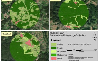
Fowad Ahmed will present his M.Sc. thesis "Agricultural landscape Configuration and Pattern Analysis with VHR Imagery in Bavaria" on Friday 11th at 11am. from the abstract: "Hedgerows and woody linear features are an integral part of the landscapes where they exist....
M.Sc. defense by Nina Gnann
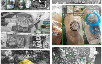
Nina Gnann will present her M.Sc. thesis "Identification of anthropogenic debris assisted by unmanned aerial vehicles and deep learning” on September 8th 12pm. From the abstract: Due to anthropogenic actions, plastic and other debris are distributed in the environment...
MSc thesis presentations by Navid Chamani
Navid Chamani is defending his thesis "Investigation on the intra-annual variations of the relationship between Landsat 8-derived LST and spectral indices in west Africa" on September 25th 10am. from the abstract: "Monitoring the variations of the land surface...
MSc defense by Salim Soltani
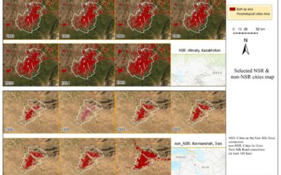
Selected map of NSR and non_NSR cities from 1990-2019, NSR cities represent the cities located directly on the New Silk Road , and non_NSR cities represent cities located far from( at least 100 Km) the New Silk Road. Salim Soltani will defend his M.Sc. thesis...
New EAGLEs in 2020
we are finally through all 140 interviews of eligible EAGLE applications. We had again very good and highly suitable candiates and in total 25 applicants passed the interviews and are accepted to the EAGLE program. Our new EAGLEs are from various countries (15...

