Aim
Designing scientific graphics that provide all necessary information without being too packed, focusing on the essential message and being able to actually create such graphics will be covered In this class. All necessary tools and and approaches to create adequate figures and maps will be covered.
Content
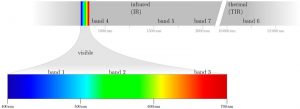
figure from the book “Remote Sensing and GIS for Ecologists” by Wegmann, Leutner and Dech, created with tikz
General guidelines of scientific graphics and maps will be covered based on e.g. Tufte and followed by practical implementation of graphic ideas, as well as critical evaluation of the results. Only open source program will be used such as R or tikz/pgf and students will have the opportunity to work specifically on certain scientific graphics or maps using e.g. ggplot2 and explore the potential and limits of good scientific graphs. Good map designs will be discussed as well and common mistakes will be pointed out. After this course you will be capable to create your own graphics for a specific scientific purpose e.g. your M.Sc. thesis.
Coding
Software
Techniques
Content
General Course News and Updates
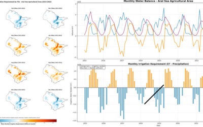
EAGLE Internship Presentation “Stream flow assessment and Irrigation demand in Central Asia (Aral Sea)”
On February 05, 2026, Anugraha Das will present her internship results on " Stream flow assessment and Irrigation demand in Central Asia (Aral Sea )" at 12:00 in seminar room 3, John-Skilton-Str. 4a. From the abstract: This presentation assesses streamflow dynamics...
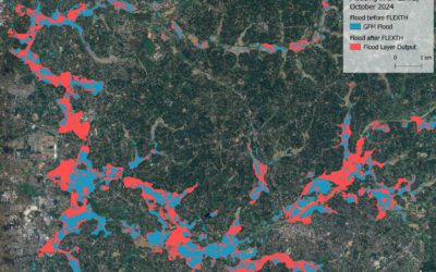
EAGLE Internship Presentation “Recommended Practices for Urban Flood Mapping in Emergency Response”
On February 10, 2026, Laura Obrecht will present her internship results on " Recommended Practices for Urban Flood Mapping in Emergency Response" at 12:00 in seminar room 3, John-Skilton-Str. 4a.type of presentation: From the abstract: Flood detection in urban...
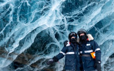
EAGLE Internship Presentation ” Internship on Svalbard”
On February 24, 2026, Leonie Sonntag and Jannis Midasch will present their internship results on " Internship on Svalbard" at 13:00 in seminar room 3, John-Skilton-Str. 4a. From the abstract: During March and April 2025, the two EAGLE students Leonie Sonntag and...
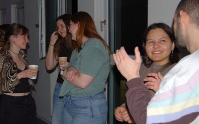
Across Cohorts and Borders: EAGLE Students Celebrate the Winter Term Together
As the winter term ends, the international students of our EAGLE M.Sc. programme gathered for an evening that was less about deadlines and data and more about community. After months of intensive coursework and research, the celebration offered a warm pause in their...
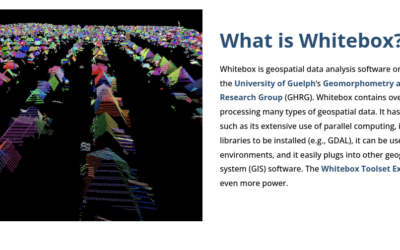
Learning Geospatial Tools in Practice: whitebox
A central goal of the EAGLE Earth Observation programme is to equip students with a broad and practical understanding of the software tools used in geospatial analysis. Rather than focusing on a single platform, students are encouraged to explore different approaches,...
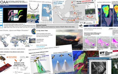
Mapping Disasters from Space: Inside the EAGLE MSc Course on Natural Hazards
From raging wildfires to devastating floods, natural hazards are becoming more frequent, more intense, and harder to predict. In this rapidly changing world, the ability to understand disasters as they unfold is no longer optional—it’s essential. This is exactly where...
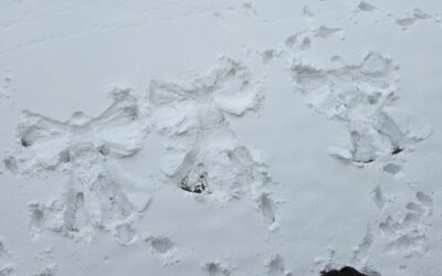
From Satellites to Snow Angels
Our EAGLE M.Sc. students, coming from all over the world, are making the most of the short breaks between courses. Whether it’s spontaneous snow angel sessions or friendly snowball fights around the EORC, laughter and flying snow are never far away. These moments of...
Where Learning Meets Friendship
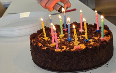
At EAGLE, studying together is only part of the story. Our students are more than classmates — they’re hiking buddies, party companions, and the kind of people who show up to lectures with birthday cakes 🎂. Today was a perfect example. Our EAGLE student...
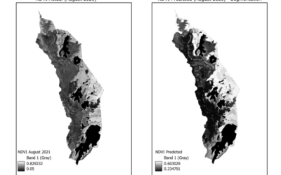
EAGLE Innolab Presentation: “Gap-Filling Optical NDVI Using SAR-Derived Indices and Machine Learning”
On February 10, 2026, Mahnoor Nadeem will present her Innolab results on " Gap-Filling Optical NDVI Using SAR-Derived Indices and Machine Learning" at 12:00 in seminar room 3, John-Skilton-Str. 4a. From the abstract: Normalized Difference Vegetation Index (NDVI) is...
EAGLE Internship Presentation: “Internship at Helmholtz Zentrum Munich”
On February 03, 2026, Agnes Zwick will present her internship "Internship at Helmholtz Zentrum Munich" at 12:00 in seminar room 3, John-Skilton-Str. 4a. From the abstract: From September to October 2025, the internship was completed at the Helmholtz Zentrum München...