About
Martin is based at the remote sensing department of Prof. S. Dech, head of DLR-DFD (German Aerospace Data Center) in Würzburg where he leads the Remote Sensing and Biodiversity research topic. Moreover he is an assistant professor at the Global Change Ecology M.Sc. Program and the point of contact for the CEOS Biodiversity initiative, which aims at coordinating space borne activities for biodiversity and conservation related activities. Moreover he is on the steering committee of the Conservation Remote Sensing group.
In his courses the theoretical background as well as the practical implementation of remote sensing for biodiversity research and conservation application are covered. The remote sensing data analysis as well as the integration with biodiversity data and the spatial statistics including spatial modelling are mainly done with OpenSource software such as R and GRASS. Some courses are also taught within the Global Change Ecology MSc. program as well as in different locations in Africa and South-East Asia. Additionally he is founding member of the AniMove.org training activity aiming at combining remote sensing with animal movement data, as well as the EcoSens.org training, that aims to teach ecologists and conservationists to appyl remote sensing in their daily work.
The added value of spatial and temporal variable environmental data sets for corresponding biodiversity modelling approaches are in the focus of his work. Especially the spatial arrangement of landcover and its implication for spatial biodiversity patterns based on remotely sensed information interests him. Most of his work has been done in Europe and Africa.
He is editor of the Remote Sensing in Ecology and Conservation journal, more details on his activties can be found on the remote-sensing.eu webpage as well as on researchgate.
 This is a book about how ecologists can integrate remote sensing and GIS in their daily work. It will allow ecologists to get started with the application of remote sensing and to understand its potential and limitations. Using practical examples, the book covers all necessary steps from planning field campaigns to deriving ecologically relevant information through remote sensing and modelling of species distributions.
This books explains how to apply remote sensing and GIS to ecological research projects. It will provide practical examples covering each step, from planning through to remote sensing and modelling. Only Open Source software will be used for the examples such as R and QGIS.
read more at http://book.ecosens.org
various M.Sc. topics for your thesis are possible and can be discussed in person. Please look also through past M.Sc. thesis in the next tab to get a better idea.
Biodiversity analysis and conservation decision relies on adequate and meaningful data that are available on a long-term and global basis. Such environmental information need adequate spatial and temporal resolution and remote sensing data does provide a wide range of potentially suitable data sets. Various approaches concerning remote sensing data use for biodiversity and conservation exist to improve the application and integration. This is especially important since the use of remote sensing has increased widely over the past decades, and therefore interdisciplinary approaches foster the understanding of needed parameters for biodiversity monitoring, which provide guidance to observation systems as to what and how to measure key aspects of biodiversity. Multi-scale, multi-sensor and multi-temporal remote sensing data analysis do provide needed and crucial information for ecological analysis, especially within conservation applications, species distribution analysis or animal movement analysis. A variety of MSc topics is available aiming to improve remote sensing usage in ecology conservation, as well as its application. It is aimed at, that all MSc are in close collaboration with ecology or conservation organizations to support a truly interdisciplinary thesis. Martin Wegmann is dedicated to use his scientific network to organizations such as SCBI, ZSL, IUCN, UNEP-WCMC, WWF etc. for embedding EAGLE MSc thesis.
For more details, please see the tab of past MSc topics. Moreover, please visit www.remote-sensing-biodiversity.org for updates on data, events and publications related to remote sensing data analysis in ecology and conservation. Additionally, AniMove.org and EcoSens.org offer further details on potential MSc topics and trainings.
list of recent graduates and their topics, mainly done in collaboration with colleagues listed under the “network” tab:
- Anna-Lena Hendel
“Effects of rain-on-snow and ground ice on seasonal NDVI in high Arctic Svalbard” - Anne Selbmann
“Spatial pattern of wildfire severity and vegetation in the Yukon Delta, Alaska” - Jakob Schwalb-Willmann
“A deep learning movement prediction model using environmental data to identify movement anomalies” - Tejas Bhagwat
“Using animal movement patterns to derive new remote sensing landcover maps for conservation” - Markus Martini
“Automated tree detection: applications for object-based image analysis in arid systems” - Dorothee Stiller
“Analysing spatio-temporal patterns of coastal aquaculture based on three decades of satellite data” - Sophie Reinermann
“Extreme Events in Europe between 2000 and 2017: Analysis of Vegetation Dynamics based on Earth Observation Time Series” - Susanne Karg
“Burn Scar Detection using Polarimetric ALOS-2 time-series data” - Frank Weiser
“Assessing the forest response along treelines to an Epirrita automnata outbreak in Abisko, using a combination of fieldwork and remote sensing” - Henrike Schulte to Bühne
“Quantifying landcover change using remote sensing data in a transboundary protected area“ - Matthias Biber:
“Can animal movement and remote sensing data help to improve conservation efforts?” - Joseph Premier
“The Lynx Effect: Behaviour of Roe Deer in the Presence of Lynx in a European Forest Ecosystem” - Andrea Hess:
“Deforestation in Myanmar – what can we say about causes?” - Anna Stephanie:
“Impact of remote sensing characteristics for biodiversity monitoring” - Yrneh Ulloah:
“Object-oriented classification of historical maps for ecosystem services” - Asja Bernd:
“Mind the Gap: A Global Analysis of Grassland Fragmentation using MODIS Land Cover Data” - Alexandra Bell:
“Moving forward – application of behaviour change point analysis and species distribution models in conservation.” - Christian Wohlfart:
“Mapping tropical dry forest in South East Asia using a continuous cover approach.” - Andrea Früh:
“Historic changes in regional ecosystem service demand.” - Wanda Graf:
“Suitability of Light detection and ranging (LiDAR) data and texture measures of aerial images to model the species distribution of Glaucidium passerinum (Pygmy Owl) in Vercors, French Alps” - Anne Simang:
“Influence of habitat and governance for landscape level conservation on Asian elephants.” - Eva-Marie Obermaier:
“Impact of environmental factors on geographical schistosomiasis distribution in the Man region of Ivory Coast.” - Vadym Sokol:
“Interaction between white stork migration patterns and urban environment in Germany.” - Judith Reise:
“Impact of model algorithm selection and remote sensing data selection on the analysis of species-habitat associations.” - Katrin Ziewers:
“Declining migratory avian species in the UK: a consequence of habitat quality alteration in western Africa” - Antonia Ortmann:
“Estimating land cover changes and current carbon stock in Tanzania in the context of REDD+” - Moses Duguru:
“Climate patterns in West-Central Africa” - Tobias Sieg:
“The potential of interferometric and polarimetric SAR data to characterize urban areas at the example of Mumbai and Manila” - Sarah Malec:
“Assessment of Soil degradation in Costa Rica using reflectance hyperspectral and simulated EnMAP imagery” - Daniela Braun:
“Estimating the current and future human impact in Tanzania for wildlife corridor management.” - Benjamin Leutner:
“Modeling biodiversity patterns in a temperate montane forest by means of hyperspectral and LiDAR remote sensing” - Michael Ewald:
“Assessing the influence of vegetation structure on roe deer habitat selection using LiDAR” - Carlos Dambroz:
“Analysing forest fragmentation characeristics among continuous vegetation gradients in South America” - Daniel Kachelriess:
“Analysis of the effectivity of Marine Protected Areas – a case study using remote sensing for the Chagos Archipelago.” - Christiane Plum:
“The underuse of remote sensing in ecology and conservation: quantifying technical and cultural constrains”. - Daniela Kretz:
“Frost in a warmer world: spatial-temporal investigation of the recovery of temperate forests after a late spring frost.” - Philipp Gnoyke:
“Large land acquisitions in East Africa” - Tim Besser:
“Sprawling crisis? Urbanization from the perspective of protected areas near Kolkata, India” - Hannes Müller:
“Modelling of forest structure with remote sensing data.” - Mary Antonette Beroya-Eitner:
“Flood vulnerability index for Delta socio-ecological systems: application to the Mekong river detla, Vietnam.” - Seyed Sadroddin Alavi Panah:
“Relationship between land surface temperature and the ratio of urban areas and urban parks” - Sophia Wisboeck:
“Explaining variation in home range size of red deer (cervus elaphus) in the Bavarian Forest National Park using LiDAR derived metrics on forest structure and fractional cover”
- Kamran Safi, MPI-O, Computational Ecology
- Jörg Müller, University Würzburg, Nationalpark Bavarian Forest, Conservation
- Thomas Müller, Chloe Bracis, BIK-F, Computational Ecology
- Björn Reineking, IRSTEA, Computational Ecology
- Justin Calabrese, Smithsonian, Computational Ecology
- Nathalie Pettorelli, ZSL, Conservation
- Duccio Rocchini, FMACH
- Thomas Köllner, Uni Bayreuth, Ecosystem Services
- Gregoire Dubois, Ilaria Palumbo, Zoltan Szantoi, EU-JRC
- Andrew Skidmore, ITC
- Inge Jonckheere, UN-FAO
- Peter Leimgruber, Smithsonian Conservation Biology Institute
- Sarah Asam, Ruth Sonnenschein, EURAC
- Allison Leidner, Woody Turner, Gary Geller, NASA, GEO
- Tobias Kümmerle, HU
- Stefan Ziegler, WWF
- Graeme Buchanan, RSPB
- Brian O’Connor, Mike Harfoot, UNEP-WCMC
- and more
- AniMove: combining animal movement analysis and remote sensing data for conservation and ecology (www.animove.org)
- EcoSens: applying remote sensing in ecology and conservation science (www.ecosens.org)
all trainings focus on applied topics and combine course work and hands-on project work. Only open-source software is used such as R, QGIS or GRASS. Most topics are covered in the book “Remote Sensing and GIS for Ecologists – Using Open Source software” (Wegmann, Leutner, Dech, 2016)
Recent News
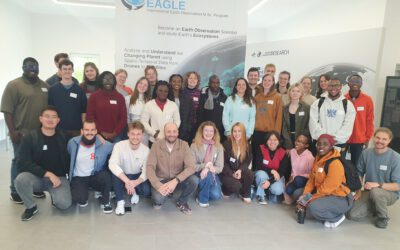
New EAGLEs take off into the Winter Term 2025/26
As in previous years, the next generation of EAGLE Master's students from around the world gathered at the Earth Observation Research Center (EORC) on the first day of the winter term to begin their studies at the University of Würzburg. Prof. Dr. Tobias Ullmann...
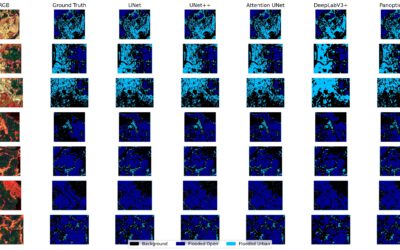
EAGLE MSc Defense “Coastal Urban Flood Detection and Analysis Using SAR and CNN-Based Methods: A Case Study for Central Vietnam”
On September 23, 2025, Elly Schmid will present her Master Thesis on " Urban Flood Detection and Analysis Using SAR and CNN-Based Methods: A Case Study for Central Vietnam" at 12:00 in seminar room 3, John-Skilton-Str. 4a. From the abstract: With over half of the...
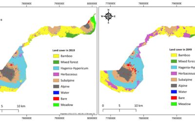
EAGLE MSc Defense “Utilizing deep learning and Earth Observation data to predict land cover changes in Volcanoes National Park, Rwanda”
On September 16, 2025, Jean de Dieu Tuyizere will present his Master Thesis on "Utilizing deep learning and Earth Observation data to predict land cover changes in Volcanoes National Park, Rwanda" at 12:00 in seminar room 3, John-Skilton-Str. 4a From the abstract:...
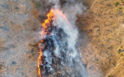
Mapping Fire from the Sky – Anna Bischof’s MSc Thesis on Savanna Fire Patterns
Wildfires are an essential ecological process in African savannas, shaping landscapes, influencing biodiversity, and playing a key role in nutrient cycling. Understanding their dynamics is crucial for both science and management – and this is where EAGLE MSc student...
Exploring the Desert: Farimah’s Internship at Gobabeb in Namibia
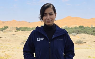
We’re excited to share that our EAGLE MSc student, Farimah, is currently spending her internship at the renowned Gobabeb Namib Research Institute, nestled in the heart of the Namib Desert—one of the oldest and most unique desert ecosystems in the world. Farimah’s...

University Wuerzburg
Department of Remote Sensing
Remote Sensing and Biodiversity Research
phone: +49(0)931 31 83446
mail: martin.wegmann@uni-wuerzburg.de
lecturer at the Global Change Ecology M.Sc. program
CEOS SBA Biodiversity Coordinator at the
German Aerospace Data Center
Earth Observation Center (DLR-EOC)
private webpage: earth-observation.org

